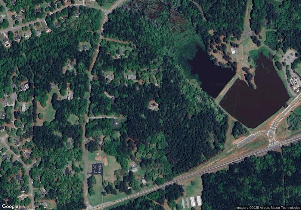
143 Howard Rd Senoia, GA 30276
Estimated Value: $267,480 - $293,000
3
Beds
2
Baths
1,440
Sq Ft
$193/Sq Ft
Est. Value
About This Home
This home is located at 143 Howard Rd, Senoia, GA 30276 and is currently estimated at $278,120, approximately $193 per square foot. 143 Howard Rd is a home located in Coweta County with nearby schools including Eastside Elementary School, East Coweta Middle School, and East Coweta High School.
Ownership History
Date
Name
Owned For
Owner Type
Purchase Details
Closed on
Nov 12, 2018
Sold by
Brook Joel L
Bought by
Clark Heather Anne
Current Estimated Value
Home Financials for this Owner
Home Financials are based on the most recent Mortgage that was taken out on this home.
Original Mortgage
$84,000
Outstanding Balance
$50,373
Interest Rate
4.9%
Mortgage Type
New Conventional
Estimated Equity
$227,747
Purchase Details
Closed on
Jun 18, 2004
Sold by
Principal Residential Mortgage
Bought by
Brook Joel L
Purchase Details
Closed on
Jul 1, 2003
Sold by
Principal Residential Mortgage
Bought by
Federal Home Loan Mortgage Corp
Purchase Details
Closed on
Mar 10, 1998
Bought by
Bailey Douglas Scott
Purchase Details
Closed on
Nov 23, 1992
Bought by
Neely Richard C
Purchase Details
Closed on
Jul 29, 1992
Bought by
Bell Kenneth H and Bell Emi
Purchase Details
Closed on
Jul 24, 1992
Bought by
Neely Richard C
Create a Home Valuation Report for This Property
The Home Valuation Report is an in-depth analysis detailing your home's value as well as a comparison with similar homes in the area
Home Values in the Area
Average Home Value in this Area
Purchase History
| Date | Buyer | Sale Price | Title Company |
|---|---|---|---|
| Clark Heather Anne | $84,000 | -- | |
| Brook Joel L | $82,500 | -- | |
| Federal Home Loan Mortgage Corp | -- | -- | |
| Bailey Douglas Scott | -- | -- | |
| Neely Richard C | -- | -- | |
| Bell Kenneth H | $4,000 | -- | |
| Neely Richard C | $8,800 | -- |
Source: Public Records
Mortgage History
| Date | Status | Borrower | Loan Amount |
|---|---|---|---|
| Open | Clark Heather Anne | $84,000 |
Source: Public Records
Tax History Compared to Growth
Tax History
| Year | Tax Paid | Tax Assessment Tax Assessment Total Assessment is a certain percentage of the fair market value that is determined by local assessors to be the total taxable value of land and additions on the property. | Land | Improvement |
|---|---|---|---|---|
| 2024 | $1,531 | $65,930 | $18,240 | $47,691 |
| 2023 | $1,531 | $56,513 | $16,889 | $39,624 |
| 2022 | $1,305 | $52,966 | $16,084 | $36,882 |
| 2021 | $1,257 | $47,762 | $16,084 | $31,678 |
| 2020 | $1,266 | $47,762 | $16,084 | $31,678 |
| 2019 | $1,011 | $34,549 | $10,928 | $23,621 |
| 2018 | $1,013 | $34,549 | $10,928 | $23,621 |
| 2017 | $1,013 | $34,549 | $10,928 | $23,621 |
| 2016 | $1,001 | $34,549 | $10,928 | $23,621 |
| 2015 | $984 | $34,549 | $10,928 | $23,621 |
| 2014 | $976 | $34,549 | $10,928 | $23,621 |
Source: Public Records
Map
Nearby Homes
- 90 Howard Rd
- 36 Cumberland Trail
- 260 Willow Dell Dr
- 71 Lower Creek Trail
- 103 Morgan St
- 126 Morgan St
- 124 Morgan St
- 215 Duck Dr
- 375 Luther Bailey Rd
- 1978 Luther Bailey Rd
- 0 Quick Dr Unit 10555827
- 374 Luther Bailey Rd
- 44 Standing Rock Rd
- 150 Duck Dr
- 0 Johnson St Unit 10612656
- 245 Kenwood Trail
- 275 Kenwood Trail
- 271 Bridge St
- 316 Hammerstone Ct Unit 19
- 300 Kenwood Trail
- 151 Howard Rd
- 149 Howard Rd
- 109 Howard Rd
- 123 Howard Rd
- 147 Howard Rd
- 71 Howard Rd
- 175 Howard Rd
- 7412 Highway 16
- 7412 Highway 16
- 7412 Highway 16
- 90 Howard Rd Unit A
- 0 Pylant St
- 0 Pylant St Unit 7506055
- 0 Pylant St Unit 7512161
- 0 Pylant St Unit 7488237
- 0 Pylant St Unit 7425764
- 0 Pylant St Unit 7269267
- 0 Pylant St Unit 7027464
- 0 Pylant St Unit 8720167
- 0 Pylant St Unit 8460803
