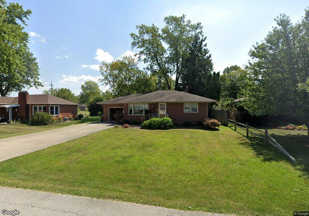
143 Lindsay Ave Tiffin, OH 44883
Estimated Value: $170,289 - $209,000
3
Beds
1
Bath
1,088
Sq Ft
$172/Sq Ft
Est. Value
About This Home
This home is located at 143 Lindsay Ave, Tiffin, OH 44883 and is currently estimated at $187,322, approximately $172 per square foot. 143 Lindsay Ave is a home located in Seneca County with nearby schools including Columbian High School, North Central Academy - Fremont, and Calvert Catholic Elementary School.
Ownership History
Date
Name
Owned For
Owner Type
Purchase Details
Closed on
Apr 4, 2003
Sold by
Arend John A
Bought by
Mcdonald Deborah S T and Mcdonald O
Current Estimated Value
Purchase Details
Closed on
Jan 6, 1999
Bought by
Arend John A
Purchase Details
Closed on
Aug 11, 1994
Bought by
Lindsay Addaline E Trustee
Purchase Details
Closed on
Nov 6, 1992
Sold by
Lindsay Addaline E
Bought by
Lindsay Addaline E
Purchase Details
Closed on
Jun 12, 1992
Sold by
Lindsay Kenneth E
Bought by
The Addaline E Lindsay
Create a Home Valuation Report for This Property
The Home Valuation Report is an in-depth analysis detailing your home's value as well as a comparison with similar homes in the area
Home Values in the Area
Average Home Value in this Area
Purchase History
| Date | Buyer | Sale Price | Title Company |
|---|---|---|---|
| Mcdonald Deborah S T | $113,000 | -- | |
| Arend John A | $1,000 | -- | |
| Lindsay Addaline E Trustee | -- | -- | |
| Lindsay Addaline E | -- | -- | |
| The Addaline E Lindsay | -- | -- |
Source: Public Records
Tax History Compared to Growth
Tax History
| Year | Tax Paid | Tax Assessment Tax Assessment Total Assessment is a certain percentage of the fair market value that is determined by local assessors to be the total taxable value of land and additions on the property. | Land | Improvement |
|---|---|---|---|---|
| 2024 | $1,617 | $47,930 | $5,850 | $42,080 |
| 2023 | $1,619 | $47,930 | $5,850 | $42,080 |
| 2022 | $1,427 | $35,060 | $5,080 | $29,980 |
| 2021 | $1,437 | $35,060 | $5,080 | $29,980 |
| 2020 | $1,465 | $35,056 | $5,075 | $29,981 |
| 2019 | $1,419 | $32,865 | $4,872 | $27,993 |
| 2018 | $1,422 | $32,865 | $4,872 | $27,993 |
| 2017 | $1,437 | $32,865 | $4,872 | $27,993 |
| 2016 | $1,346 | $31,553 | $4,725 | $26,828 |
| 2015 | $1,331 | $31,553 | $4,725 | $26,828 |
| 2014 | $1,253 | $31,553 | $4,725 | $26,828 |
| 2013 | $1,340 | $32,529 | $4,872 | $27,657 |
Source: Public Records
Map
Nearby Homes
- 115 Lindsay Ave
- 0 W Market St
- 39 Cherry St
- 314 S Sandusky St
- 29 Virginia Ave
- 169 Nelson St
- 2695 Ohio 18
- 0 Miami St Unit 20242078
- 0 Miami St Unit 6116475
- 28 Orange St
- 0 Township Road 198a Unit 20242098
- 0 Township Road 198a Unit 6116514
- 17 Franklin St
- 50 Clay St
- 0 County Road 54 Unit 225023228
- 0 County Road 54 Unit 20242258
- 48 Clay St
- 841 S Sandusky St
- 185 Longfellow Dr
- 106 Sycamore Woods Ln
- 149 Lindsay Ave
- 135 Lindsay Ave
- 155 Lindsay Ave
- 144 Lindsay Ave
- 161 Lindsay Ave
- 150 Lindsay Ave
- 136 Lindsay Ave
- 144 Hillcrest Dr
- 138 Hillcrest Dr
- 156 Lindsay Ave
- 127 Lindsay Ave
- 110 Lindsay Ave
- 160 Lindsay Ave
- 148 Hillcrest Dr
- 171 Lindsay Ave
- 121 Lindsay Ave
- 130 Hillcrest Dr
- 0 Lindsay Ave
- 168 Lindsay Ave
- 120 Hillcrest Dr