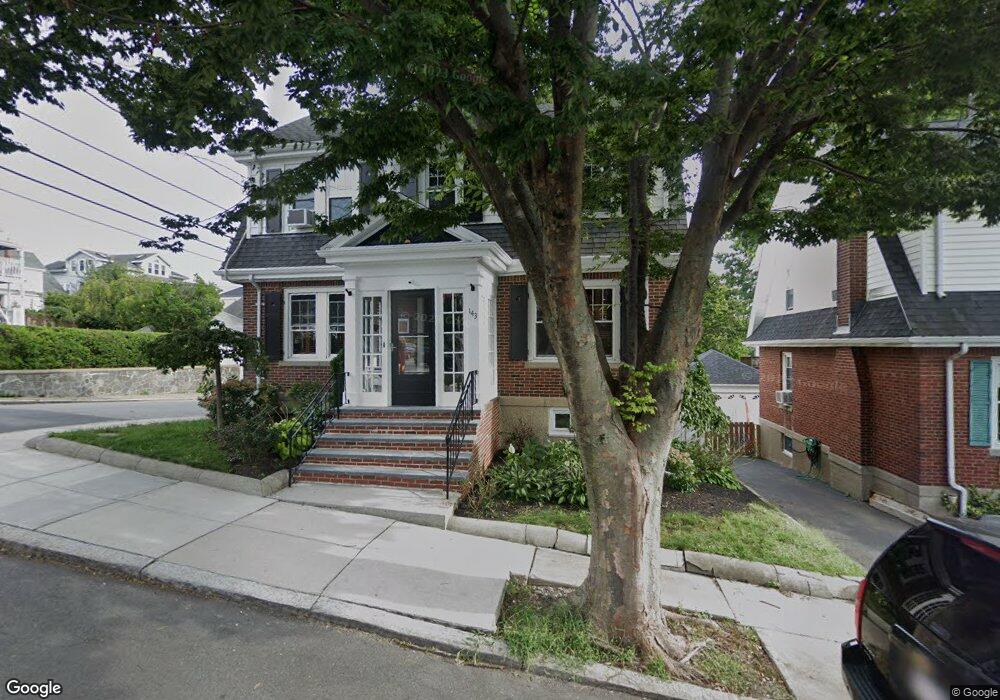
143 Milton St Dorchester Center, MA 02124
Lower Mills NeighborhoodEstimated Value: $1,062,000 - $1,245,594
5
Beds
2
Baths
2,867
Sq Ft
$389/Sq Ft
Est. Value
About This Home
This home is located at 143 Milton St, Dorchester Center, MA 02124 and is currently estimated at $1,116,649, approximately $389 per square foot. 143 Milton St is a home located in Suffolk County with nearby schools including Conservatory Lab Upper School, St Brendan School, and Saint John Paul II Catholic Academy.
Ownership History
Date
Name
Owned For
Owner Type
Purchase Details
Closed on
Oct 19, 2024
Sold by
Wyse James J and Wyse Ellen M
Bought by
Wyse Ft and Wyse
Current Estimated Value
Purchase Details
Closed on
Nov 20, 1997
Sold by
Lee Lorraine F
Bought by
Wyse Jame J and Wyse Ellen M
Create a Home Valuation Report for This Property
The Home Valuation Report is an in-depth analysis detailing your home's value as well as a comparison with similar homes in the area
Home Values in the Area
Average Home Value in this Area
Purchase History
| Date | Buyer | Sale Price | Title Company |
|---|---|---|---|
| Wyse Ft | -- | None Available | |
| Wyse Ft | -- | None Available | |
| Wyse Jame J | $160,000 | -- | |
| Wyse Jame J | $160,000 | -- |
Source: Public Records
Mortgage History
| Date | Status | Borrower | Loan Amount |
|---|---|---|---|
| Previous Owner | Wyse Jame J | $260,000 | |
| Previous Owner | Wyse Jame J | $200,000 | |
| Previous Owner | Wyse Jame J | $50,000 |
Source: Public Records
Tax History Compared to Growth
Tax History
| Year | Tax Paid | Tax Assessment Tax Assessment Total Assessment is a certain percentage of the fair market value that is determined by local assessors to be the total taxable value of land and additions on the property. | Land | Improvement |
|---|---|---|---|---|
| 2025 | $13,104 | $1,131,600 | $288,300 | $843,300 |
| 2024 | $11,999 | $1,100,800 | $212,700 | $888,100 |
| 2023 | $11,054 | $1,029,200 | $198,900 | $830,300 |
| 2022 | $10,766 | $989,500 | $191,200 | $798,300 |
| 2021 | $9,880 | $926,000 | $182,100 | $743,900 |
| 2020 | $8,822 | $835,400 | $183,200 | $652,200 |
| 2019 | $8,223 | $780,200 | $148,600 | $631,600 |
| 2018 | $7,502 | $715,800 | $148,600 | $567,200 |
| 2017 | $7,219 | $681,700 | $148,600 | $533,100 |
| 2016 | $6,943 | $631,200 | $148,600 | $482,600 |
| 2015 | $6,206 | $512,500 | $137,500 | $375,000 |
| 2014 | $6,323 | $502,600 | $137,500 | $365,100 |
Source: Public Records
Map
Nearby Homes
- 25 Crockett Ave
- 61 Hill Top St
- 9 Grayson St
- 10-12 Charlemont St
- 107 Minot St
- 103 Minot St
- 40 Westmoreland St Unit 5
- 885-887 Adams St Unit 1
- 37 Westmoreland St
- 80 Beaumont St Unit 101
- 80 Westmoreland St Unit 1
- 667 Adams St
- 33 Pierce Ave
- 45 Chickatawbut St Unit 1
- 45 Chickatawbut St Unit 2
- 78 Hillsdale St
- 43 Chickatawbut St
- 97 Oakton Ave Unit two
- 16 Beaumont St
- 977-979 Adams St
- 141 Milton St
- 139 Milton St
- 137 Milton St
- 137 Milton St Unit 2
- 149 Milton St Unit 1
- 149 Milton St
- 46 Rockne Ave
- 62 Myrtlebank Ave
- 70 Myrtlebank Ave
- 142 Milton St
- 140 Milton St
- 151 Milton St
- 48 Rockne Ave
- 138 Milton St
- 53 Rockne Ave
- 53 Rockne Ave
- 146 Milton St
- 72 Myrtlebank Ave
- 136 Milton St
- 136 Milton St Unit 1