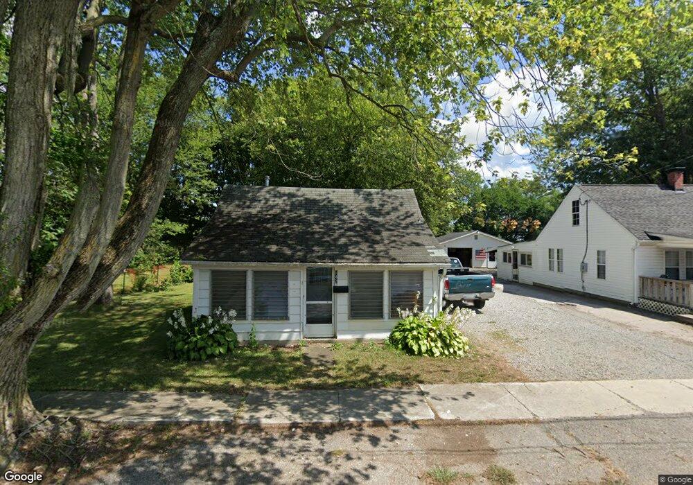
143 Pearl St Richwood, OH 43344
Estimated Value: $65,000 - $188,000
1
Bed
1
Bath
632
Sq Ft
$175/Sq Ft
Est. Value
About This Home
This home is located at 143 Pearl St, Richwood, OH 43344 and is currently estimated at $110,907, approximately $175 per square foot. 143 Pearl St is a home located in Union County with nearby schools including North Union Elementary School, North Union Middle School, and North Union High School.
Ownership History
Date
Name
Owned For
Owner Type
Purchase Details
Closed on
Aug 28, 2023
Sold by
Mcelroy Kendra and Mcelroy Jeffrey
Bought by
Risner Kelly
Current Estimated Value
Purchase Details
Closed on
Nov 12, 2010
Sold by
Stapleton Thomas A and Stapleton Barbara G
Bought by
Parks Anita R
Purchase Details
Closed on
Jul 25, 2005
Sold by
Richwood Investors Llp
Bought by
Stapleton Thomas A and Stapleton Barbara G
Purchase Details
Closed on
Mar 16, 1998
Sold by
Est Wendell W Daniel
Bought by
Richwood Investors
Create a Home Valuation Report for This Property
The Home Valuation Report is an in-depth analysis detailing your home's value as well as a comparison with similar homes in the area
Home Values in the Area
Average Home Value in this Area
Purchase History
| Date | Buyer | Sale Price | Title Company |
|---|---|---|---|
| Risner Kelly | $27,400 | None Listed On Document | |
| Parks Anita R | $30,500 | Attorney | |
| Stapleton Thomas A | $10,000 | -- | |
| Richwood Investors | $30,000 | -- |
Source: Public Records
Tax History Compared to Growth
Tax History
| Year | Tax Paid | Tax Assessment Tax Assessment Total Assessment is a certain percentage of the fair market value that is determined by local assessors to be the total taxable value of land and additions on the property. | Land | Improvement |
|---|---|---|---|---|
| 2024 | $950 | $19,140 | $3,210 | $15,930 |
| 2023 | $950 | $19,140 | $3,210 | $15,930 |
| 2022 | $927 | $19,140 | $3,210 | $15,930 |
| 2021 | $701 | $13,530 | $2,470 | $11,060 |
| 2020 | $701 | $13,530 | $2,470 | $11,060 |
| 2019 | $705 | $13,530 | $2,470 | $11,060 |
| 2018 | $458 | $8,710 | $2,100 | $6,610 |
| 2017 | $423 | $8,710 | $2,100 | $6,610 |
| 2016 | $432 | $8,710 | $2,100 | $6,610 |
| 2015 | $419 | $8,120 | $2,100 | $6,020 |
| 2014 | $419 | $8,120 | $2,100 | $6,020 |
| 2013 | $409 | $8,240 | $2,100 | $6,140 |
Source: Public Records
Map
Nearby Homes
- 20 E Bomford St
- 106 S Clinton St
- 24 W Bomford St
- 119 W Ottawa St
- 299 S Franklin St
- 607 Kells Ln
- 380 E Blagrove St
- 220 Grove St Unit 220 1/2
- 268 N Franklin St
- 303 N Franklin St
- 313 N Franklin St
- 11403 State Route 47
- 29900 Le Masters Rd
- 0 Richwood Miller Rd Unit 225033397
- 6343 State Route 4
- 27900 Zook Rd
- 27770 Zook Rd
- 0 Fulton Creek Rd
- 30760 Snare Rd
- 9793 Boundary Rd