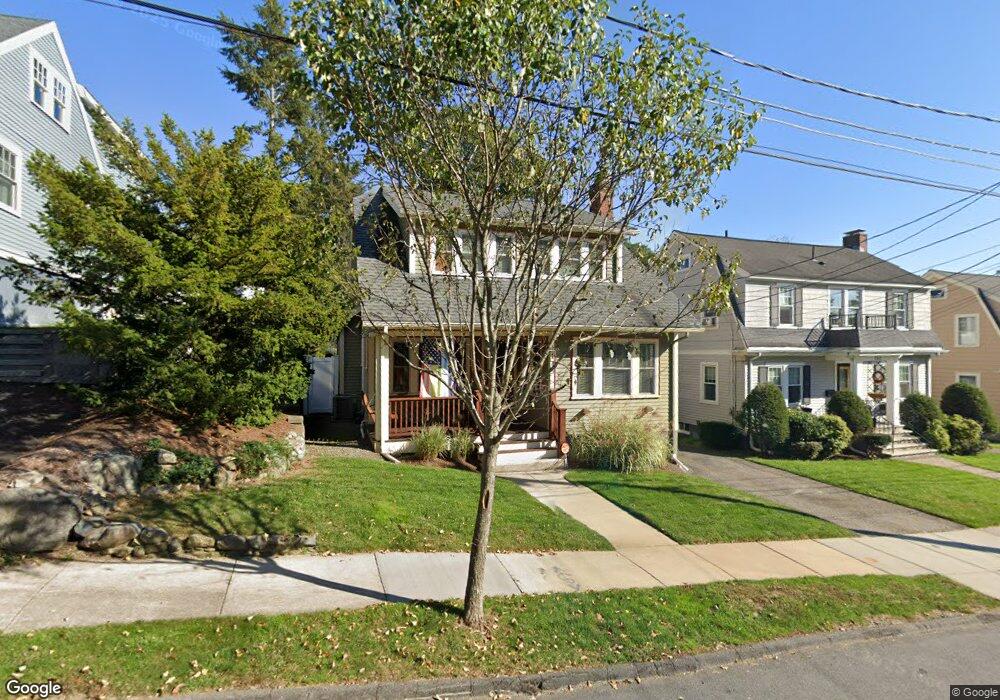
143 Robbins Rd Watertown, MA 02472
East Watertown NeighborhoodEstimated Value: $953,094 - $1,252,000
3
Beds
2
Baths
1,810
Sq Ft
$628/Sq Ft
Est. Value
About This Home
This home is located at 143 Robbins Rd, Watertown, MA 02472 and is currently estimated at $1,136,024, approximately $627 per square foot. 143 Robbins Rd is a home located in Middlesex County with nearby schools including The Kendall School and Beacon High School.
Ownership History
Date
Name
Owned For
Owner Type
Purchase Details
Closed on
Mar 12, 2008
Sold by
Renyi Christopher T and Renyi Katharine E
Bought by
Foley Aileen M and Woodman Joanna
Current Estimated Value
Purchase Details
Closed on
Aug 5, 2003
Sold by
Cunthia A White Lt and White
Bought by
Renyi Katharine E and Renyi Christopher T
Purchase Details
Closed on
Jan 18, 1991
Sold by
Mahler Martin B
Bought by
White Cynthia A
Create a Home Valuation Report for This Property
The Home Valuation Report is an in-depth analysis detailing your home's value as well as a comparison with similar homes in the area
Home Values in the Area
Average Home Value in this Area
Purchase History
| Date | Buyer | Sale Price | Title Company |
|---|---|---|---|
| Foley Aileen M | $582,000 | -- | |
| Foley Aileen M | $582,000 | -- | |
| Foley Aileen M | $582,000 | -- | |
| Renyi Katharine E | $454,000 | -- | |
| Renyi Katharine E | $454,000 | -- | |
| White Cynthia A | $34,000 | -- | |
| White Cynthia A | $34,000 | -- |
Source: Public Records
Mortgage History
| Date | Status | Borrower | Loan Amount |
|---|---|---|---|
| Open | White Cynthia A | $407,000 | |
| Closed | White Cynthia A | $414,000 | |
| Closed | White Cynthia A | $106,000 |
Source: Public Records
Tax History
| Year | Tax Paid | Tax Assessment Tax Assessment Total Assessment is a certain percentage of the fair market value that is determined by local assessors to be the total taxable value of land and additions on the property. | Land | Improvement |
|---|---|---|---|---|
| 2025 | $10,402 | $890,600 | $478,800 | $411,800 |
| 2024 | $9,649 | $824,700 | $456,600 | $368,100 |
| 2023 | $10,356 | $762,600 | $435,200 | $327,400 |
| 2022 | $9,843 | $742,900 | $428,100 | $314,800 |
| 2021 | $9,014 | $735,800 | $421,000 | $314,800 |
| 2020 | $8,673 | $714,400 | $399,600 | $314,800 |
| 2019 | $8,235 | $639,400 | $385,300 | $254,100 |
| 2018 | $7,592 | $563,600 | $342,500 | $221,100 |
| 2017 | $7,785 | $560,500 | $342,500 | $218,000 |
| 2016 | $6,936 | $507,000 | $308,600 | $198,400 |
| 2015 | $7,620 | $507,000 | $308,600 | $198,400 |
| 2014 | $7,585 | $507,000 | $308,600 | $198,400 |
Source: Public Records
Map
Nearby Homes
- 456 Belmont St Unit 10
- 34 Bradford Rd Unit 34
- 519 Belmont St
- 519 Belmont St Unit 2
- 589-591 Belmont St
- 25 Barnard Ave
- 40 Marion Rd
- 125 Trapelo Rd Unit 21
- 125 Trapelo Rd Unit 36
- 85 Lowell Ave
- 87 Lowell Ave Unit 87
- 324 Mount Auburn St Unit 2
- 235 Mount Auburn St
- 71 Carroll St Unit 71
- 29 Commonwealth Rd Unit 1
- 73 Palfrey St Unit 73
- 71 Palfrey St Unit 71
- 11 Harriet Ave Unit 2
- 9 Harriet Ave Unit 1
- 118 Spring St Unit 118
- 141 Robbins Rd
- 137 Robbins Rd
- 153 Robbins Rd
- 5 Bellevue Terrace
- 144 Robbins Rd Unit 146
- 144 Robbins Rd Unit 1
- 142 Robbins Rd
- 148 Robbins Rd Unit 150
- 150 Robbins Rd Unit 1
- 150 Robbins Rd Unit 150
- 148 Robbins Rd Unit 1
- 155 Robbins Rd
- 2 Bellevue Terrace
- 129 Robbins Rd
- 152 Robbins Rd
- 198 Bellevue Rd
- 184 Bellevue Rd
- 217 Common St
- 217 Common St Unit 2
- 217 Common St Unit 217
Your Personal Tour Guide
Ask me questions while you tour the home.