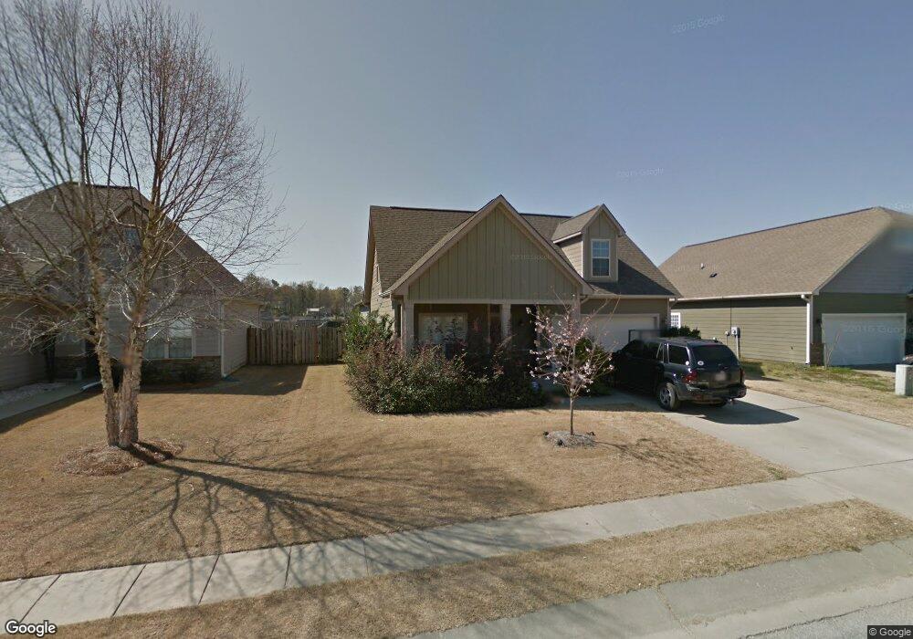
143 Robin St Calera, AL 35040
Estimated Value: $287,782 - $303,000
Studio
--
Bath
2,254
Sq Ft
$132/Sq Ft
Est. Value
About This Home
This home is located at 143 Robin St, Calera, AL 35040 and is currently estimated at $298,446, approximately $132 per square foot. 143 Robin St is a home located in Shelby County with nearby schools including Calera Intermediate School, Calera Elementary School, and Calera Middle School.
Ownership History
Date
Name
Owned For
Owner Type
Purchase Details
Closed on
Apr 27, 2006
Sold by
P D Bailey Homes Inc
Bought by
Sanders Brantley S and Sanders Shannon
Current Estimated Value
Home Financials for this Owner
Home Financials are based on the most recent Mortgage that was taken out on this home.
Original Mortgage
$185,000
Outstanding Balance
$106,592
Interest Rate
6.31%
Mortgage Type
Fannie Mae Freddie Mac
Estimated Equity
$191,854
Purchase Details
Closed on
Jan 19, 2006
Sold by
Nottingham Llc
Bought by
P D Bailey Homes Inc
Home Financials for this Owner
Home Financials are based on the most recent Mortgage that was taken out on this home.
Original Mortgage
$147,200
Interest Rate
6.22%
Mortgage Type
Construction
Create a Home Valuation Report for This Property
The Home Valuation Report is an in-depth analysis detailing your home's value as well as a comparison with similar homes in the area
Home Values in the Area
Average Home Value in this Area
Purchase History
| Date | Buyer | Sale Price | Title Company |
|---|---|---|---|
| Sanders Brantley S | $185,000 | None Available | |
| P D Bailey Homes Inc | $30,000 | None Available |
Source: Public Records
Mortgage History
| Date | Status | Borrower | Loan Amount |
|---|---|---|---|
| Open | Sanders Brantley S | $185,000 | |
| Previous Owner | P D Bailey Homes Inc | $147,200 |
Source: Public Records
Tax History
| Year | Tax Paid | Tax Assessment Tax Assessment Total Assessment is a certain percentage of the fair market value that is determined by local assessors to be the total taxable value of land and additions on the property. | Land | Improvement |
|---|---|---|---|---|
| 2024 | $1,664 | $30,820 | $0 | $0 |
| 2023 | $1,582 | $30,060 | $0 | $0 |
| 2022 | $1,217 | $23,300 | $0 | $0 |
| 2021 | $1,125 | $21,600 | $0 | $0 |
| 2020 | $1,071 | $20,600 | $0 | $0 |
| 2019 | $1,022 | $19,680 | $0 | $0 |
| 2017 | $944 | $18,240 | $0 | $0 |
| 2015 | $1,025 | $19,740 | $0 | $0 |
| 2014 | $915 | $17,700 | $0 | $0 |
Source: Public Records
Map
Nearby Homes
- 113 Robin St
- 293 Rossburg Dr
- 2051 Rossburg Place
- 129 Little John Cir
- 1009 Daventry Way
- 935 Daventry Trail
- 100 Little John Cir
- 904 Daventry Trail
- 928 Daventry Trail
- 5714 Smokey Rd
- 142 Creekstone Trail
- 157 Union Station Dr
- 172 the Heights Dr
- 167 Southern Hills Dr
- 140 Southern Hills Dr
- 185 Creekstone Trail
- 509 Union Station Place
- 229 the Heights Dr
- The Freeport Plan at Koslin Farms
- The Cali Plan at Koslin Farms