
Seller's Agent in 2025
Jenny Fessler
Mullen Realty Associates
(570) 366-4686
1 in this area
157 Total Sales
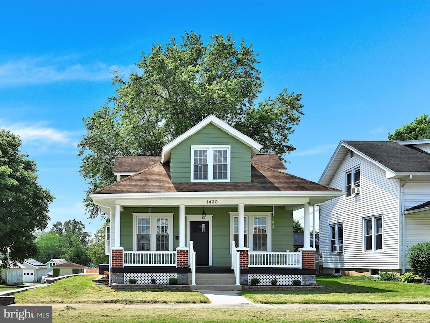
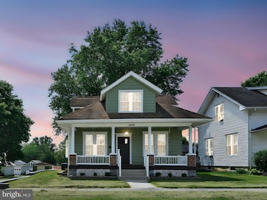
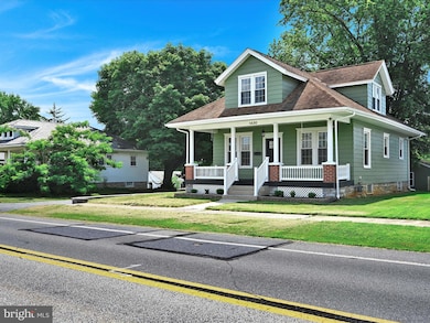
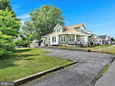
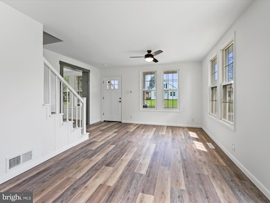
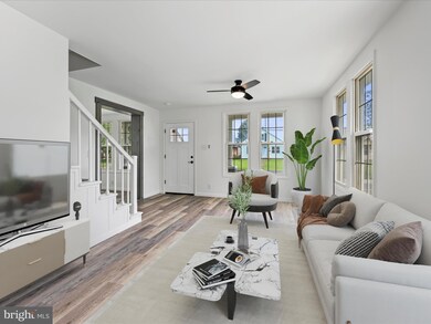
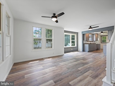
Welcome to this beautifully updated Craftsman-style home in Hershey, PA—where timeless charm meets modern luxury on a spacious double lot. From the inviting front porch to the thoughtful upgrades throughout, this home is truly a rare find... as rich and satisfying as your favorite piece of chocolate. Everything inside has been updated—flooring, paint, fixtures, appliances, plumbing, and more—making this home completely move-in ready. Step inside to discover all-new flooring, fresh paint, and stylish grey-washed woodwork that give the home a clean, upscale feel. The open-concept layout includes a bright and airy living room, dining area with a bay window, and a galley kitchen with soft-close cabinetry, granite countertops, and all-new appliances. A sunny breakfast nook overlooks the backyard, offering the perfect start to your day. The main level also features a cozy den or home office, a beautifully updated full bath, and a first-floor primary bedroom. Laundry is easy with a washer/dryer combo also on this level. Upstairs, you’ll find three more bedrooms and a second full bath. The finished lower level provides even more flexible living space—ideal as a family room, guest suite, or fifth bedroom. There’s also a third full bath/utility room, and an additional washer/dryer—perfect for guests or extended family. Outside, enjoy a private patio, detached one-car garage with a workshop (great for car enthusiasts or DIYers), and a separate shed for lawn equipment. Plenty of parking from both the front and back. Conveniently located close to Hersheypark, Hershey attractions, shopping, restaurants, and Penn State Hershey Medical Center—with easy access to Routes 422 and 81—this home offers the best of both comfort and convenience. Sweet, solid, and full of character... it’s everything you’ve been craving. All this and more, right here in the sweetest place on earth.
Last Agent to Sell the Property
(570) 366-4686 jenny@bradmullensells.com Mullen Realty Associates License #AB069348 Listed on: 07/16/2025
Last Buyer's Agent
(570) 366-4686 jenny@bradmullensells.com Mullen Realty Associates License #AB069348 Listed on: 07/16/2025
| Date | Type | Sale Price | Title Company |
|---|---|---|---|
| Deed | $200,000 | None Listed On Document | |
| Deed | $200,000 | None Listed On Document |
| Date | Event | Price | List to Sale | Price per Sq Ft |
|---|---|---|---|---|
| 08/15/2025 08/15/25 | Sold | $393,000 | -8.6% | $191 / Sq Ft |
| 07/22/2025 07/22/25 | Pending | -- | -- | -- |
| 07/16/2025 07/16/25 | For Sale | $429,900 | -- | $209 / Sq Ft |
| Year | Tax Paid | Tax Assessment Tax Assessment Total Assessment is a certain percentage of the fair market value that is determined by local assessors to be the total taxable value of land and additions on the property. | Land | Improvement |
|---|---|---|---|---|
| 2025 | $2,728 | $87,300 | $29,400 | $57,900 |
| 2024 | $2,564 | $87,300 | $29,400 | $57,900 |
| 2023 | $2,519 | $87,300 | $29,400 | $57,900 |
| 2022 | $2,463 | $87,300 | $29,400 | $57,900 |
| 2021 | $2,463 | $87,300 | $29,400 | $57,900 |
| 2020 | $2,463 | $87,300 | $29,400 | $57,900 |
| 2019 | $335 | $87,300 | $29,400 | $57,900 |
| 2018 | $2,354 | $87,300 | $29,400 | $57,900 |
| 2017 | $2,354 | $87,300 | $29,400 | $57,900 |
| 2016 | $0 | $87,300 | $29,400 | $57,900 |
| 2015 | -- | $87,300 | $29,400 | $57,900 |
| 2014 | -- | $87,300 | $29,400 | $57,900 |
Seller's Agent in 2025
Jenny Fessler
Mullen Realty Associates
(570) 366-4686
1 in this area
157 Total Sales
Source: Bright MLS
MLS Number: PADA2047366
APN: 24-006-049
Disclaimer: Certain information contained herein is derived from information provided by parties other than Homes.com. All information provided is deemed reliable, but is not guaranteed to be accurate and should be independently verified.
![]() The data relating to real estate for sale on this website appears in part through the BRIGHT Internet Data Exchange program, a voluntary cooperative exchange of property listing data between licensed real estate brokerage firms, and is provided by BRIGHT through a licensing agreement.
The data relating to real estate for sale on this website appears in part through the BRIGHT Internet Data Exchange program, a voluntary cooperative exchange of property listing data between licensed real estate brokerage firms, and is provided by BRIGHT through a licensing agreement.
Listing information is from various brokers who participate in the Bright MLS IDX program and not all listings may be visible on the site.
The property information being provided on or through the website is for the personal, non-commercial use of consumers and such information may not be used for any purpose other than to identify prospective properties consumers may be interested in purchasing.
Some properties which appear for sale on the website may no longer be available because they are for instance, under contract, sold or are no longer being offered for sale.
Property information displayed is deemed reliable but is not guaranteed.
Copyright 2026 Bright MLS, Inc.
Ask me questions while you tour the home.