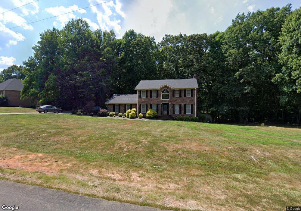
1430 Mcdaniel Dr Asheboro, NC 27205
Estimated Value: $397,000 - $458,000
3
Beds
3
Baths
2,921
Sq Ft
$149/Sq Ft
Est. Value
About This Home
This home is located at 1430 Mcdaniel Dr, Asheboro, NC 27205 and is currently estimated at $434,561, approximately $148 per square foot. 1430 Mcdaniel Dr is a home located in Randolph County with nearby schools including Sycamore Elementary School, Farmer Elementary School, and Uwharrie Ridge Six-Twelve.
Ownership History
Date
Name
Owned For
Owner Type
Purchase Details
Closed on
Nov 3, 2009
Sold by
Coltrane Crandel L and Coltrane Jessica C
Bought by
Coltrane Crandel L and Coltrane Jessica C
Current Estimated Value
Purchase Details
Closed on
Apr 10, 2003
Bought by
Coltrane Crandel L Cramer Jessica
Purchase Details
Closed on
Jun 5, 1998
Bought by
Coltrane Crandel L Cramer Jessica
Purchase Details
Closed on
Jan 11, 1994
Bought by
Coltrane Crandel L Cramer Jessica
Create a Home Valuation Report for This Property
The Home Valuation Report is an in-depth analysis detailing your home's value as well as a comparison with similar homes in the area
Home Values in the Area
Average Home Value in this Area
Purchase History
| Date | Buyer | Sale Price | Title Company |
|---|---|---|---|
| Coltrane Crandel L | -- | None Available | |
| Coltrane Crandel L Cramer Jessica | $198,800 | -- | |
| Coltrane Crandel L Cramer Jessica | $212,000 | -- | |
| Coltrane Crandel L Cramer Jessica | $15,000 | -- |
Source: Public Records
Tax History Compared to Growth
Tax History
| Year | Tax Paid | Tax Assessment Tax Assessment Total Assessment is a certain percentage of the fair market value that is determined by local assessors to be the total taxable value of land and additions on the property. | Land | Improvement |
|---|---|---|---|---|
| 2025 | $2,131 | $322,540 | $51,200 | $271,340 |
| 2024 | $2,098 | $322,540 | $51,200 | $271,340 |
| 2023 | $2,098 | $322,540 | $51,200 | $271,340 |
| 2022 | $1,808 | $230,670 | $36,020 | $194,650 |
| 2021 | $1,808 | $230,670 | $36,020 | $194,650 |
| 2020 | $1,761 | $230,670 | $36,020 | $194,650 |
| 2019 | $1,759 | $230,670 | $36,020 | $194,650 |
| 2018 | $1,630 | $208,320 | $33,760 | $174,560 |
| 2016 | $1,609 | $208,324 | $33,760 | $174,564 |
| 2015 | $1,594 | $208,324 | $33,760 | $174,564 |
| 2014 | -- | $208,324 | $33,760 | $174,564 |
Source: Public Records
Map
Nearby Homes
- 0 Nc Highway 49 S Unit 1162269
- 1559 Allen Ct
- 2442 Farmwood Ln
- 2209 Cedarwood Ct
- 1564 Walker Rd
- 1746 Taylors Creek Dr
- 1575 Leslie St
- 2318 Doul Mountain Rd
- 2272 Doul Mountain Rd
- 0 Muriel Ln
- 1301 Nc Highway 49 S
- 1669 Moore Rd
- 00 U S Highway 64
- 2634 Fox Ridge Rd
- 2626 Fox Ridge Rd
- 0 Fox Ridge Rd Unit 1197775
- Lot 37 Fox Ridge Rd
- 0 Danny Bell Rd
- 0 Deer Ridge Rd Unit 1190677
- 0 Deer Ridge Rd Unit 1191444
- 1448 Mcdaniel Dr
- 1437 Richards Cir
- 1473 Richards Cir
- 1411 Mcdaniel Dr
- 1431 Richards Cir
- 1403 Mcdaniel Dr
- 1387 Mcdaniel Dr
- 1451 Mcdaniel Dr
- 1482 Richards Cir
- 1417 Richards Cir
- 1478 Richards Cir
- 1436 Richards Cir
- 1483 Mcdaniel Dr
- 1413 Richards Cir
- 1391 Mcdaniel Dr
- 1486 Mcdaniel Dr
- 1424 Richards Cir
- 0 Nc Highway 49 S Unit 1038862
- 0 Nc Highway 49 S Unit 513313
- 0 Nc Highway 49 S Unit 840344