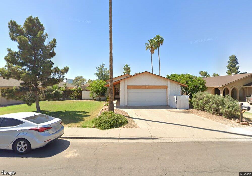
1430 S Date Mesa, AZ 85210
West Central Mesa NeighborhoodEstimated Value: $351,973 - $421,000
4
Beds
2
Baths
1,500
Sq Ft
$267/Sq Ft
Est. Value
About This Home
This home is located at 1430 S Date, Mesa, AZ 85210 and is currently estimated at $400,743, approximately $267 per square foot. 1430 S Date is a home located in Maricopa County with nearby schools including Redbird Elementary School, Franklin at Brimhall Elementary School, and Franklin West Elementary School.
Ownership History
Date
Name
Owned For
Owner Type
Purchase Details
Closed on
Jul 21, 2011
Sold by
Manes Walter D and Manes Eleanor L
Bought by
Manes Greg A
Current Estimated Value
Purchase Details
Closed on
Mar 18, 2004
Sold by
Webster Ronald T
Bought by
Manes Sue A
Home Financials for this Owner
Home Financials are based on the most recent Mortgage that was taken out on this home.
Original Mortgage
$106,500
Interest Rate
5.57%
Mortgage Type
New Conventional
Purchase Details
Closed on
Apr 26, 2001
Sold by
Fox James T and Fox Mary T
Bought by
Webster Ronald T
Home Financials for this Owner
Home Financials are based on the most recent Mortgage that was taken out on this home.
Original Mortgage
$123,400
Interest Rate
6.98%
Mortgage Type
New Conventional
Create a Home Valuation Report for This Property
The Home Valuation Report is an in-depth analysis detailing your home's value as well as a comparison with similar homes in the area
Home Values in the Area
Average Home Value in this Area
Purchase History
| Date | Buyer | Sale Price | Title Company |
|---|---|---|---|
| Manes Greg A | -- | None Available | |
| Manes Walter D | -- | None Available | |
| Manes Sue A | $146,500 | First American Title Ins Co | |
| Webster Ronald T | $129,900 | First American Title |
Source: Public Records
Mortgage History
| Date | Status | Borrower | Loan Amount |
|---|---|---|---|
| Previous Owner | Manes Sue A | $106,500 | |
| Previous Owner | Webster Ronald T | $123,400 |
Source: Public Records
Tax History
| Year | Tax Paid | Tax Assessment Tax Assessment Total Assessment is a certain percentage of the fair market value that is determined by local assessors to be the total taxable value of land and additions on the property. | Land | Improvement |
|---|---|---|---|---|
| 2025 | $1,299 | $13,170 | -- | -- |
| 2024 | $1,303 | $12,543 | -- | -- |
| 2023 | $1,303 | $30,210 | $6,040 | $24,170 |
| 2022 | $1,276 | $23,120 | $4,620 | $18,500 |
| 2021 | $1,292 | $21,570 | $4,310 | $17,260 |
| 2020 | $1,275 | $19,670 | $3,930 | $15,740 |
| 2019 | $1,191 | $18,100 | $3,620 | $14,480 |
| 2018 | $1,143 | $15,250 | $3,050 | $12,200 |
| 2017 | $1,109 | $14,310 | $2,860 | $11,450 |
| 2016 | $1,089 | $13,620 | $2,720 | $10,900 |
| 2015 | $871 | $13,160 | $2,630 | $10,530 |
Source: Public Records
Map
Nearby Homes
- 639 W Grove Cir
- 461 W Holmes Ave Unit 258
- 461 W Holmes Ave Unit 350
- 461 W Holmes Ave Unit 150
- 461 W Holmes Ave Unit 383
- 625 W Southern Ave
- 808 W Isabella Ave
- 823 W Isabella Ave
- 1064 S Revere
- 1367 S Country Club Dr Unit 1118
- 1367 S Country Club Dr Unit 1239
- 1367 S Country Club Dr Unit 1344
- 1367 S Country Club Dr Unit 1041
- 1367 S Country Club Dr Unit 1125
- 604 W Emelita Ave
- 1850 S Westwood Unit 47
- 1056 W Farmdale Ave
- 1018 W Enid Ave
- 839 S Westwood Unit 287
- 839 S Westwood Unit 265
Your Personal Tour Guide
Ask me questions while you tour the home.