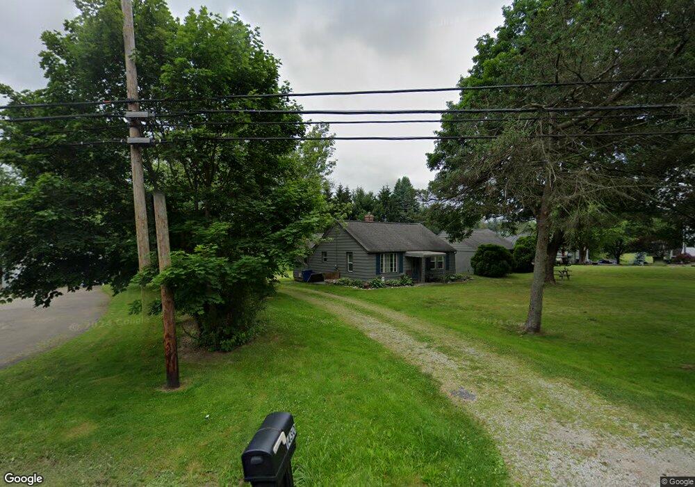
1430 Steese Rd Uniontown, OH 44685
Estimated Value: $164,555 - $220,000
2
Beds
1
Bath
840
Sq Ft
$227/Sq Ft
Est. Value
About This Home
This home is located at 1430 Steese Rd, Uniontown, OH 44685 and is currently estimated at $190,639, approximately $226 per square foot. 1430 Steese Rd is a home located in Summit County with nearby schools including Greenwood Elementary School, Green Intermediate Elementary School, and Green Primary School.
Ownership History
Date
Name
Owned For
Owner Type
Purchase Details
Closed on
Jun 28, 2005
Sold by
Porter Jay L
Bought by
Barnhart Randall L
Current Estimated Value
Home Financials for this Owner
Home Financials are based on the most recent Mortgage that was taken out on this home.
Original Mortgage
$99,900
Outstanding Balance
$52,821
Interest Rate
5.86%
Mortgage Type
Fannie Mae Freddie Mac
Estimated Equity
$137,818
Purchase Details
Closed on
Aug 26, 2004
Sold by
Doughty Evelyn
Bought by
Porter Jay L
Home Financials for this Owner
Home Financials are based on the most recent Mortgage that was taken out on this home.
Original Mortgage
$74,700
Interest Rate
5.95%
Mortgage Type
Purchase Money Mortgage
Create a Home Valuation Report for This Property
The Home Valuation Report is an in-depth analysis detailing your home's value as well as a comparison with similar homes in the area
Home Values in the Area
Average Home Value in this Area
Purchase History
| Date | Buyer | Sale Price | Title Company |
|---|---|---|---|
| Barnhart Randall L | $99,900 | Netwide Title Agency Inc | |
| Porter Jay L | $83,000 | Land America-Lawyers Title |
Source: Public Records
Mortgage History
| Date | Status | Borrower | Loan Amount |
|---|---|---|---|
| Open | Barnhart Randall L | $99,900 | |
| Previous Owner | Porter Jay L | $74,700 |
Source: Public Records
Tax History Compared to Growth
Tax History
| Year | Tax Paid | Tax Assessment Tax Assessment Total Assessment is a certain percentage of the fair market value that is determined by local assessors to be the total taxable value of land and additions on the property. | Land | Improvement |
|---|---|---|---|---|
| 2025 | $2,369 | $50,586 | $20,818 | $29,768 |
| 2024 | $2,369 | $50,586 | $20,818 | $29,768 |
| 2023 | $2,369 | $50,586 | $20,818 | $29,768 |
| 2022 | $1,933 | $37,041 | $15,085 | $21,956 |
| 2021 | $1,812 | $37,041 | $15,085 | $21,956 |
| 2020 | $1,776 | $37,050 | $15,090 | $21,960 |
| 2019 | $1,729 | $33,790 | $14,480 | $19,310 |
| 2018 | $1,767 | $33,790 | $14,480 | $19,310 |
| 2017 | $1,704 | $33,790 | $14,480 | $19,310 |
| 2016 | $1,696 | $30,590 | $14,480 | $16,110 |
| 2015 | $1,704 | $30,590 | $14,480 | $16,110 |
| 2014 | $1,693 | $30,590 | $14,480 | $16,110 |
| 2013 | $1,712 | $30,700 | $14,480 | $16,220 |
Source: Public Records
Map
Nearby Homes
- 4237 Springdale Rd
- 4426 Royce Ave
- 4350 Sunnyview Dr
- 1501 Spring Wood Ln
- 1499 King Dr
- Mystique Plan at Brier Creek
- Countryview Plan at Brier Creek
- Prosperity Plan at Brier Creek
- 3982 Crest View Dr
- 3943 Crest View Dr
- 4608 S Arlington Rd
- 1659 King Dr
- 3930 Crest View Dr
- 3831 Golden Wood Way
- Westchester Plan at Jacobs Ridge - Estates
- Newberry Plan at Jacobs Ridge - Crossings
- Mercer Plan at Jacobs Ridge - Crossings
- Amberwood Plan at Jacobs Ridge - Estates
- Ascend Plan at Jacobs Ridge - Crossings
- Boardwalk Plan at Jacobs Ridge - Crossings
- 1412 Steese Rd
- 4297 Brookview Ct
- 4305 Brookview Ct
- 1398 Steese Rd
- 1444 Steese Rd
- 4306 Brookview Ct
- 1421 Steese Rd
- 4287 Slaughter Rd
- 4313 Brookview Ct
- 1460 Steese Rd
- 1386 Steese Rd
- 4314 Brookview Ct
- 1405 Steese Rd
- 4347 Ridge View Dr
- 4321 Brookview Ct
- 4322 Brookview Ct
- 1391 Steese Rd
- 1467 Steese Rd
- 1468 Steese Rd
- 4277 Slaughter Rd