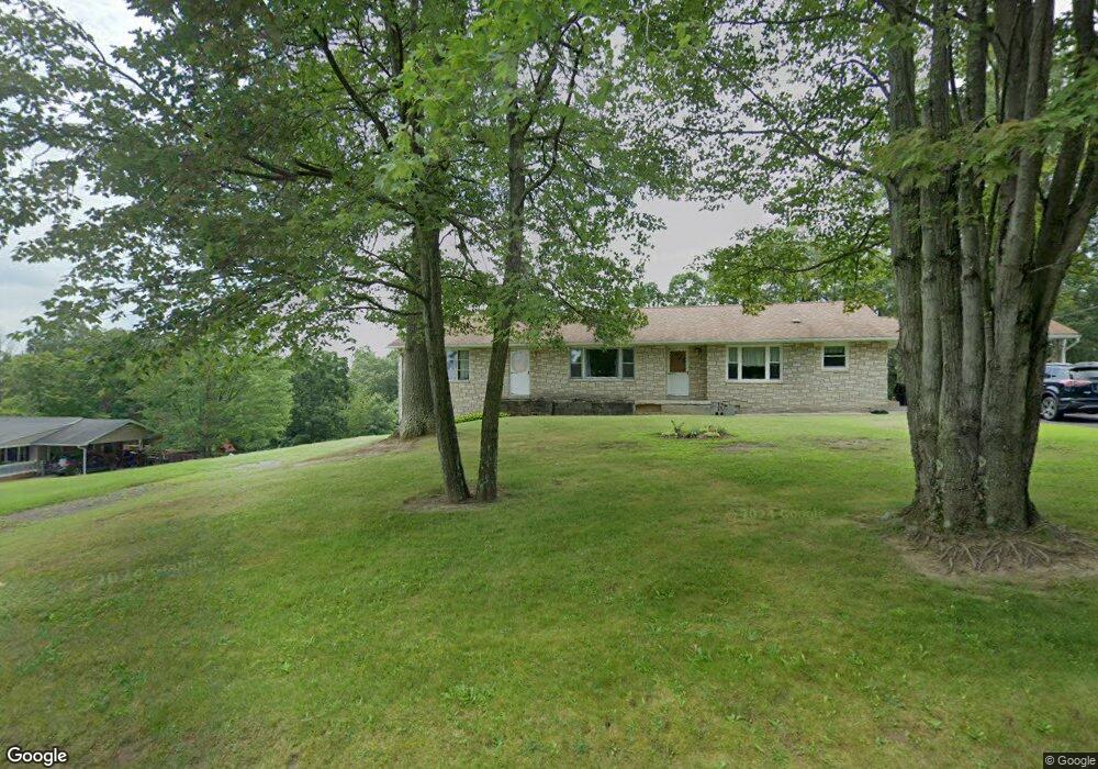
14302 Brant Rd SW Cumberland, MD 21502
Estimated Value: $226,516 - $299,000
--
Bed
4
Baths
1,920
Sq Ft
$134/Sq Ft
Est. Value
About This Home
This home is located at 14302 Brant Rd SW, Cumberland, MD 21502 and is currently estimated at $257,379, approximately $134 per square foot. 14302 Brant Rd SW is a home located in Allegany County with nearby schools including Cresaptown Elementary School, Braddock Middle School, and Allegany High School.
Ownership History
Date
Name
Owned For
Owner Type
Purchase Details
Closed on
Apr 22, 1988
Sold by
Ware William Dale
Bought by
Morgan Jeffrey A-Debra I
Current Estimated Value
Home Financials for this Owner
Home Financials are based on the most recent Mortgage that was taken out on this home.
Original Mortgage
$60,000
Interest Rate
10.3%
Create a Home Valuation Report for This Property
The Home Valuation Report is an in-depth analysis detailing your home's value as well as a comparison with similar homes in the area
Home Values in the Area
Average Home Value in this Area
Purchase History
| Date | Buyer | Sale Price | Title Company |
|---|---|---|---|
| Morgan Jeffrey A-Debra I | $75,000 | -- |
Source: Public Records
Mortgage History
| Date | Status | Borrower | Loan Amount |
|---|---|---|---|
| Closed | Morgan Jeffrey A-Debra I | $60,000 |
Source: Public Records
Tax History Compared to Growth
Tax History
| Year | Tax Paid | Tax Assessment Tax Assessment Total Assessment is a certain percentage of the fair market value that is determined by local assessors to be the total taxable value of land and additions on the property. | Land | Improvement |
|---|---|---|---|---|
| 2025 | $2,046 | $186,600 | $35,000 | $151,600 |
| 2024 | $1,964 | $176,000 | $0 | $0 |
| 2023 | $1,755 | $165,400 | $0 | $0 |
| 2022 | $1,807 | $154,800 | $33,800 | $121,000 |
| 2021 | $1,788 | $154,633 | $0 | $0 |
| 2020 | $1,803 | $154,467 | $0 | $0 |
| 2019 | $1,801 | $154,300 | $33,800 | $120,500 |
| 2018 | $1,801 | $154,300 | $33,800 | $120,500 |
| 2017 | $1,802 | $154,300 | $0 | $0 |
| 2016 | -- | $180,500 | $0 | $0 |
| 2015 | -- | $174,700 | $0 | $0 |
| 2014 | -- | $168,900 | $0 | $0 |
Source: Public Records
Map
Nearby Homes
- 14129 Louise Dr SW
- 11813 Illinois Ave
- 14104 Louise Dr SW
- 14801 Connecticut Ave
- 14003 Cedarwood Dr SW
- 14308L Greenfield Crescent SW
- 15509 Westwood Rd SW
- 0 Fir Tree Ln Unit MDAL2012106
- 15609 Westwood Rd SW
- 14407 N Bel Air Dr SW
- 14619 Redwood St
- 15507 Ivy Ct SW
- 14620 Redwood St
- 15700 Acorn Ct SW
- 14200 Stonefield Ln
- 15008 Laurel Ridge Rd SW
- 14804 Bell St
- 15708 Downing St SW
- 14211 Sparrow Ln SW
- 14219 N Bel Air Dr SW
- 14308 Brant Rd SW
- 14214 Brant Rd SW
- 14310 Brant Rd SW
- 14212 Brant Rd SW
- 14215 Brant Rd SW
- 14209 Cedarwood Dr SW
- 14207 Brant Rd SW
- 14211 Cedarwood Dr SW
- 14400 Brant Rd SW
- 14903 Haines Dr SW
- 14200 Brant Rd SW
- 14905 Haines Dr SW
- 14203 Cedarwood Dr SW Unit 1B
- 14203 Cedarwood Dr SW Unit 4B
- 14203 Cedarwood Dr SW Unit 1-24
- 14309 Brant Rd SW
- 14900 Weitzel Rd SW
- 15001 Lillian Dr SW
- 14201 Cedarwood Dr SW Unit 4A
- 14201 Cedarwood Dr SW Unit 7A & 11A