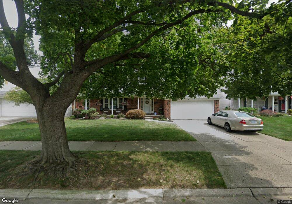
14302 Hubbard St Livonia, MI 48154
Estimated Value: $366,675 - $412,000
--
Bed
1
Bath
1,918
Sq Ft
$205/Sq Ft
Est. Value
About This Home
This home is located at 14302 Hubbard St, Livonia, MI 48154 and is currently estimated at $392,919, approximately $204 per square foot. 14302 Hubbard St is a home located in Wayne County with nearby schools including Kennedy Elementary School, Johnson Upper Elementary School, and Frost Middle School.
Ownership History
Date
Name
Owned For
Owner Type
Purchase Details
Closed on
Mar 15, 2002
Sold by
Berger Steven F
Bought by
Rudd Jennifer
Current Estimated Value
Purchase Details
Closed on
Jun 10, 1994
Sold by
Juenemann Jeffrey G
Bought by
Berger Steven F and Berger Yvonne
Home Financials for this Owner
Home Financials are based on the most recent Mortgage that was taken out on this home.
Original Mortgage
$113,600
Interest Rate
5.12%
Mortgage Type
New Conventional
Create a Home Valuation Report for This Property
The Home Valuation Report is an in-depth analysis detailing your home's value as well as a comparison with similar homes in the area
Home Values in the Area
Average Home Value in this Area
Purchase History
| Date | Buyer | Sale Price | Title Company |
|---|---|---|---|
| Rudd Jennifer | $240,000 | -- | |
| Berger Steven F | $142,000 | -- |
Source: Public Records
Mortgage History
| Date | Status | Borrower | Loan Amount |
|---|---|---|---|
| Previous Owner | Berger Steven F | $113,600 |
Source: Public Records
Tax History Compared to Growth
Tax History
| Year | Tax Paid | Tax Assessment Tax Assessment Total Assessment is a certain percentage of the fair market value that is determined by local assessors to be the total taxable value of land and additions on the property. | Land | Improvement |
|---|---|---|---|---|
| 2025 | $2,051 | $164,700 | $0 | $0 |
| 2024 | $2,051 | $157,300 | $0 | $0 |
| 2023 | $1,957 | $144,400 | $0 | $0 |
| 2022 | $3,436 | $131,900 | $0 | $0 |
| 2021 | $3,338 | $123,400 | $0 | $0 |
| 2019 | $3,202 | $115,200 | $0 | $0 |
| 2018 | $1,654 | $106,000 | $0 | $0 |
| 2017 | $2,929 | $101,700 | $0 | $0 |
| 2016 | $3,079 | $101,700 | $0 | $0 |
| 2015 | $7,299 | $91,940 | $0 | $0 |
| 2012 | -- | $69,070 | $15,300 | $53,770 |
Source: Public Records
Map
Nearby Homes
- 14214 Cranston St
- 32136 Lyndon St
- 32950 Perth St
- 33025 Martin St
- 33040 Allen St
- 14677 Auburndale St
- 14563 Melrose St
- 14327 Arden St
- 14879 Fairfield St
- 15075 Hubbard St Unit 5
- 15040 Berwick St
- 31126 Grennada St
- 31221 Lyndon St
- 14164 Bainbridge St
- 32651 5 Mile Rd Unit 15
- 14292 Hubbell St
- 14154 Hubbell St
- 30831 Lyndon St
- 14127 Hillcrest St
- 15600 Auburndale St
- 14320 Hubbard St
- 14284 Hubbard St
- 14305 Cranston St
- 14338 Hubbard St
- 14266 Hubbard St
- 14323 Cranston St
- 14287 Cranston St
- 14341 Cranston St
- 14269 Cranston St
- 14356 Hubbard St
- 14248 Hubbard St
- 14303 Hubbard St
- 14321 Hubbard St
- 14359 Cranston St
- 14251 Cranston St
- 14285 Hubbard St
- 14339 Hubbard St
- 14267 Hubbard St
- 14374 Hubbard St
- 14230 Hubbard St