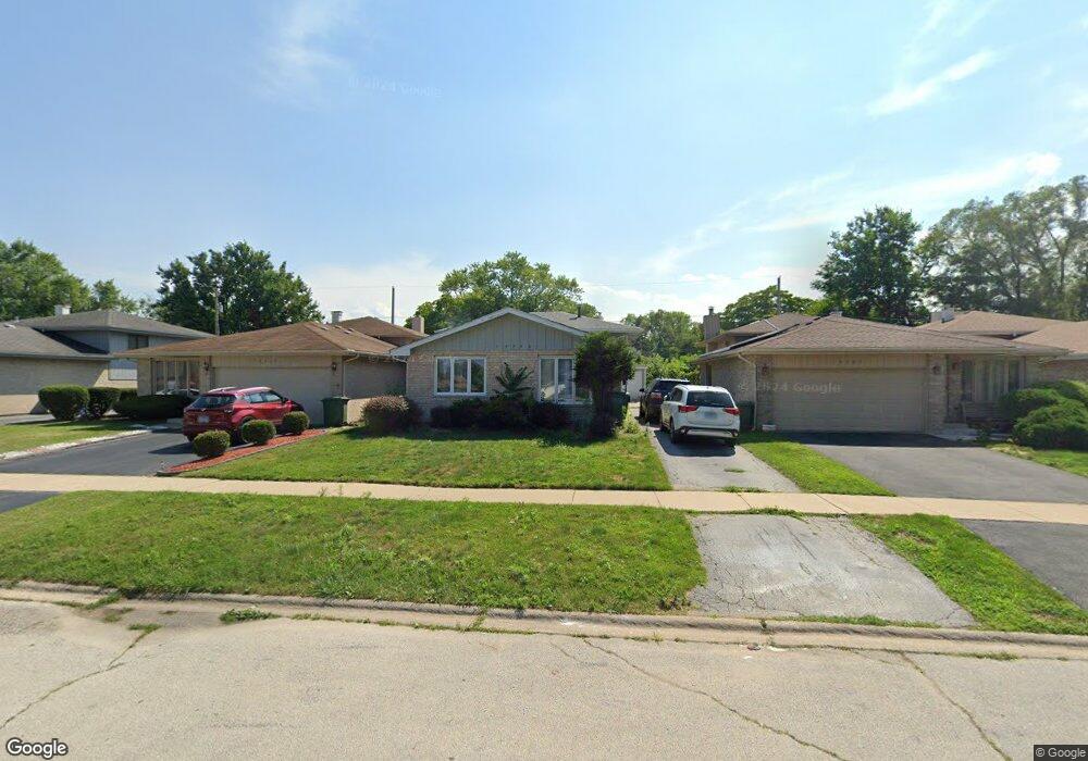
14308 Shepard Dr Dolton, IL 60419
Estimated Value: $168,943 - $202,000
3
Beds
2
Baths
1,065
Sq Ft
$179/Sq Ft
Est. Value
About This Home
This home is located at 14308 Shepard Dr, Dolton, IL 60419 and is currently estimated at $190,486, approximately $178 per square foot. 14308 Shepard Dr is a home located in Cook County with nearby schools including Lincoln Elementary School, Lincoln Junior High School, and Thornridge High School.
Ownership History
Date
Name
Owned For
Owner Type
Purchase Details
Closed on
May 26, 2017
Sold by
Pascal Eddie
Bought by
Brown Monique
Current Estimated Value
Home Financials for this Owner
Home Financials are based on the most recent Mortgage that was taken out on this home.
Original Mortgage
$107,025
Outstanding Balance
$89,862
Interest Rate
4.37%
Mortgage Type
FHA
Estimated Equity
$100,624
Purchase Details
Closed on
Mar 6, 2013
Sold by
Wells Fargo Bank Na
Bought by
Pascal Eddie
Purchase Details
Closed on
Oct 20, 2010
Sold by
Pulley Ondray and Pulley Ondray L
Bought by
Wells Fargo Bank Na
Purchase Details
Closed on
Mar 30, 2006
Sold by
Huggs Willis and Huggs Karen
Bought by
Pulley Ondray
Home Financials for this Owner
Home Financials are based on the most recent Mortgage that was taken out on this home.
Original Mortgage
$140,000
Interest Rate
7.37%
Mortgage Type
Credit Line Revolving
Create a Home Valuation Report for This Property
The Home Valuation Report is an in-depth analysis detailing your home's value as well as a comparison with similar homes in the area
Home Values in the Area
Average Home Value in this Area
Purchase History
| Date | Buyer | Sale Price | Title Company |
|---|---|---|---|
| Brown Monique | $109,000 | Stewart Title | |
| Pascal Eddie | $48,000 | None Available | |
| Wells Fargo Bank Na | -- | None Available | |
| Pulley Ondray | $175,000 | None Available |
Source: Public Records
Mortgage History
| Date | Status | Borrower | Loan Amount |
|---|---|---|---|
| Open | Brown Monique | $107,025 | |
| Previous Owner | Pulley Ondray | $140,000 |
Source: Public Records
Tax History Compared to Growth
Tax History
| Year | Tax Paid | Tax Assessment Tax Assessment Total Assessment is a certain percentage of the fair market value that is determined by local assessors to be the total taxable value of land and additions on the property. | Land | Improvement |
|---|---|---|---|---|
| 2024 | $7,518 | $14,745 | $2,125 | $12,620 |
| 2023 | $7,815 | $16,000 | $2,125 | $13,875 |
| 2022 | $7,815 | $12,634 | $1,875 | $10,759 |
| 2021 | $7,798 | $12,634 | $1,875 | $10,759 |
| 2020 | $10,008 | $12,634 | $1,875 | $10,759 |
| 2019 | $8,919 | $10,175 | $1,750 | $8,425 |
| 2018 | $8,651 | $10,175 | $1,750 | $8,425 |
| 2017 | $5,442 | $10,175 | $1,750 | $8,425 |
| 2016 | $5,248 | $9,655 | $1,625 | $8,030 |
| 2015 | $6,862 | $9,655 | $1,625 | $8,030 |
| 2014 | $6,809 | $9,655 | $1,625 | $8,030 |
| 2013 | $5,963 | $9,197 | $1,625 | $7,572 |
Source: Public Records
Map
Nearby Homes
- 14408 Lincoln Ave
- 14421 Murray Ave
- 14322 Irving Ave
- 14326 Irving Ave
- 14411 Irving Ave
- 14263 Lincoln Ave
- 14514 Cottage Grove Ave
- 14502 Irving Ave
- 14418 Drexel Ave
- 14333 Drexel Ave
- 14526 Cottage Grove Ave
- 664 E 142nd St
- 14325 Ingleside Ave
- 631 E 142nd St
- 14221 Ingleside Ave
- 14635 Greenwood Rd Unit B103
- 933 E 142nd St
- 14131 Lincoln Ave
- 14119 Lincoln Ave
- 14320 Dobson Ave
- 14312 Shepard Dr
- 14306 Shepard Dr
- 14300 Shepard Dr
- 14316 Shepard Dr
- 14258 Shepard Dr
- 14320 Shepard Dr
- 14331 Lincoln Ave
- 14339 Lincoln Ave
- 14256 Shepard Dr
- 14341 Lincoln Ave
- 14324 Shepard Dr
- 14323 Lincoln Ave
- 14323 Lincoln Ave
- 14254 Shepard Dr
- 14343 Lincoln Ave
- 14343 Lincoln Ave
- 14328 Shepard Dr
- 14244 Evans Ave
- 14244 Evans Ave
- 14252 Shepard Dr