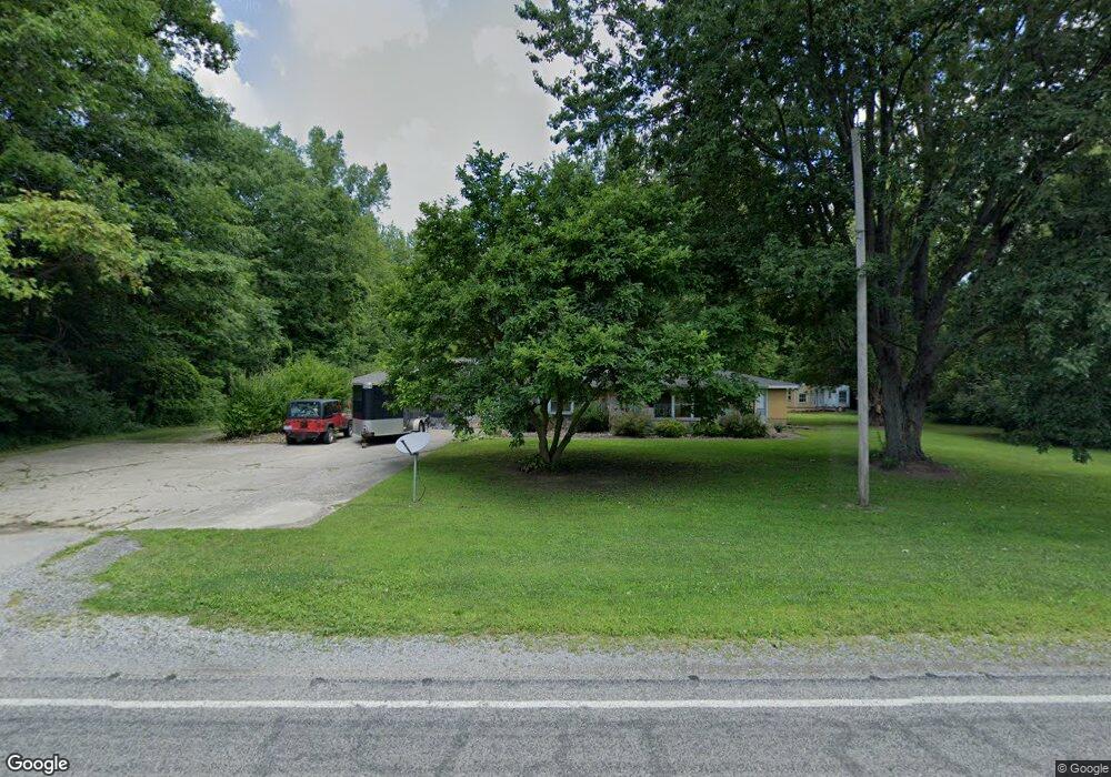
1431 Curtis Rd Birch Run, MI 48415
Estimated Value: $208,000 - $269,000
3
Beds
1
Bath
2,088
Sq Ft
$112/Sq Ft
Est. Value
About This Home
This home is located at 1431 Curtis Rd, Birch Run, MI 48415 and is currently estimated at $234,008, approximately $112 per square foot. 1431 Curtis Rd is a home located in Saginaw County with nearby schools including Thomas White School, Iuka Elementary School, and Martin G. Atkins Elementary School.
Ownership History
Date
Name
Owned For
Owner Type
Purchase Details
Closed on
Aug 12, 2016
Sold by
Sheriff Of Saginaw County
Bought by
Two Stars Llc
Current Estimated Value
Purchase Details
Closed on
May 16, 2008
Sold by
Thompson Carl E
Bought by
Thompson Carl E and Kellogg Carl E
Purchase Details
Closed on
Nov 26, 2004
Sold by
Strait Mable A Aka Mableann Strait
Bought by
Thompson Carl E
Purchase Details
Closed on
May 26, 2004
Sold by
Strait Dennis M
Bought by
Thompson Carl E
Purchase Details
Closed on
Sep 24, 1997
Sold by
Strait Mable A Fka Thompson
Bought by
Strait Mable A and Strait Dennis M
Create a Home Valuation Report for This Property
The Home Valuation Report is an in-depth analysis detailing your home's value as well as a comparison with similar homes in the area
Home Values in the Area
Average Home Value in this Area
Purchase History
| Date | Buyer | Sale Price | Title Company |
|---|---|---|---|
| Two Stars Llc | $35,547 | None Available | |
| Thompson Carl E | -- | -- | |
| Thompson Carl E | -- | -- | |
| Thompson Carl E | -- | -- | |
| Strait Mable A | -- | -- |
Source: Public Records
Tax History Compared to Growth
Tax History
| Year | Tax Paid | Tax Assessment Tax Assessment Total Assessment is a certain percentage of the fair market value that is determined by local assessors to be the total taxable value of land and additions on the property. | Land | Improvement |
|---|---|---|---|---|
| 2025 | $3,708 | $107,100 | $0 | $0 |
| 2024 | $690 | $103,800 | $0 | $0 |
| 2023 | $657 | $93,600 | $0 | $0 |
| 2022 | $3,192 | $83,300 | $0 | $0 |
| 2021 | $2,989 | $73,200 | $0 | $0 |
| 2020 | $2,925 | $68,800 | $0 | $0 |
| 2019 | $2,814 | $64,600 | $6,300 | $58,300 |
| 2018 | $573 | $61,700 | $0 | $0 |
| 2017 | $1,665 | $58,000 | $0 | $0 |
| 2016 | $1,869 | $56,900 | $0 | $0 |
| 2014 | -- | $49,800 | $0 | $44,400 |
| 2013 | -- | $49,500 | $0 | $0 |
Source: Public Records
Map
Nearby Homes
- 1750 Curtis Rd
- 7365 Cole Rd
- 7863 Sheridan Rd Lot #2 Rd
- 7863 Sheridan Rd Lot 4 Rd
- 7863 Sheridan Rd Lot #3 Rd
- 1374 E Moore Rd
- 1160 E Moore Rd
- 1944 E Moore Rd
- VL E Moore Rd
- 1865 W Moore Rd
- 1321 Ruby Ann Dr
- 1891 W Moore Rd
- 6580 Bell Rd
- 5521 Cole Rd
- 5665 East Rd
- 5126 Youngstown Place
- 3130 E Moore Rd
- 1261 Houlihan Rd
- 6493 Mower Rd
- VL Fort Rd
- 1340 Curtis Rd
- 1250 Curtis Rd
- 1385 E Curtis Rd
- 1500 Curtis Rd
- 1500 Curtis Rd
- 1495 Curtis Rd
- 1555 Curtis Rd
- 1597 Curtis Rd
- 1570 Curtis Rd
- 1570 Curtis Rd
- 1641 Curtis Rd
- 7125 Sheridan Rd
- 7090 Sheridan Rd
- 6930 Sheridan Rd
- 6920 Sheridan Rd
- 6900 Sheridan Rd
- 6888 Sheridan Rd
- 7180 Sheridan Rd
- 6880 Sheridan Rd
- 1072 W Curtis Rd