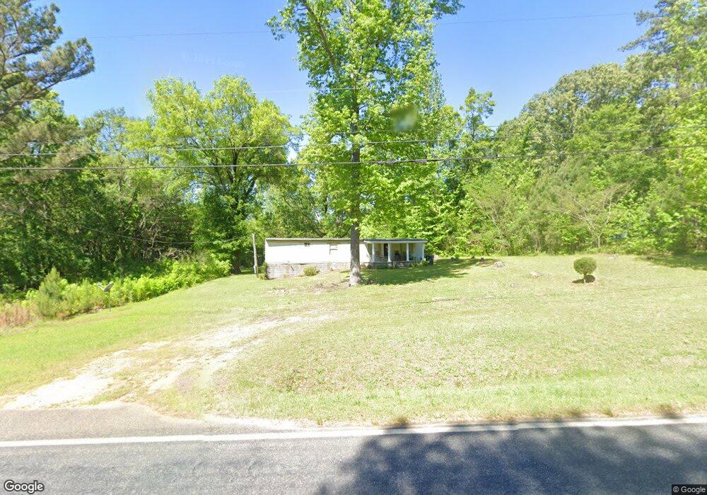
1431 Highway 77 N Union Point, GA 30669
Estimated Value: $211,000 - $322,000
--
Bed
--
Bath
2,154
Sq Ft
$117/Sq Ft
Est. Value
About This Home
This home is located at 1431 Highway 77 N, Union Point, GA 30669 and is currently estimated at $252,853, approximately $117 per square foot. 1431 Highway 77 N is a home with nearby schools including Greene County High School.
Ownership History
Date
Name
Owned For
Owner Type
Purchase Details
Closed on
Oct 21, 2005
Sold by
Smith Frances K
Bought by
Stephens Benjamin M and Plaisted Sandra Stephens
Current Estimated Value
Purchase Details
Closed on
Jan 1, 1996
Sold by
Smith Smith A and Smith Frances K
Bought by
Smith Frances K - Will
Purchase Details
Closed on
Jan 1, 1983
Sold by
Holman Michael and Holman Judith
Bought by
Smith Smith A and Smith Frances K
Purchase Details
Closed on
Jan 1, 1980
Sold by
Mauldin Sandra R
Bought by
Holman Michael and Holman Judith
Purchase Details
Closed on
Jan 1, 1976
Sold by
Mauldin Larry
Bought by
Mauldin Sandra R
Purchase Details
Closed on
Jan 1, 1967
Bought by
Mauldin Larry
Create a Home Valuation Report for This Property
The Home Valuation Report is an in-depth analysis detailing your home's value as well as a comparison with similar homes in the area
Home Values in the Area
Average Home Value in this Area
Purchase History
| Date | Buyer | Sale Price | Title Company |
|---|---|---|---|
| Stephens Benjamin M | -- | -- | |
| Smith Frances K - Will | -- | -- | |
| Smith Smith A | -- | -- | |
| Holman Michael | -- | -- | |
| Mauldin Sandra R | -- | -- | |
| Mauldin Larry | -- | -- |
Source: Public Records
Tax History Compared to Growth
Tax History
| Year | Tax Paid | Tax Assessment Tax Assessment Total Assessment is a certain percentage of the fair market value that is determined by local assessors to be the total taxable value of land and additions on the property. | Land | Improvement |
|---|---|---|---|---|
| 2024 | $1,660 | $94,360 | $11,040 | $83,320 |
| 2023 | $1,571 | $89,040 | $9,200 | $79,840 |
| 2022 | $1,206 | $60,800 | $7,080 | $53,720 |
| 2021 | $1,157 | $54,520 | $7,080 | $47,440 |
| 2020 | $946 | $39,000 | $5,440 | $33,560 |
| 2019 | $983 | $39,000 | $5,440 | $33,560 |
| 2018 | $962 | $39,000 | $5,440 | $33,560 |
| 2017 | $907 | $39,023 | $5,462 | $33,561 |
| 2016 | $932 | $40,264 | $5,462 | $34,802 |
| 2015 | $892 | $40,264 | $5,462 | $34,802 |
| 2014 | $880 | $38,645 | $5,462 | $33,183 |
Source: Public Records
Map
Nearby Homes
- 1581 Highway 77 S Hwy
- 1581 Highway 77 S
- 1241 Old Siloam Rd
- 1041 Hillcrest Dr
- 0 S Rhodes St Unit 10618488
- 112 Hendry St
- 202 Veazey St
- 324 N Rhodes St
- 215 Hunter St
- 5401 Union Point Hwy
- 0 Woodland Ct Unit 10543600
- 0 Washington Hwy Unit 7276060
- 1201 Buffalo Lick Rd
- 0 Buffalo Lick Rd Unit 10551234
- 0 Buffalo Lick Rd Unit 10551325
- 1251 Brick House Rd
- 1251 Brickhouse Rd
- 0 Old Union Point Rd Unit 1 10557753
- 1860 Washington Hwy
- 1681 Sibley School Rd
- 1421 Highway 77 S
- 1420 Highway 77 S
- 1450 Highway 77 S
- 1411 Old Siloam Rd
- 1321 Old Siloam Rd
- 1511 Highway 77 S
- 1290 Old Siloam Rd
- 1282 Old Siloam Rd
- 1360 Highway 77 S
- 1001 Green Acres Dr
- 1311 Green Acres Dr
- 1530 Highway 77 N
- 1241 Green Acres Dr
- 1290 Green Acres Dr
- 131 Green Acres Dr
- 1231 Green Acres Dr
- 1090 Green Acres Dr
- 1321 Highway 77 S
- 1220 Green Acres Dr
- 1190 Green Acres Dr