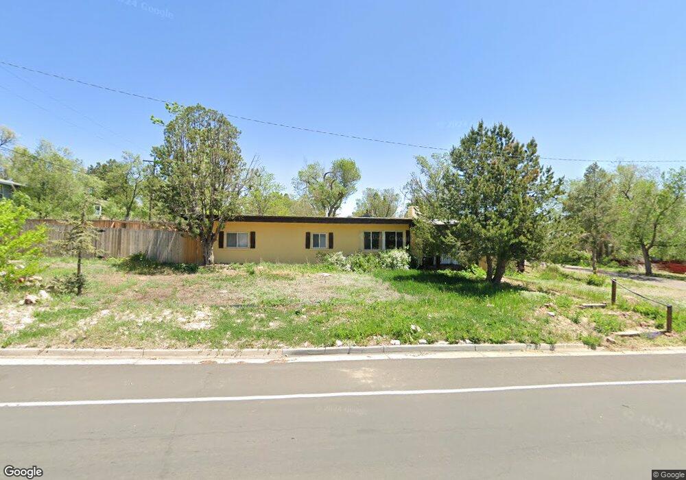
1431 Lorraine St Colorado Springs, CO 80905
Ivywild NeighborhoodEstimated Value: $480,000 - $520,623
3
Beds
2
Baths
1,790
Sq Ft
$280/Sq Ft
Est. Value
About This Home
This home is located at 1431 Lorraine St, Colorado Springs, CO 80905 and is currently estimated at $501,656, approximately $280 per square foot. 1431 Lorraine St is a home located in El Paso County with nearby schools including Adams Elementary School, North Middle School, and William J. Palmer High School.
Ownership History
Date
Name
Owned For
Owner Type
Purchase Details
Closed on
Jul 3, 2015
Sold by
Meadow Lane Investments Xi Llc
Bought by
Blakesley Paul W and Blakesley Nicole C
Current Estimated Value
Home Financials for this Owner
Home Financials are based on the most recent Mortgage that was taken out on this home.
Original Mortgage
$237,650
Outstanding Balance
$186,719
Interest Rate
4.08%
Mortgage Type
New Conventional
Estimated Equity
$314,937
Purchase Details
Closed on
Mar 12, 2015
Sold by
Gasaway Philip W
Bought by
Meadow Lane Investments Xi Llc
Home Financials for this Owner
Home Financials are based on the most recent Mortgage that was taken out on this home.
Original Mortgage
$137,625
Interest Rate
12%
Mortgage Type
Unknown
Purchase Details
Closed on
Jul 11, 2014
Sold by
Bryson Grady C and Bryson Rachel I
Bought by
Gasaway Philip W and The Grady C & Rachel I Bryson Irrevocabl
Create a Home Valuation Report for This Property
The Home Valuation Report is an in-depth analysis detailing your home's value as well as a comparison with similar homes in the area
Home Values in the Area
Average Home Value in this Area
Purchase History
| Date | Buyer | Sale Price | Title Company |
|---|---|---|---|
| Blakesley Paul W | $245,000 | Unified Title Company | |
| Meadow Lane Investments Xi Llc | $133,500 | Unified Title Company | |
| Gasaway Philip W | -- | None Available |
Source: Public Records
Mortgage History
| Date | Status | Borrower | Loan Amount |
|---|---|---|---|
| Open | Blakesley Paul W | $237,650 | |
| Previous Owner | Meadow Lane Investments Xi Llc | $137,625 |
Source: Public Records
Tax History Compared to Growth
Tax History
| Year | Tax Paid | Tax Assessment Tax Assessment Total Assessment is a certain percentage of the fair market value that is determined by local assessors to be the total taxable value of land and additions on the property. | Land | Improvement |
|---|---|---|---|---|
| 2025 | $1,627 | $35,080 | -- | -- |
| 2024 | $1,511 | $33,710 | $4,620 | $29,090 |
| 2022 | $1,406 | $25,130 | $3,820 | $21,310 |
| 2021 | $1,525 | $25,850 | $3,930 | $21,920 |
| 2020 | $1,431 | $21,090 | $3,290 | $17,800 |
| 2019 | $1,424 | $21,090 | $3,290 | $17,800 |
| 2018 | $1,330 | $18,120 | $2,740 | $15,380 |
| 2017 | $1,259 | $18,120 | $2,740 | $15,380 |
| 2016 | $504 | $8,690 | $2,790 | $5,900 |
| 2015 | $251 | $8,690 | $2,790 | $5,900 |
| 2014 | $246 | $8,190 | $2,630 | $5,560 |
Source: Public Records
Map
Nearby Homes
- 1611 Lorraine St
- 326 W Ramona Ave
- 219 W Ramona Ave
- 229-231 Crestone Ave
- 308 Laclede Ave
- 313 Laclede Ave
- 403 Laclede Ave
- 312 Cheyenne Blvd
- 1510 S Cascade Ave
- 416 Cheyenne Blvd
- 1824 Lorraine St
- 777 Saturn Dr Unit 200
- 777 Saturn Dr Unit 312
- 777 Saturn Dr Unit 409
- 777 Saturn Dr Unit 301
- 924 Tabor Place
- 31 Noyer Ct
- 25 Noyer Ct
- 6 Alsace Way
- 19 Noyer Ct
- 426 Yucca Dr
- 323 W Brookside St
- 321 W Brookside St
- 1509 Lorraine St
- 502 Yucca Dr
- 319 W Brookside St
- 424 Yucca Dr
- 425 Yucca Dr
- 1402 Lorraine St
- 1502 Lorraine St
- 315 W Brookside St
- 1511 Lorraine St
- 516 Yucca Dr
- 427 Yucca Dr
- 420 Yucca Dr
- 322 W Brookside St
- 503 W Brookside St
- 1512 Lorraine St
- 400 W Brookside St
- 515 Yucca Dr