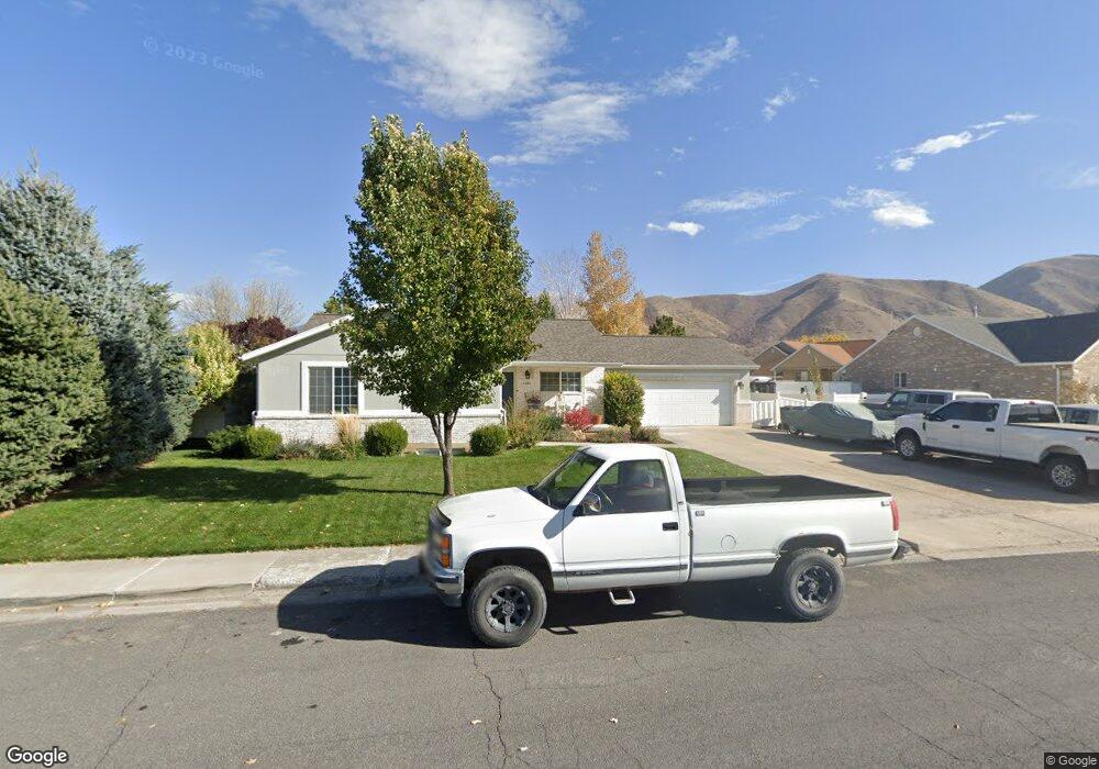
1431 S 600 W Payson, UT 84651
Estimated Value: $543,000 - $582,000
6
Beds
3
Baths
3,186
Sq Ft
$178/Sq Ft
Est. Value
About This Home
This home is located at 1431 S 600 W, Payson, UT 84651 and is currently estimated at $567,475, approximately $178 per square foot. 1431 S 600 W is a home located in Utah County with nearby schools including Spring Lake Elementary, Payson Junior High School, and Payson High School.
Ownership History
Date
Name
Owned For
Owner Type
Purchase Details
Closed on
Dec 11, 2020
Sold by
Delahoyde Willaim E and Delahoyde Janet L
Bought by
Delahoyde William E and Delahoyde Janet L
Current Estimated Value
Home Financials for this Owner
Home Financials are based on the most recent Mortgage that was taken out on this home.
Original Mortgage
$327,531
Outstanding Balance
$292,120
Interest Rate
2.8%
Mortgage Type
FHA
Estimated Equity
$275,355
Purchase Details
Closed on
Apr 25, 2018
Sold by
Oldham Samuel H and Oldham Sarah
Bought by
Delahoyde William E and Delahoyde Janet L
Home Financials for this Owner
Home Financials are based on the most recent Mortgage that was taken out on this home.
Original Mortgage
$334,823
Interest Rate
4.37%
Mortgage Type
FHA
Purchase Details
Closed on
Jun 23, 2016
Sold by
Oldhanm Samuel H
Bought by
Oldham Samuel H and Oldham Sarah
Home Financials for this Owner
Home Financials are based on the most recent Mortgage that was taken out on this home.
Original Mortgage
$214,000
Interest Rate
3.64%
Mortgage Type
New Conventional
Purchase Details
Closed on
Feb 7, 2011
Sold by
Federal Home Loan Mortgage Corporation
Bought by
Oldham Samuel H
Home Financials for this Owner
Home Financials are based on the most recent Mortgage that was taken out on this home.
Original Mortgage
$195,904
Interest Rate
4.67%
Mortgage Type
FHA
Purchase Details
Closed on
Oct 13, 2010
Sold by
Holt David P and Holt Kimberly A
Bought by
Federal Home Loan Mortgage Corp
Purchase Details
Closed on
Sep 20, 2002
Sold by
Chipman Afton C
Bought by
Holt David P
Home Financials for this Owner
Home Financials are based on the most recent Mortgage that was taken out on this home.
Original Mortgage
$168,000
Interest Rate
4.5%
Purchase Details
Closed on
Aug 30, 2001
Sold by
Swain Fred E and Swain Louisa
Bought by
Holt David P and Chipman Afton C
Home Financials for this Owner
Home Financials are based on the most recent Mortgage that was taken out on this home.
Original Mortgage
$166,250
Interest Rate
7.09%
Create a Home Valuation Report for This Property
The Home Valuation Report is an in-depth analysis detailing your home's value as well as a comparison with similar homes in the area
Home Values in the Area
Average Home Value in this Area
Purchase History
| Date | Buyer | Sale Price | Title Company |
|---|---|---|---|
| Delahoyde William E | -- | First American Title Ins Co | |
| Delahoyde William E | -- | Utah First Title Insurance A | |
| Oldham Samuel H | -- | Utah First Title Ins Ag | |
| Oldham Samuel H | -- | Utah First Title Ins Ag | |
| Oldham Samuel H | -- | First American Union Heig | |
| Federal Home Loan Mortgage Corp | $220,000 | Etitle Insurance Agency | |
| Holt David P | -- | Pro Title & Escrow Inc | |
| Holt David P | -- | Mountain West Title Co |
Source: Public Records
Mortgage History
| Date | Status | Borrower | Loan Amount |
|---|---|---|---|
| Open | Delahoyde William E | $327,531 | |
| Closed | Delahoyde William E | $334,823 | |
| Previous Owner | Oldham Samuel H | $214,000 | |
| Previous Owner | Oldham Samuel H | $195,904 | |
| Previous Owner | Holt David P | $168,000 | |
| Previous Owner | Holt David P | $166,250 |
Source: Public Records
Tax History Compared to Growth
Tax History
| Year | Tax Paid | Tax Assessment Tax Assessment Total Assessment is a certain percentage of the fair market value that is determined by local assessors to be the total taxable value of land and additions on the property. | Land | Improvement |
|---|---|---|---|---|
| 2025 | $2,766 | $298,650 | $171,800 | $371,200 |
| 2024 | $2,766 | $281,545 | $0 | $0 |
| 2023 | $2,831 | $288,915 | $0 | $0 |
| 2022 | $2,629 | $263,890 | $0 | $0 |
| 2021 | $2,227 | $358,500 | $112,800 | $245,700 |
| 2020 | $2,112 | $332,600 | $102,500 | $230,100 |
| 2019 | $1,942 | $313,600 | $84,900 | $228,700 |
| 2018 | $1,755 | $273,200 | $74,300 | $198,900 |
| 2017 | $1,671 | $139,865 | $0 | $0 |
| 2016 | $1,635 | $135,960 | $0 | $0 |
| 2015 | $1,481 | $122,320 | $0 | $0 |
| 2014 | $1,301 | $108,240 | $0 | $0 |
Source: Public Records
Map
Nearby Homes
- 588 W 1450 S
- 802 Brookside Ct
- 598 W Saddlebrook Dr
- 1161 Utah 198
- 1163 S 730 W
- 1582 S 790 W
- 1592 S 790 W
- 1579 S 910 W
- 1087 S 680 W
- 1172 S 880 W
- 1002 W Temple Rim Ln
- 32 E 1690 S
- 32 E 1690 S Unit 113
- 922 W 1620 S
- 1408 S 30 E
- 1872 100 E Unit 6
- 44 W 1690 S Unit 109
- 1287 S 1080 W
- 1825 S 410 W
- 211 W 1800 S