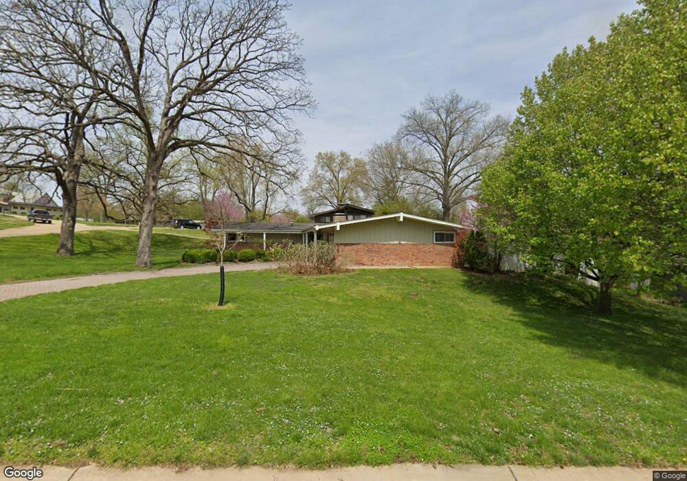
1431 Shands Ct Saint Louis, MO 63122
Estimated Value: $413,000 - $460,000
3
Beds
2
Baths
1,775
Sq Ft
$247/Sq Ft
Est. Value
About This Home
This home is located at 1431 Shands Ct, Saint Louis, MO 63122 and is currently estimated at $439,187, approximately $247 per square foot. 1431 Shands Ct is a home located in St. Louis County with nearby schools including George R. Robinson Elementary School, Nipher Middle School, and Kirkwood Senior High School.
Ownership History
Date
Name
Owned For
Owner Type
Purchase Details
Closed on
Aug 1, 2003
Sold by
Humphrey Donald M
Bought by
Chamberlain Larry D and Chamberlain Larry G
Current Estimated Value
Home Financials for this Owner
Home Financials are based on the most recent Mortgage that was taken out on this home.
Original Mortgage
$138,400
Outstanding Balance
$59,257
Interest Rate
5.24%
Mortgage Type
Purchase Money Mortgage
Estimated Equity
$379,930
Purchase Details
Closed on
Sep 19, 1997
Sold by
Humphrey Donald M and Humphrey Virginia M
Bought by
Humphrey Donald M and Humphrey Virginia M
Create a Home Valuation Report for This Property
The Home Valuation Report is an in-depth analysis detailing your home's value as well as a comparison with similar homes in the area
Home Values in the Area
Average Home Value in this Area
Purchase History
| Date | Buyer | Sale Price | Title Company |
|---|---|---|---|
| Chamberlain Larry D | $173,000 | -- | |
| Humphrey Donald M | -- | -- |
Source: Public Records
Mortgage History
| Date | Status | Borrower | Loan Amount |
|---|---|---|---|
| Open | Chamberlain Larry D | $138,400 |
Source: Public Records
Tax History Compared to Growth
Tax History
| Year | Tax Paid | Tax Assessment Tax Assessment Total Assessment is a certain percentage of the fair market value that is determined by local assessors to be the total taxable value of land and additions on the property. | Land | Improvement |
|---|---|---|---|---|
| 2025 | $3,938 | $69,960 | $49,690 | $20,270 |
| 2024 | $3,938 | $62,820 | $35,800 | $27,020 |
| 2023 | $3,876 | $62,820 | $35,800 | $27,020 |
| 2022 | $3,607 | $54,520 | $35,800 | $18,720 |
| 2021 | $3,560 | $54,520 | $35,800 | $18,720 |
| 2020 | $3,319 | $48,850 | $31,500 | $17,350 |
| 2019 | $3,331 | $48,850 | $31,500 | $17,350 |
| 2018 | $3,636 | $47,140 | $23,310 | $23,830 |
| 2017 | $3,632 | $47,140 | $23,310 | $23,830 |
| 2016 | $3,456 | $45,190 | $19,460 | $25,730 |
| 2015 | $3,439 | $45,190 | $19,460 | $25,730 |
| 2014 | $3,467 | $44,580 | $10,470 | $34,110 |
Source: Public Records
Map
Nearby Homes
- 726 S Ballas Rd
- 602 S Ballas Rd
- 514 Coulter Ave
- 11922 Big Bend Rd
- 12243 Old Big Bend Rd
- 406 Meyer Ave
- 416 S Ballas Rd
- 1010 Station Bend Ln
- 410 Bach Ave
- 621 Crest Ct
- 1889 N Signal Hills Dr
- 1920 Hunting Lake Ct Unit 202
- 1924 Greenglen Dr Unit 101
- 320 Frieda Ave
- 1932 Green Glen Dr Unit 304
- 1968 Greenglen Dr Unit 102
- 1931 Greenglen Dr Unit 301
- 1926 Hunting Lake Ct Unit 304
- 1951 Greenpoint Dr Unit 103
- 1925 W Woodbine Ave
- 812 Kinyon Ct
- 1419 Shands Ct
- 1432 Shands Ct
- 819 Kinyon Ct
- 824 Kinyon Ct
- 1415 Shands Ct
- 806 Kinyon Ct
- 1428 Shands Ct
- 823 Kinyon Ct
- 807 Kinyon Ct
- 1409 Shands Ct
- 1422 Shands Ct
- 811 Kinyon Ct
- 827 Kinyon Ct
- 1441 Craig Dr
- 1412 Shands Ct
- 1511 Coulter Forest
- 1502 Coulter Forest
- 1507 Coulter Forest
- 1515 Coulter Forest