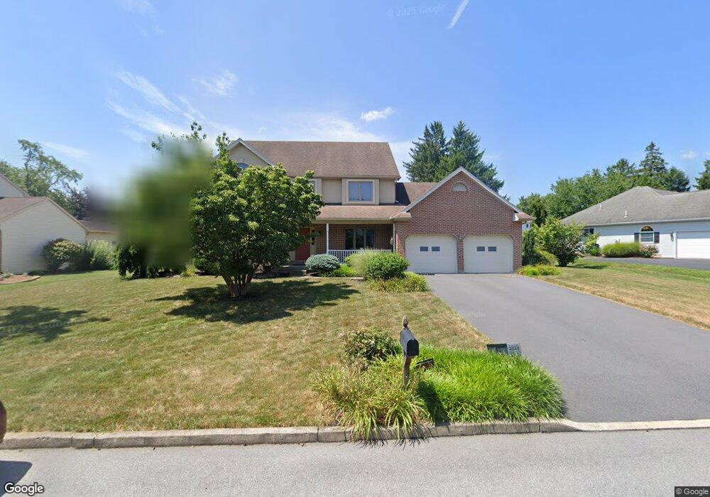
1431 Stark Rd Bethlehem, PA 18017
Estimated Value: $556,000 - $662,000
4
Beds
3
Baths
2,644
Sq Ft
$223/Sq Ft
Est. Value
About This Home
This home is located at 1431 Stark Rd, Bethlehem, PA 18017 and is currently estimated at $589,580, approximately $222 per square foot. 1431 Stark Rd is a home located in Northampton County with nearby schools including Hanover Elementary School, Nitschmann Middle School, and Liberty High School.
Ownership History
Date
Name
Owned For
Owner Type
Purchase Details
Closed on
Apr 2, 2015
Sold by
Rivera Myrna L
Bought by
Werkheiser Drew N and Werkheiser Monica L
Current Estimated Value
Home Financials for this Owner
Home Financials are based on the most recent Mortgage that was taken out on this home.
Original Mortgage
$225,000
Outstanding Balance
$173,398
Interest Rate
3.77%
Mortgage Type
New Conventional
Estimated Equity
$416,182
Purchase Details
Closed on
Jan 5, 2013
Sold by
Rivera Ismael and Rivera Myrna L
Bought by
Rivera Myrna L
Purchase Details
Closed on
May 1, 1996
Bought by
Rivera Ismael and Rivera Myrna L
Create a Home Valuation Report for This Property
The Home Valuation Report is an in-depth analysis detailing your home's value as well as a comparison with similar homes in the area
Home Values in the Area
Average Home Value in this Area
Purchase History
| Date | Buyer | Sale Price | Title Company |
|---|---|---|---|
| Werkheiser Drew N | $300,000 | First American Title Ins Co | |
| Rivera Myrna L | -- | None Available | |
| Rivera Ismael | $57,000 | -- |
Source: Public Records
Mortgage History
| Date | Status | Borrower | Loan Amount |
|---|---|---|---|
| Open | Werkheiser Drew N | $225,000 |
Source: Public Records
Tax History Compared to Growth
Tax History
| Year | Tax Paid | Tax Assessment Tax Assessment Total Assessment is a certain percentage of the fair market value that is determined by local assessors to be the total taxable value of land and additions on the property. | Land | Improvement |
|---|---|---|---|---|
| 2025 | $1,025 | $94,900 | $24,800 | $70,100 |
| 2024 | $6,918 | $94,900 | $24,800 | $70,100 |
| 2023 | $6,942 | $94,900 | $24,800 | $70,100 |
| 2022 | $6,876 | $94,900 | $24,800 | $70,100 |
| 2021 | $6,820 | $94,900 | $24,800 | $70,100 |
| 2020 | $6,829 | $94,900 | $24,800 | $70,100 |
| 2019 | $6,801 | $94,900 | $24,800 | $70,100 |
| 2018 | $6,667 | $94,900 | $24,800 | $70,100 |
| 2017 | $6,619 | $94,900 | $24,800 | $70,100 |
| 2016 | -- | $94,900 | $24,800 | $70,100 |
| 2015 | -- | $94,900 | $24,800 | $70,100 |
| 2014 | -- | $94,900 | $24,800 | $70,100 |
Source: Public Records
Map
Nearby Homes
- 1225 Brentwood Ave
- 4064 Autumn Ridge Rd
- 3760 Jacksonville Rd
- 1560 Stafore Dr
- 4410 Greenfield Rd
- 4110 Greenfield Rd
- 1560 Chaucer Ln
- 4621 Maryann Ln
- 1410 Stoke Park Rd
- 3474 Lord Byron Dr
- 1434 Colgate Dr
- 4940 Matts Dr
- 4439 Loraine Ln
- 4204 Maria Ln
- 809 Overlook Dr
- 6075 Airport Rd
- 6172 Airport Rd
- 1179 Blair Rd
- 922 Wedgewood Rd
- 7019 Oak Ln