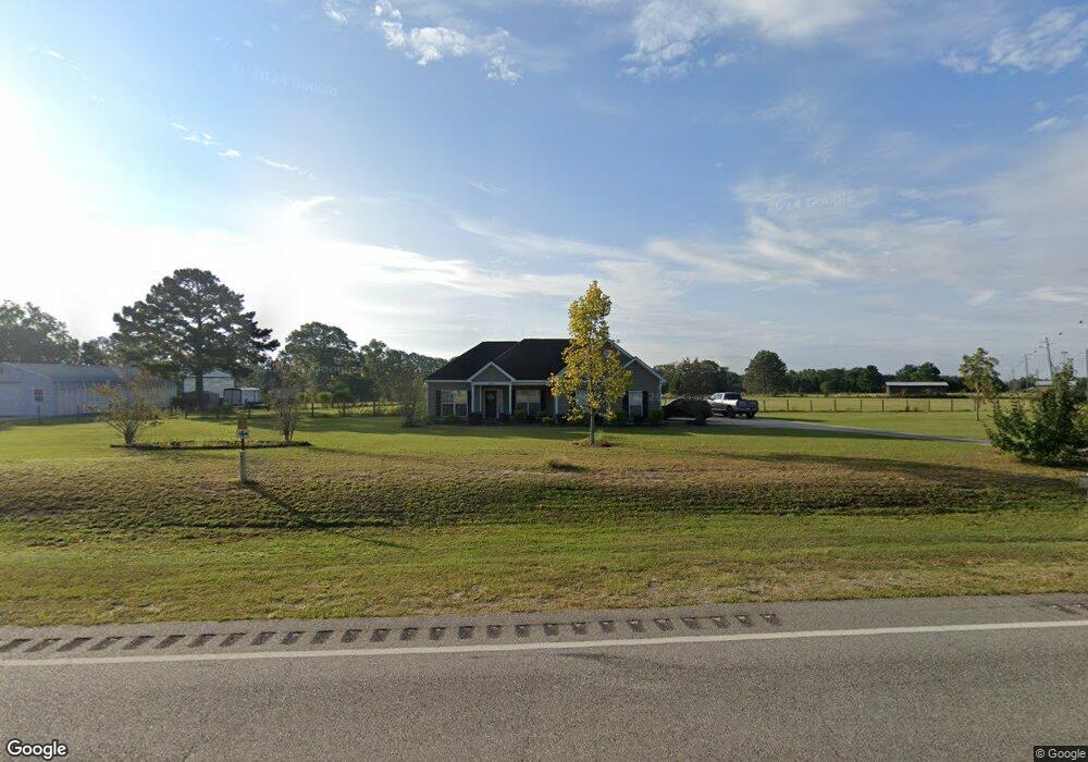
1431 W State Highway 92 Newton, AL 36352
Estimated Value: $238,000 - $344,000
3
Beds
2
Baths
1,600
Sq Ft
$179/Sq Ft
Est. Value
About This Home
This home is located at 1431 W State Highway 92, Newton, AL 36352 and is currently estimated at $287,083, approximately $179 per square foot. 1431 W State Highway 92 is a home located in Houston County with nearby schools including Wicksburg High School.
Ownership History
Date
Name
Owned For
Owner Type
Purchase Details
Closed on
Oct 29, 2019
Sold by
Forrester Michael and Forrester Tiffany
Bought by
Tatum Aaron and Tatum Iris
Current Estimated Value
Purchase Details
Closed on
Dec 21, 2017
Sold by
Forrester Amity
Bought by
Forrester Michael
Purchase Details
Closed on
Jun 16, 2009
Sold by
Butler Molly C
Bought by
Forrester Michael R and Forrester Amity M
Home Financials for this Owner
Home Financials are based on the most recent Mortgage that was taken out on this home.
Original Mortgage
$5,400
Interest Rate
4.79%
Create a Home Valuation Report for This Property
The Home Valuation Report is an in-depth analysis detailing your home's value as well as a comparison with similar homes in the area
Home Values in the Area
Average Home Value in this Area
Purchase History
| Date | Buyer | Sale Price | Title Company |
|---|---|---|---|
| Tatum Aaron | $189,000 | None Available | |
| Forrester Michael | -- | None Available | |
| Forrester Michael R | $180,000 | -- |
Source: Public Records
Mortgage History
| Date | Status | Borrower | Loan Amount |
|---|---|---|---|
| Previous Owner | Forrester Michael R | $5,400 | |
| Previous Owner | Forrester Michael R | $176,739 |
Source: Public Records
Tax History Compared to Growth
Tax History
| Year | Tax Paid | Tax Assessment Tax Assessment Total Assessment is a certain percentage of the fair market value that is determined by local assessors to be the total taxable value of land and additions on the property. | Land | Improvement |
|---|---|---|---|---|
| 2024 | $748 | $24,940 | $0 | $0 |
| 2023 | $748 | $23,880 | $0 | $0 |
| 2022 | $570 | $20,080 | $0 | $0 |
| 2021 | $540 | $19,520 | $0 | $0 |
| 2020 | $1,115 | $36,780 | $0 | $0 |
| 2019 | $1,090 | $35,940 | $0 | $0 |
| 2018 | $477 | $16,920 | $0 | $0 |
| 2017 | $511 | $18,060 | $0 | $0 |
| 2016 | $515 | $0 | $0 | $0 |
| 2015 | $498 | $0 | $0 | $0 |
| 2014 | $490 | $0 | $0 | $0 |
Source: Public Records
Map
Nearby Homes
- 714 Hanners Rd
- 1041 Sandbed Rd
- 160 Sandbed Rd
- 1180 Sandbed Rd
- 1220 Sandbed Rd
- 0 Windmill Rd Unit 21836366
- 0 Windmill Rd
- 1226 Sandbed Rd
- The Rosewood at Cottage Grove Plan at Cottage Grove
- The Overton at Cottage Grove Plan at Cottage Grove
- The Sherfield at Cottage Grove Plan at Cottage Grove
- The Kinkade at Cottage Grove Plan at Cottage Grove
- The Lenox at Cottage Grove Plan at Cottage Grove
- The Hampton at Cottage Grove Plan at Cottage Grove
- The Kendrick at Cottage Grove Plan at Cottage Grove
- 1017 Sandbed Rd
- 70 Beckett Ln
- 17064 U S 84
- 0 Power Dam Rd
- 2 Power Dam Rd
- 1403 Alabama 92
- 1403 W State Highway 92
- 1531 Alabama 92
- 1531 W State Highway 92
- 242 Windmill Rd
- 1585 W Highway 92
- 1585 W State Highway 92
- 1259 W State Highway 92
- 45 Windmill Rd
- 2872 Wicksburg Rd
- 290 Windmill Rd
- 2778 Wicksburg Rd
- 2754 Wicksburg Rd
- 1221 W State Highway 92
- 2920 Wicksburg Rd
- 1200 W State Highway 92
- 2648 Wicksburg Rd
- 370 Windmill Rd
- 1170 W State Highway 92
- 1170 W State Highway 92