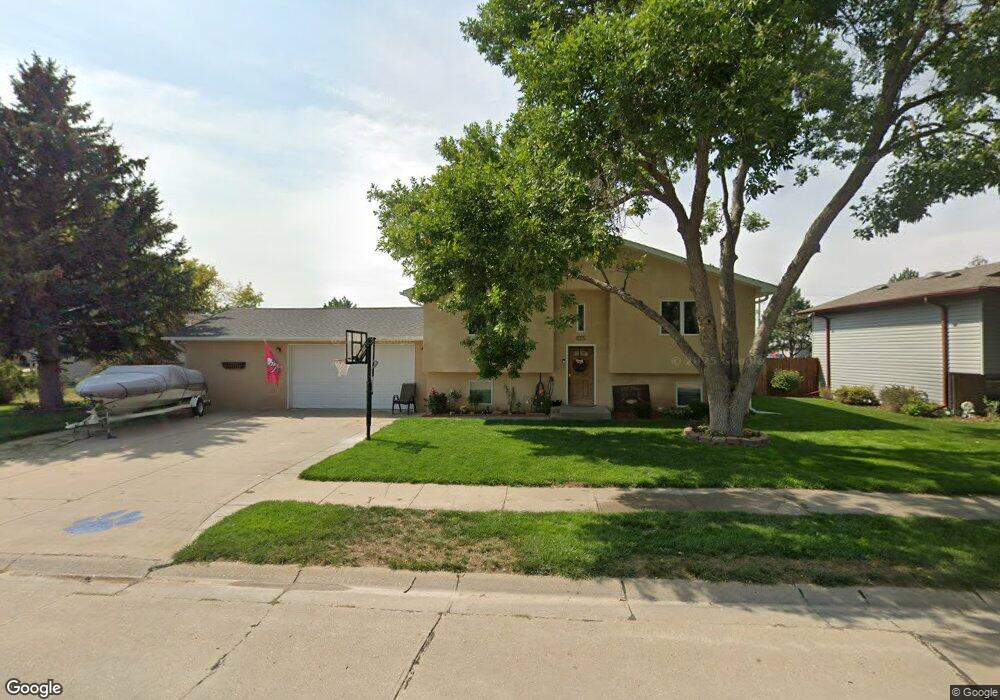
1432 Countryside Ln Alliance, NE 69301
Estimated Value: $153,000 - $297,000
3
Beds
2
Baths
1,574
Sq Ft
$164/Sq Ft
Est. Value
About This Home
This home is located at 1432 Countryside Ln, Alliance, NE 69301 and is currently estimated at $258,554, approximately $164 per square foot. 1432 Countryside Ln is a home located in Box Butte County with nearby schools including Alliance High School, St. Agnes Academy, and Immanuel Evangelical Lutheran School.
Ownership History
Date
Name
Owned For
Owner Type
Purchase Details
Closed on
May 30, 2025
Sold by
Baker Michael D and Baker Valerie J
Bought by
Bauer Wendy and Bauer Brent
Current Estimated Value
Home Financials for this Owner
Home Financials are based on the most recent Mortgage that was taken out on this home.
Original Mortgage
$244,000
Outstanding Balance
$243,374
Interest Rate
6.81%
Mortgage Type
New Conventional
Estimated Equity
$15,180
Purchase Details
Closed on
May 25, 2007
Sold by
Messersmith Clay E and Messersmith Michelle L
Bought by
Luedke David Jay and Luedke Melissa Ann
Home Financials for this Owner
Home Financials are based on the most recent Mortgage that was taken out on this home.
Original Mortgage
$206,000
Interest Rate
6.15%
Mortgage Type
Stand Alone First
Create a Home Valuation Report for This Property
The Home Valuation Report is an in-depth analysis detailing your home's value as well as a comparison with similar homes in the area
Home Values in the Area
Average Home Value in this Area
Purchase History
| Date | Buyer | Sale Price | Title Company |
|---|---|---|---|
| Bauer Wendy | $305,000 | Kunzman Title | |
| Luedke David Jay | -- | Kunzman Title |
Source: Public Records
Mortgage History
| Date | Status | Borrower | Loan Amount |
|---|---|---|---|
| Open | Bauer Wendy | $244,000 | |
| Previous Owner | Luedke David Jay | $206,000 |
Source: Public Records
Tax History Compared to Growth
Tax History
| Year | Tax Paid | Tax Assessment Tax Assessment Total Assessment is a certain percentage of the fair market value that is determined by local assessors to be the total taxable value of land and additions on the property. | Land | Improvement |
|---|---|---|---|---|
| 2024 | $3,406 | $271,942 | $11,187 | $260,755 |
| 2023 | $4,675 | $271,942 | $11,187 | $260,755 |
| 2022 | $3,905 | $214,443 | $10,068 | $204,375 |
| 2021 | $3,642 | $197,588 | $10,068 | $187,520 |
| 2020 | $3,632 | $197,588 | $10,068 | $187,520 |
| 2019 | $3,547 | $197,588 | $10,068 | $187,520 |
| 2018 | $3,530 | $197,588 | $10,068 | $187,520 |
| 2017 | $3,492 | $188,149 | $9,509 | $178,640 |
| 2016 | $3,452 | $188,150 | $9,510 | $178,640 |
| 2015 | $3,957 | $178,050 | $9,510 | $168,540 |
| 2014 | $3,957 | $178,169 | $9,509 | $168,660 |
Source: Public Records
Map
Nearby Homes
- 1021 Dakota Ave
- 1232 Emerson Ave
- 672 W 20th St
- 928 Black Hills Ave
- 20th St Emerson Ave To Colorado Ave
- 936 Platte Ave
- 1239 Toluca Ave
- 819 Black Hills Ave
- 911 Emerson Ave
- 1232 Cheyenne Ave
- 924 Big Horn Ave
- 907 Toluca Ave
- 719 Toluca Ave
- 621 Emerson Ave
- 1019 Laramie Ave
- 904 Laramie Ave
- 2039 Niobrara Ave
- 316 Big Horn Ave
- 420 Laramie Ave
- 1231 Missouri Ave
- 1442 Countryside Ln
- 1420 Countryside Ln
- 1408 Countryside Ln
- 1435 Countryside Ln
- 1429 Countryside Ln
- 1448 Countryside Ln
- 1441 Countryside Ln
- 1423 Countryside Ln
- 1419 Countryside Ln
- 1447 Countryside Ln
- 1415 Countryside Ln
- 1454 Countryside Ln
- 1411 Countryside Ln
- 1436 Bel Air Ave
- 1407 Countryside Ln
- 1430 Bel Air Ave
- 1434 Buchfinck Ave
- 1436 Buchfinck Ave
- 1430 Buchfinck Ave
- 1442 Bel Air Ave