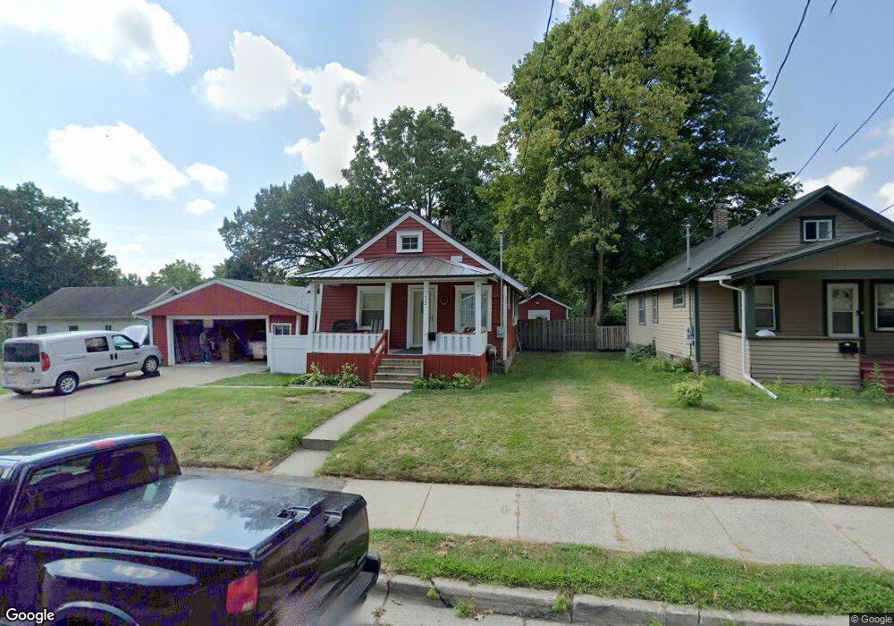
1432 Perkins St Lansing, MI 48912
Potter Walsh NeighborhoodEstimated Value: $92,000 - $110,000
--
Bed
--
Bath
872
Sq Ft
$114/Sq Ft
Est. Value
About This Home
This home is located at 1432 Perkins St, Lansing, MI 48912 and is currently estimated at $99,571, approximately $114 per square foot. 1432 Perkins St is a home located in Ingham County with nearby schools including Pattengill Academy, Lyons Elementary School, and Eastern High School.
Ownership History
Date
Name
Owned For
Owner Type
Purchase Details
Closed on
Oct 1, 2019
Sold by
Michaels Ray S and Michaels Rita M
Bought by
Michaels Ray S and Michaels Rita M
Current Estimated Value
Purchase Details
Closed on
Aug 27, 2013
Sold by
Ingham County Treasurer
Bought by
Michaels Ray S and Michaels Rita M
Purchase Details
Closed on
Mar 30, 2000
Sold by
Bankers Trust Co Of California Na
Bought by
Stiffler Michael R
Home Financials for this Owner
Home Financials are based on the most recent Mortgage that was taken out on this home.
Original Mortgage
$28,500
Interest Rate
8.24%
Mortgage Type
Purchase Money Mortgage
Purchase Details
Closed on
Apr 30, 1999
Sold by
Preston Judy A and Washburn Robert A
Bought by
Bankers Trust Co Of California Na
Purchase Details
Closed on
Apr 1, 1995
Create a Home Valuation Report for This Property
The Home Valuation Report is an in-depth analysis detailing your home's value as well as a comparison with similar homes in the area
Home Values in the Area
Average Home Value in this Area
Purchase History
| Date | Buyer | Sale Price | Title Company |
|---|---|---|---|
| Michaels Ray S | -- | None Available | |
| Michaels Ray S | -- | Capital Fund Title Services | |
| Stiffler Michael R | $30,000 | Transnation Title | |
| Bankers Trust Co Of California Na | $40,973 | -- | |
| -- | $32,500 | -- |
Source: Public Records
Mortgage History
| Date | Status | Borrower | Loan Amount |
|---|---|---|---|
| Previous Owner | Stiffler Michael R | $28,500 |
Source: Public Records
Tax History Compared to Growth
Tax History
| Year | Tax Paid | Tax Assessment Tax Assessment Total Assessment is a certain percentage of the fair market value that is determined by local assessors to be the total taxable value of land and additions on the property. | Land | Improvement |
|---|---|---|---|---|
| 2025 | $2,093 | $53,500 | $5,000 | $48,500 |
| 2024 | $16 | $43,500 | $5,000 | $38,500 |
| 2023 | $1,964 | $35,800 | $5,000 | $30,800 |
| 2022 | $1,773 | $34,100 | $4,600 | $29,500 |
| 2021 | $1,737 | $30,800 | $4,200 | $26,600 |
| 2020 | $1,726 | $28,800 | $4,200 | $24,600 |
| 2019 | $1,653 | $27,800 | $4,200 | $23,600 |
| 2018 | $1,551 | $26,100 | $4,200 | $21,900 |
| 2017 | $1,484 | $26,100 | $4,200 | $21,900 |
| 2016 | $1,634 | $25,600 | $4,200 | $21,400 |
| 2015 | $1,634 | $25,000 | $8,347 | $16,653 |
| 2014 | $1,634 | $21,400 | $8,347 | $13,053 |
Source: Public Records
Map
Nearby Homes
- 1128 Lathrop St
- 1204 Shepard St
- 1019 Dakin St
- 1200 S Holmes St
- 1225 Regent St
- 910 S Holmes St
- 1212 Climax St
- 1201 Climax St
- 607 Shepard St Unit 2
- 1620 Clifton Ave
- 523 Clifford St
- 1221 Pershing Dr
- 1423 Pontiac St
- 637 S Clemens Ave
- 701 S Fairview Ave
- 1529 S Pennsylvania Ave
- 727 S Magnolia Ave
- 0 E Mount Hope Ave
- 1437 Ada St
- 517 S Clemens Ave
- 1430 Perkins St
- 1214 Lathrop St
- 1213 Mccullough St
- 1426 Perkins St
- 1435 Perkins St
- 1217 Mccullough St
- 1218 Lathrop St
- 1136 Lathrop St
- 1141 Mccullough St
- 1219 Mccullough St
- 1222 Lathrop St
- 1209 Lathrop St
- 1215 Lathrop St
- 1223 Mccullough St
- 1141 Lathrop St
- 1217 Lathrop St
- 1226 Lathrop St
- 1225 Mccullough St
- 1137 Lathrop St
- 1219 Lathrop St