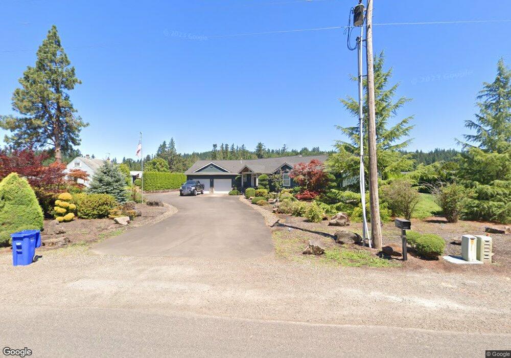
14323 S Graves Rd Mulino, OR 97042
Estimated Value: $882,000 - $1,073,000
4
Beds
3
Baths
2,511
Sq Ft
$398/Sq Ft
Est. Value
About This Home
This home is located at 14323 S Graves Rd, Mulino, OR 97042 and is currently estimated at $999,408, approximately $398 per square foot. 14323 S Graves Rd is a home located in Clackamas County.
Ownership History
Date
Name
Owned For
Owner Type
Purchase Details
Closed on
Sep 11, 2018
Sold by
Vlcek Michael R and The Michael R Vlcek Living Tru
Bought by
The Michael R Vlcek Living Trust
Current Estimated Value
Purchase Details
Closed on
Jun 24, 2009
Sold by
West Coast Bank
Bought by
Vlcek Michael R and Vlcek Rosemary
Home Financials for this Owner
Home Financials are based on the most recent Mortgage that was taken out on this home.
Original Mortgage
$150,000
Outstanding Balance
$94,875
Interest Rate
4.87%
Mortgage Type
Seller Take Back
Estimated Equity
$904,533
Purchase Details
Closed on
Aug 30, 2008
Sold by
Yarbrough Ron and Yarbrough Carol
Bought by
West Coast Bank
Purchase Details
Closed on
Jun 30, 2006
Sold by
Blaine Rojer C and Blaine Linda G
Bought by
Yarbrough Ronald M and Yarbrough Carol A
Home Financials for this Owner
Home Financials are based on the most recent Mortgage that was taken out on this home.
Original Mortgage
$503,944
Interest Rate
6.57%
Mortgage Type
Purchase Money Mortgage
Create a Home Valuation Report for This Property
The Home Valuation Report is an in-depth analysis detailing your home's value as well as a comparison with similar homes in the area
Home Values in the Area
Average Home Value in this Area
Purchase History
| Date | Buyer | Sale Price | Title Company |
|---|---|---|---|
| The Michael R Vlcek Living Trust | -- | None Available | |
| Vlcek Michael R | $425,000 | Lawyers Title Ins Corp | |
| West Coast Bank | -- | Pacific Nw Title | |
| Yarbrough Ronald M | $210,000 | Chicago Title Co |
Source: Public Records
Mortgage History
| Date | Status | Borrower | Loan Amount |
|---|---|---|---|
| Open | Vlcek Michael R | $150,000 | |
| Previous Owner | Yarbrough Ronald M | $503,944 |
Source: Public Records
Tax History Compared to Growth
Tax History
| Year | Tax Paid | Tax Assessment Tax Assessment Total Assessment is a certain percentage of the fair market value that is determined by local assessors to be the total taxable value of land and additions on the property. | Land | Improvement |
|---|---|---|---|---|
| 2025 | $7,534 | $502,050 | -- | -- |
| 2024 | $7,295 | $487,428 | -- | -- |
| 2023 | $7,295 | $473,232 | $0 | $0 |
| 2022 | $6,169 | $459,449 | $0 | $0 |
| 2021 | $5,898 | $446,067 | $0 | $0 |
| 2020 | $5,735 | $433,075 | $0 | $0 |
| 2019 | $5,416 | $408,945 | $0 | $0 |
| 2018 | $5,266 | $397,034 | $0 | $0 |
| 2017 | $4,922 | $380,381 | $0 | $0 |
| 2016 | $4,468 | $355,919 | $0 | $0 |
| 2015 | $4,340 | $345,552 | $0 | $0 |
| 2014 | $4,200 | $335,487 | $0 | $0 |
Source: Public Records
Map
Nearby Homes
- 26250 S Milk Creek Cir
- 0 S Ranch Hills Rd
- 13920 S Lucia Ln
- 14980 S Buckner Creek Rd
- 13511 S Freeman Rd
- 26684 S Fish Rd
- 26740 S Fish Rd
- 15693 S Hidden Rd
- 14001 S Union Mills Rd
- 24450 S Highway 213
- 28502 S Highway 213
- 28502 Oregon 213
- 16428 S Buckner Creek Rd
- 15441 S Union Mills Rd
- 0000 S Buckner Creek Rd
- 12192 S Mulino Rd
- 12051 S Riggs Damm Rd
- 15678 S Spangler Rd
- 28381 S Salo Rd
- 11600 S Emerson Rd
- 14273 S Graves Rd
- 26500 S Milk Creek Cir
- 14333 S Graves Rd
- 26440 S Milk Creek Cir
- 26390 S Milk Creek Cir
- 14262 S Graves Rd
- 14332 S Graves Rd
- 14370 S Graves Rd
- 26330 S Milk Creek Cir
- 26524 S Ranch Hills Rd
- 26515 S Ranch Hills Rd
- 14384 S Graves Rd
- 14360 S Graves Rd
- 26280 S Milk Creek Cir
- 14424 S Graves Rd
- 26265 S Milk Creek Cir
- 26600 S Ranch Hills Rd
- 26422 S Brandt Rd
- 26376 S Brandt Rd
- 26494 S Brandt Rd