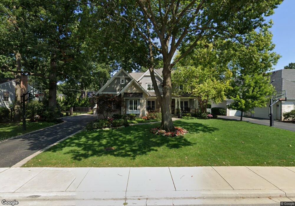
1433 Ambleside Dr Deerfield, IL 60015
Estimated Value: $1,334,000 - $1,453,000
4
Beds
3
Baths
4,255
Sq Ft
$331/Sq Ft
Est. Value
About This Home
This home is located at 1433 Ambleside Dr, Deerfield, IL 60015 and is currently estimated at $1,407,151, approximately $330 per square foot. 1433 Ambleside Dr is a home located in Lake County with nearby schools including Walden Elementary School, Alan B Shepard Middle School, and Deerfield High School.
Ownership History
Date
Name
Owned For
Owner Type
Purchase Details
Closed on
Aug 13, 2007
Sold by
White Jeanette F and White Nancy E
Bought by
Johnson Mark C and Johnson Mindey B
Current Estimated Value
Home Financials for this Owner
Home Financials are based on the most recent Mortgage that was taken out on this home.
Original Mortgage
$393,700
Outstanding Balance
$245,551
Interest Rate
6.37%
Mortgage Type
Unknown
Estimated Equity
$1,161,600
Purchase Details
Closed on
Mar 30, 1998
Sold by
White Mary D
Bought by
White Mary D and Mary D White Living Trust
Create a Home Valuation Report for This Property
The Home Valuation Report is an in-depth analysis detailing your home's value as well as a comparison with similar homes in the area
Home Values in the Area
Average Home Value in this Area
Purchase History
| Date | Buyer | Sale Price | Title Company |
|---|---|---|---|
| Johnson Mark C | $525,000 | Ticor | |
| White Mary D | -- | -- |
Source: Public Records
Mortgage History
| Date | Status | Borrower | Loan Amount |
|---|---|---|---|
| Open | Johnson Mark C | $393,700 |
Source: Public Records
Tax History Compared to Growth
Tax History
| Year | Tax Paid | Tax Assessment Tax Assessment Total Assessment is a certain percentage of the fair market value that is determined by local assessors to be the total taxable value of land and additions on the property. | Land | Improvement |
|---|---|---|---|---|
| 2024 | $30,632 | $347,620 | $59,116 | $288,504 |
| 2023 | $29,404 | $333,608 | $56,733 | $276,875 |
| 2022 | $29,404 | $316,454 | $60,937 | $255,517 |
| 2021 | $27,753 | $305,104 | $58,751 | $246,353 |
| 2020 | $26,691 | $305,746 | $58,875 | $246,871 |
| 2019 | $26,079 | $305,227 | $58,775 | $246,452 |
| 2018 | $25,495 | $310,716 | $62,297 | $248,419 |
| 2017 | $25,293 | $309,725 | $62,098 | $247,627 |
| 2016 | $24,611 | $298,013 | $59,750 | $238,263 |
| 2015 | $24,137 | $280,008 | $56,140 | $223,868 |
| 2014 | $23,905 | $273,464 | $56,541 | $216,923 |
| 2012 | $23,306 | $271,051 | $56,042 | $215,009 |
Source: Public Records
Map
Nearby Homes
- 1423 Northwoods Rd
- 1504 Northwoods Rd
- 1341 Carlisle Place
- 1263 Carlisle Place
- 970 Ivy Ln Unit C
- 1127 Kenton Rd
- 1342 Barclay Ln Unit 36
- 1666 Cloverdale Ave
- 505 Margate Terrace
- 1131 Linden Ave
- 1045 Fairoaks Ave
- 1770 Overland Trail
- 2013 Castlewood Rd
- 1265 Woodland Dr
- 1075 Heather Rd
- 1103 Hazel Ave
- 1672 Huntington Ln
- 904 Forest Ave
- 1410 Berkley Ct
- 828 Chestnut St
- 1439 Ambleside Dr
- 1434 Warrington Rd
- 1440 Warrington Rd
- 1426 Warrington Rd
- 1445 Ambleside Dr
- 1436 Ambleside Dr
- 1426 Ambleside Dr Unit 2
- 1423 Ambleside Dr
- 1458 Warrington Rd
- 1418 Warrington Rd
- 1451 Ambleside Dr
- 1466 Warrington Rd
- 631 Dimmeydale Dr
- 630 Ambleside Dr
- 1410 Warrington Rd
- 611 Ambleside Dr
- 623 Ambleside Dr
- 1457 Ambleside Dr
- 626 Dimmeydale Dr
