Estimated Value: $117,000 - $336,000
2
Beds
2
Baths
1,440
Sq Ft
$153/Sq Ft
Est. Value
About This Home
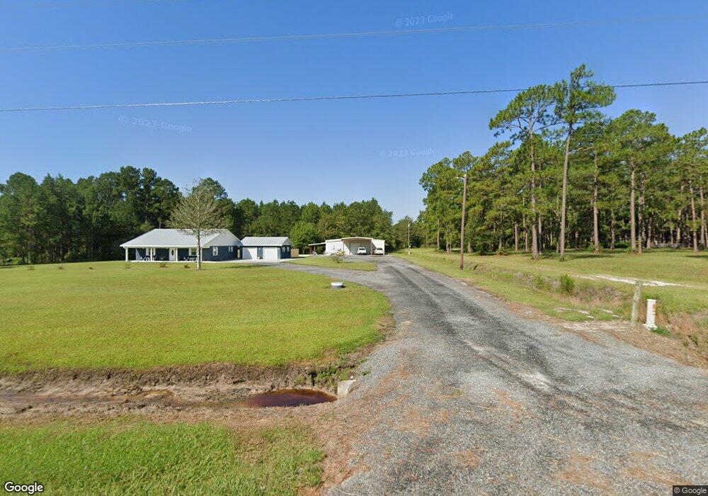
This home is located at 1433 Radio Station Rd, Alma, GA 31510 and is currently estimated at $220,800, approximately $153 per square foot. 1433 Radio Station Rd is a home located in Bacon County with nearby schools including Bacon County Primary School, Bacon County Elementary School, and Bacon County Middle School.
Ownership History
Date
Name
Owned For
Owner Type
Purchase Details
Closed on
Mar 6, 2018
Sold by
Singleton Carl
Bought by
Lavender Teresa Gail
Current Estimated Value
Purchase Details
Closed on
Nov 14, 2017
Sold by
Lavender Teresa Gail
Bought by
Singleton Carl and Singleton Ann
Purchase Details
Closed on
Jul 1, 2016
Sold by
Anderson Roger
Bought by
Lavender Teresa Gail
Purchase Details
Closed on
Jun 1, 2015
Sold by
Fnb South
Bought by
Anderson Roger
Purchase Details
Closed on
Apr 7, 2015
Sold by
Lee Michael Craig
Bought by
Fnb South
Purchase Details
Closed on
Jan 7, 2005
Sold by
Cason Kenneth R
Bought by
Lee Michael C
Purchase Details
Closed on
Aug 10, 1979
Sold by
Smith M E
Bought by
Cason Kenneth R
Create a Home Valuation Report for This Property
The Home Valuation Report is an in-depth analysis detailing your home's value as well as a comparison with similar homes in the area
Home Values in the Area
Average Home Value in this Area
Purchase History
| Date | Buyer | Sale Price | Title Company |
|---|---|---|---|
| Lavender Teresa Gail | -- | -- | |
| Singleton Carl | -- | -- | |
| Lavender Teresa Gail | $40,000 | -- | |
| Anderson Roger | $27,500 | -- | |
| Fnb South | -- | -- | |
| Lee Michael C | $98,000 | -- | |
| Cason Kenneth R | -- | -- |
Source: Public Records
Tax History Compared to Growth
Tax History
| Year | Tax Paid | Tax Assessment Tax Assessment Total Assessment is a certain percentage of the fair market value that is determined by local assessors to be the total taxable value of land and additions on the property. | Land | Improvement |
|---|---|---|---|---|
| 2024 | $2,187 | $85,800 | $2,760 | $83,040 |
| 2023 | $2,085 | $78,520 | $2,600 | $75,920 |
| 2022 | $1,459 | $55,560 | $2,600 | $52,960 |
| 2021 | $1,392 | $53,080 | $2,600 | $50,480 |
| 2020 | $1,335 | $48,681 | $2,168 | $46,513 |
| 2019 | $1,337 | $48,681 | $2,168 | $46,513 |
| 2018 | $240 | $8,366 | $2,168 | $6,198 |
| 2017 | $240 | $8,366 | $2,168 | $6,198 |
| 2016 | $248 | $8,633 | $2,168 | $6,465 |
| 2015 | $323 | $11,269 | $2,168 | $9,101 |
| 2014 | -- | $32,850 | $2,168 | $30,682 |
| 2013 | -- | $28,443 | $3,422 | $25,021 |
Source: Public Records
Map
Nearby Homes
- 0 Jasmine Ln
- TBD Cartertown Rd
- TBD Cartertown Rd
- Lot 8 Cartertown Rd
- Lot 5 Cartertown Rd
- Lot 6 Cartertown Rd
- Lot 4 Cartertown Rd
- Lot 7 Cartertown Rd
- 1348 U S 1
- 301 Taylor Rd
- 403 S Ware St
- 122 Grace Loop Unit 1
- 118 Grace Loop Unit 1
- 117 Grace Loop Unit 1
- 9TH E 417
- 314 W 16th St
- 113 Brite Blue Dr
- 245 Starling Rd
- 0 E 6th St Unit 114222
- 166 Grace Loop Unit 1
- 1419 Radio Station Rd
- 180 Radio Station Rd
- 1487 Radio Station Rd
- 1409 Radio Station Rd
- 1521 Radio Station Rd
- 1479 Radio Station Rd
- 1370 Radio Station Rd
- 1440 Radio Station Rd
- 1346 Radio Station Rd
- 1320 Radio Station Rd
- 372 Elizabeth Chapel Rd
- 1292 Radio Station Rd
- 1562 Radio Station Rd
- 406 Elizabeth Chapel Rd
- 356 Elizabeth Chapel Rd
- 1246 Radio Station Rd
- 106 Wood Ln
- 170 Thorn Rd