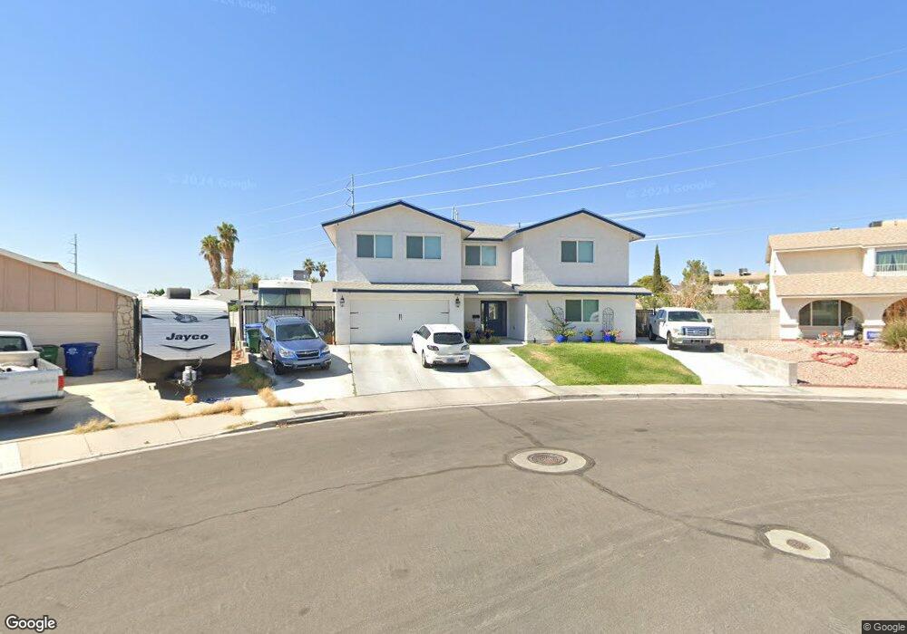
1433 Rawhide Rd Boulder City, NV 89005
Estimated Value: $699,000 - $1,306,701
9
Beds
8
Baths
6,249
Sq Ft
$155/Sq Ft
Est. Value
About This Home
This home is located at 1433 Rawhide Rd, Boulder City, NV 89005 and is currently estimated at $969,175, approximately $155 per square foot. 1433 Rawhide Rd is a home located in Clark County with nearby schools including Andrew Mitchell Elementary School, Martha P. King Elementary School, and Elton M. & Madelaine E. Garrett Junior High School.
Ownership History
Date
Name
Owned For
Owner Type
Purchase Details
Closed on
May 30, 2023
Sold by
Magaw 1997 Trust
Bought by
Stewart Kathleen D and Stewart Thomas W
Current Estimated Value
Home Financials for this Owner
Home Financials are based on the most recent Mortgage that was taken out on this home.
Original Mortgage
$380,000
Outstanding Balance
$369,839
Interest Rate
6.39%
Mortgage Type
New Conventional
Estimated Equity
$599,336
Purchase Details
Closed on
Aug 20, 2020
Sold by
Magaw David L
Bought by
Magaw David L and Magaw 1997 Trust
Home Financials for this Owner
Home Financials are based on the most recent Mortgage that was taken out on this home.
Original Mortgage
$100,000
Interest Rate
2.9%
Mortgage Type
Credit Line Revolving
Purchase Details
Closed on
Mar 3, 1997
Sold by
Magaw David L and Magaw Joanne V
Bought by
Magaw David L and Magaw Joanne
Create a Home Valuation Report for This Property
The Home Valuation Report is an in-depth analysis detailing your home's value as well as a comparison with similar homes in the area
Home Values in the Area
Average Home Value in this Area
Purchase History
| Date | Buyer | Sale Price | Title Company |
|---|---|---|---|
| Stewart Kathleen D | $400,000 | Driggs Title Agency | |
| Magaw David L | -- | Driggs Title Agency Inc | |
| Magaw David | -- | Driggs Title Agency Inc | |
| Magaw David L | -- | -- |
Source: Public Records
Mortgage History
| Date | Status | Borrower | Loan Amount |
|---|---|---|---|
| Open | Stewart Kathleen D | $380,000 | |
| Previous Owner | Magaw David | $100,000 |
Source: Public Records
Tax History Compared to Growth
Tax History
| Year | Tax Paid | Tax Assessment Tax Assessment Total Assessment is a certain percentage of the fair market value that is determined by local assessors to be the total taxable value of land and additions on the property. | Land | Improvement |
|---|---|---|---|---|
| 2025 | $8,695 | $356,170 | $57,750 | $298,420 |
| 2024 | $8,441 | $356,170 | $57,750 | $298,420 |
| 2023 | $2,009 | $71,143 | $43,890 | $27,253 |
| 2022 | $1,648 | $64,195 | $38,500 | $25,695 |
| 2021 | $1,526 | $59,486 | $34,265 | $25,221 |
| 2020 | $1,417 | $58,822 | $33,110 | $25,712 |
| 2019 | $1,399 | $55,260 | $29,260 | $26,000 |
| 2018 | $1,335 | $53,974 | $28,490 | $25,484 |
| 2017 | $1,434 | $54,914 | $28,490 | $26,424 |
| 2016 | $1,249 | $53,355 | $25,795 | $27,560 |
| 2015 | $1,246 | $46,988 | $19,250 | $27,738 |
| 2014 | $1,210 | $45,866 | $17,325 | $28,541 |
Source: Public Records
Map
Nearby Homes
- 1325 Appaloosa Rd
- 641 Otono Dr
- 1441 Bronco Rd
- 655 Otono Dr
- 1307 Appaloosa Rd
- 1405 Bronco Rd
- 1126 Azul Way
- 1120 Fuente Way
- 1124 Grillo Way
- 1115 Mariposa Way
- 632 Paloma Dr
- 1118 Olmo Way
- 1110 Cummings Dr
- 1095 Endora Way
- 1115 Endora Way
- 627 Don Vincente Dr
- 1104 Endora Way
- 573 7th St
- 557 6th St
- 517 5th St