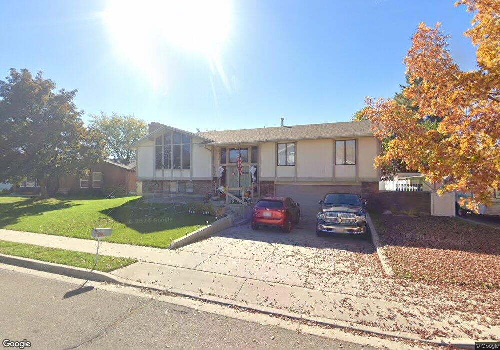
1433 W 1100 N Provo, UT 84604
Grandview South NeighborhoodEstimated Value: $555,000 - $637,000
3
Beds
2
Baths
1,945
Sq Ft
$304/Sq Ft
Est. Value
About This Home
This home is located at 1433 W 1100 N, Provo, UT 84604 and is currently estimated at $591,750, approximately $304 per square foot. 1433 W 1100 N is a home located in Utah County with nearby schools including Westridge Elementary School, Dixon Middle School, and Provo High School.
Ownership History
Date
Name
Owned For
Owner Type
Purchase Details
Closed on
Apr 9, 2025
Sold by
Rollins Glenda Dawn
Bought by
Glenda M Beck Revocable Trust and Beck
Current Estimated Value
Purchase Details
Closed on
Jul 27, 1999
Sold by
Rollins Jackson Keith
Bought by
Rollins Glenda Dawn
Create a Home Valuation Report for This Property
The Home Valuation Report is an in-depth analysis detailing your home's value as well as a comparison with similar homes in the area
Home Values in the Area
Average Home Value in this Area
Purchase History
| Date | Buyer | Sale Price | Title Company |
|---|---|---|---|
| Glenda M Beck Revocable Trust | -- | None Listed On Document | |
| Rollins Glenda Dawn | -- | Old Republic Title |
Source: Public Records
Tax History Compared to Growth
Tax History
| Year | Tax Paid | Tax Assessment Tax Assessment Total Assessment is a certain percentage of the fair market value that is determined by local assessors to be the total taxable value of land and additions on the property. | Land | Improvement |
|---|---|---|---|---|
| 2025 | $2,662 | $282,590 | $168,000 | $345,800 |
| 2024 | $2,662 | $262,020 | $0 | $0 |
| 2023 | $2,731 | $265,045 | $0 | $0 |
| 2022 | $2,705 | $264,715 | $0 | $0 |
| 2021 | $2,093 | $357,200 | $106,600 | $250,600 |
| 2020 | $2,017 | $322,700 | $96,900 | $225,800 |
| 2019 | $1,894 | $315,100 | $96,900 | $218,200 |
| 2018 | $1,663 | $280,600 | $90,000 | $190,600 |
| 2017 | $1,460 | $135,355 | $0 | $0 |
| 2016 | $1,427 | $123,310 | $0 | $0 |
| 2015 | $1,274 | $111,320 | $0 | $0 |
| 2014 | $1,149 | $104,665 | $0 | $0 |
Source: Public Records
Map
Nearby Homes