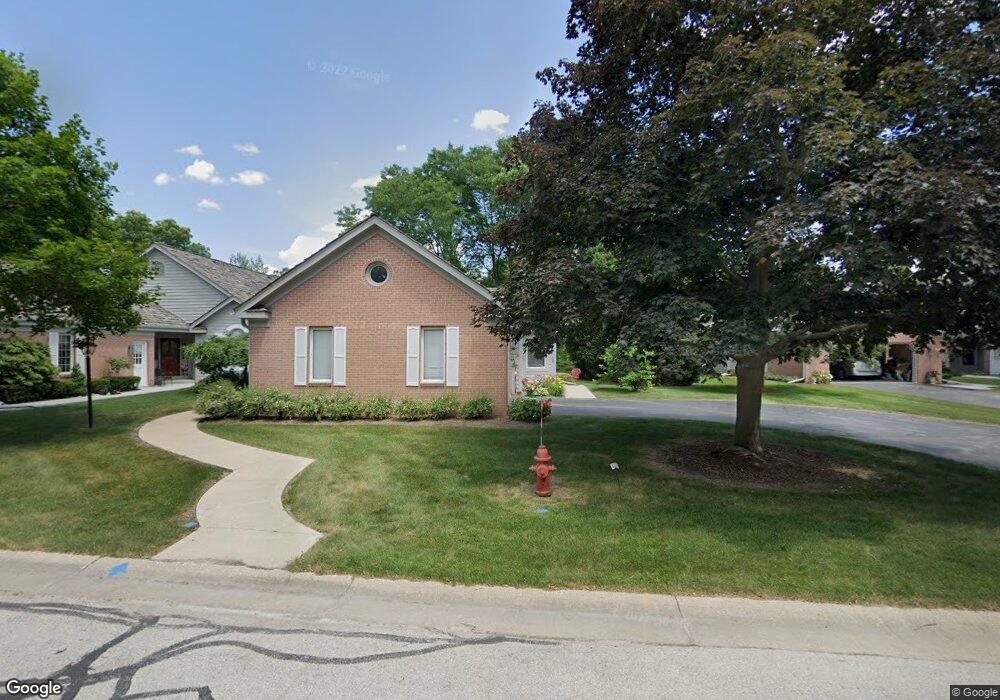
14330 Chestnut Grove Ct Unit A Brookfield, WI 53005
Estimated Value: $682,000 - $869,000
3
Beds
3
Baths
2,632
Sq Ft
$310/Sq Ft
Est. Value
About This Home
This home is located at 14330 Chestnut Grove Ct Unit A, Brookfield, WI 53005 and is currently estimated at $816,112, approximately $310 per square foot. 14330 Chestnut Grove Ct Unit A is a home located in Waukesha County with nearby schools including Tonawanda Elementary School, Pilgrim Park Middle School, and Brookfield East High School.
Ownership History
Date
Name
Owned For
Owner Type
Purchase Details
Closed on
Oct 6, 2025
Sold by
Gray Kelley Borden
Bought by
Kelley B Gray 2022 Revocable Trust and Gray
Current Estimated Value
Purchase Details
Closed on
Oct 2, 2024
Sold by
Mary S Casper Revocable Living Trust
Bought by
Kelley Borden Gray Trust
Purchase Details
Closed on
Feb 9, 2021
Sold by
Casper Trust
Bought by
Casper Trust
Home Financials for this Owner
Home Financials are based on the most recent Mortgage that was taken out on this home.
Original Mortgage
$190,000
Interest Rate
2.7%
Mortgage Type
New Conventional
Purchase Details
Closed on
May 2, 2016
Sold by
Adamson David A and Sandra Casper M
Bought by
Adamson David A and Sandra Casper M
Create a Home Valuation Report for This Property
The Home Valuation Report is an in-depth analysis detailing your home's value as well as a comparison with similar homes in the area
Home Values in the Area
Average Home Value in this Area
Purchase History
| Date | Buyer | Sale Price | Title Company |
|---|---|---|---|
| Kelley B Gray 2022 Revocable Trust | -- | None Listed On Document | |
| Gray Kelley Borden | -- | None Listed On Document | |
| Kelley Borden Gray Trust | $828,000 | Merit Title | |
| Casper Trust | $508,000 | Knight Barry Title | |
| Adamson David A | -- | None Available |
Source: Public Records
Mortgage History
| Date | Status | Borrower | Loan Amount |
|---|---|---|---|
| Previous Owner | Casper Trust | $190,000 |
Source: Public Records
Tax History Compared to Growth
Tax History
| Year | Tax Paid | Tax Assessment Tax Assessment Total Assessment is a certain percentage of the fair market value that is determined by local assessors to be the total taxable value of land and additions on the property. | Land | Improvement |
|---|---|---|---|---|
| 2024 | $7,585 | $671,100 | $143,800 | $527,300 |
| 2023 | $7,597 | $671,100 | $143,800 | $527,300 |
| 2022 | $7,337 | $508,000 | $138,000 | $370,000 |
| 2021 | $7,776 | $508,000 | $138,000 | $370,000 |
| 2020 | $8,088 | $508,000 | $138,000 | $370,000 |
| 2019 | $7,777 | $508,000 | $138,000 | $370,000 |
| 2018 | $7,741 | $491,800 | $110,000 | $381,800 |
| 2017 | $8,800 | $491,800 | $110,000 | $381,800 |
| 2016 | $7,838 | $491,800 | $110,000 | $381,800 |
| 2015 | $7,788 | $491,800 | $110,000 | $381,800 |
| 2014 | $7,801 | $491,800 | $110,000 | $381,800 |
| 2013 | $8,079 | $491,800 | $110,000 | $381,800 |
Source: Public Records
Map
Nearby Homes
- 2415 Walnut Grove Ct Unit B
- 2455 Mound Zion Woods Ct
- 14625 Club Dr
- 15300 Fieldstone Dr
- 15260 Marilyn Dr
- 14220 Hillside Rd
- 15555 Esser Ct
- 1660 Lindhurst Ct
- 13145 Kittridge Ct
- 12675 W North Ave
- 13640 W Burleigh Rd
- 1920 Fairhaven Blvd
- 15305 Cascade Dr
- 12455 W Center St
- 15430 W Burleigh Rd
- 1775 Melody Ln
- 3285 Old Lantern Dr
- 2925 N 124th St
- 13130 Watertown Plank Rd Unit 312
- 16425 Alverno Dr
- 2390 Walnut Grove Ct Unit B
- 2390 Walnut Grove Ct Unit A
- 2370 Walnut Grove Ct Unit A
- 2370 Walnut Grove Ct Unit B
- 2410 Walnut Grove Ct Unit A
- 2410 Walnut Grove Ct Unit B
- 2350 Walnut Grove Ct Unit A
- 2350 Walnut Grove Ct Unit B
- 2420 Walnut Grove Ct Unit A
- 2420 Walnut Grove Ct Unit B
- 2420 Walnut Grove Ct
- 2420 Walnut Grove Ct Unit 2420
- 14250 Chestnut Grove Ct Unit A
- 14250 Chestnut Grove Ct Unit B
- 2415 Walnut Grove Ct Unit A
- 14290 Chestnut Grove Ct Unit A
- 14290 Chestnut Grove Ct Unit B
- 14290 Chestnut Grove Ct Unit 14290
- 2435 Walnut Grove Ct Unit A
- 2435 Walnut Grove Ct Unit B