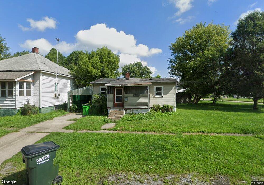
1434 Front St Alliance, OH 44601
Estimated Value: $58,000 - $103,000
2
Beds
1
Bath
1,007
Sq Ft
$77/Sq Ft
Est. Value
About This Home
This home is located at 1434 Front St, Alliance, OH 44601 and is currently estimated at $77,812, approximately $77 per square foot. 1434 Front St is a home located in Stark County with nearby schools including Alliance Early Learning School, Alliance Intermediate School at Northside, and Alliance Middle School.
Ownership History
Date
Name
Owned For
Owner Type
Purchase Details
Closed on
Oct 1, 2009
Sold by
Percy Irvin G
Bought by
Black Kelvin
Current Estimated Value
Purchase Details
Closed on
Aug 18, 2006
Sold by
Guy Sue
Bought by
Percy Ii Irvin G
Purchase Details
Closed on
Aug 10, 2006
Sold by
Estate Of John Guy
Bought by
Guy Sue
Purchase Details
Closed on
Feb 29, 2000
Sold by
Staten Stanley E and Staten Roberta
Bought by
Guy John and Guy Sue
Create a Home Valuation Report for This Property
The Home Valuation Report is an in-depth analysis detailing your home's value as well as a comparison with similar homes in the area
Home Values in the Area
Average Home Value in this Area
Purchase History
| Date | Buyer | Sale Price | Title Company |
|---|---|---|---|
| Black Kelvin | $2,000 | Attorney | |
| Percy Ii Irvin G | $1,000 | None Available | |
| Guy Sue | -- | None Available | |
| Guy John | $5,000 | -- |
Source: Public Records
Tax History Compared to Growth
Tax History
| Year | Tax Paid | Tax Assessment Tax Assessment Total Assessment is a certain percentage of the fair market value that is determined by local assessors to be the total taxable value of land and additions on the property. | Land | Improvement |
|---|---|---|---|---|
| 2025 | -- | $4,270 | $1,610 | $2,660 |
| 2024 | -- | $4,270 | $1,610 | $2,660 |
| 2023 | $142 | $3,440 | $320 | $3,120 |
| 2022 | $143 | $3,440 | $320 | $3,120 |
| 2021 | $143 | $3,440 | $320 | $3,120 |
| 2020 | $117 | $2,630 | $250 | $2,380 |
| 2019 | $115 | $2,630 | $250 | $2,380 |
| 2018 | $116 | $2,630 | $250 | $2,380 |
| 2017 | $520 | $2,310 | $210 | $2,100 |
| 2016 | $387 | $2,310 | $210 | $2,100 |
| 2015 | $111 | $2,310 | $210 | $2,100 |
| 2014 | $89 | $1,860 | $320 | $1,540 |
| 2013 | $44 | $1,860 | $320 | $1,540 |
Source: Public Records
Map
Nearby Homes
- 1214 Jersey St
- 263 Franklin Ave
- 142 S Seneca Ave
- 831 Wade Ave
- V/L S Fredeom Ave
- 652 N Webb Ave
- 361 E Main St
- 356 E Broadway St
- 432 S Linden Ave
- 814 Milner St
- 452 E Summit St
- 1044 S Liberty Ave
- 1233 Woodland Ave
- 1005 S Freedom Ave
- 710 N Freedom Ave
- 1175 S Freedom Ave
- 124 E Wayne St
- 551 South St
- 1395 S Webb Ave
- 11310 Webb Ave NE
- 1432 Front St
- 30 N Mahoning Ave
- 44 N Mahoning Ave
- 31 N Mahoning Ave
- 31 N Mahoning Ave
- 66 N Mahoning Ave
- 67 N Mahoning Ave
- 68 N Mahoning Ave
- 1090 Regent Dr
- 13668 Stanley Ave
- 13670 Stanley Ave
- 13670 Stanley Ave
- 85 N Mahoning Ave
- 82 N Mahoning Ave
- 13720 Stanley Ave
- 13622 Stanley Ave
- 90 N Mahoning Ave
- 13610 Stanley Ave
- 1431 Jersey St
- 1423 Jersey St