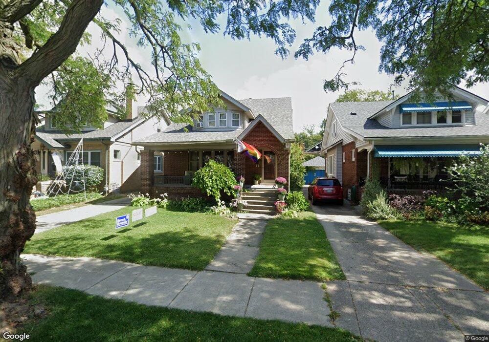
1434 Nottingham Rd Grosse Pointe Park, MI 48230
Estimated Value: $335,187 - $383,000
--
Bed
3
Baths
1,844
Sq Ft
$196/Sq Ft
Est. Value
About This Home
This home is located at 1434 Nottingham Rd, Grosse Pointe Park, MI 48230 and is currently estimated at $362,047, approximately $196 per square foot. 1434 Nottingham Rd is a home located in Wayne County with nearby schools including George Defer Elementary School, Pierce Middle School, and Grosse Pointe South High School.
Ownership History
Date
Name
Owned For
Owner Type
Purchase Details
Closed on
Aug 31, 2004
Sold by
Martin Brian B and Martin Christina M
Bought by
Ozar Kevin
Current Estimated Value
Purchase Details
Closed on
Apr 23, 1997
Sold by
Baer Kathryn and Baer Arthur F
Bought by
Darrah C and Porter Joan E
Purchase Details
Closed on
Oct 16, 1995
Sold by
Paul M and Cwengro Doris M
Bought by
Arthur F Stidfole and Arthur Kathryn Baur
Create a Home Valuation Report for This Property
The Home Valuation Report is an in-depth analysis detailing your home's value as well as a comparison with similar homes in the area
Home Values in the Area
Average Home Value in this Area
Purchase History
| Date | Buyer | Sale Price | Title Company |
|---|---|---|---|
| Ozar Kevin | $216,000 | Metropolitan Title Company | |
| Darrah C | $131,000 | -- | |
| Arthur F Stidfole | $190,000 | -- | |
| Arthur F Stidfole | $12,000 | -- |
Source: Public Records
Tax History Compared to Growth
Tax History
| Year | Tax Paid | Tax Assessment Tax Assessment Total Assessment is a certain percentage of the fair market value that is determined by local assessors to be the total taxable value of land and additions on the property. | Land | Improvement |
|---|---|---|---|---|
| 2025 | $2,187 | $136,900 | $0 | $0 |
| 2024 | $2,187 | $133,800 | $0 | $0 |
| 2023 | $2,089 | $131,500 | $0 | $0 |
| 2022 | $1,984 | $119,800 | $0 | $0 |
| 2021 | $3,913 | $111,700 | $0 | $0 |
| 2019 | $4,027 | $100,400 | $0 | $0 |
| 2018 | $1,892 | $90,400 | $0 | $0 |
| 2017 | $4,421 | $59,900 | $0 | $0 |
| 2016 | $4,047 | $81,000 | $0 | $0 |
| 2015 | $7,081 | $79,900 | $0 | $0 |
| 2013 | $6,860 | $71,300 | $0 | $0 |
| 2012 | $1,785 | $68,600 | $21,100 | $47,500 |
Source: Public Records
Map
Nearby Homes
- 1417 Beaconsfield Ave
- 1451 Beaconsfield Ave
- 15239 Mack Ave
- 3650 Somerset Ave
- 3666 Somerset Ave
- 1306 Beaconsfield Ave Unit 1308
- 3615 Barham St
- 1465 Maryland St
- 3661 Beaconsfield St
- 1318 Maryland St
- 1447 Wayburn St
- 1254 Beaconsfield Ave
- 3900 Somerset Ave
- 1449 Wayburn St
- 3918 Nottingham Rd
- 3905 Beaconsfield St
- 1316 Maryland St
- 3911 Beaconsfield St
- 1324 Wayburn St
- 3919 Beaconsfield St
- 1438 Nottingham Rd
- 1430 Nottingham Rd
- 1426 Nottingham Rd
- 1442 Nottingham Rd
- 1422 Nottingham Rd
- 1446 Nottingham Rd
- 1431 Somerset Ave Unit 1433
- 1439 Somerset Ave Unit 1441
- 1435 Somerset Ave
- 1435 Somerset Ave Unit 1435 Upper
- 1435 Somerset Ave Unit 1437 Loweer
- 1443 Somerset Ave Unit 1445
- 1427 Somerset Ave Unit 29
- 1420 Nottingham Rd
- 1437 Nottingham Rd
- 1423 Somerset Ave Unit 25
- 1452 Nottingham Rd
- 1431 Nottingham Rd
- 1441 Nottingham Rd
- 1447 Somerset Ave