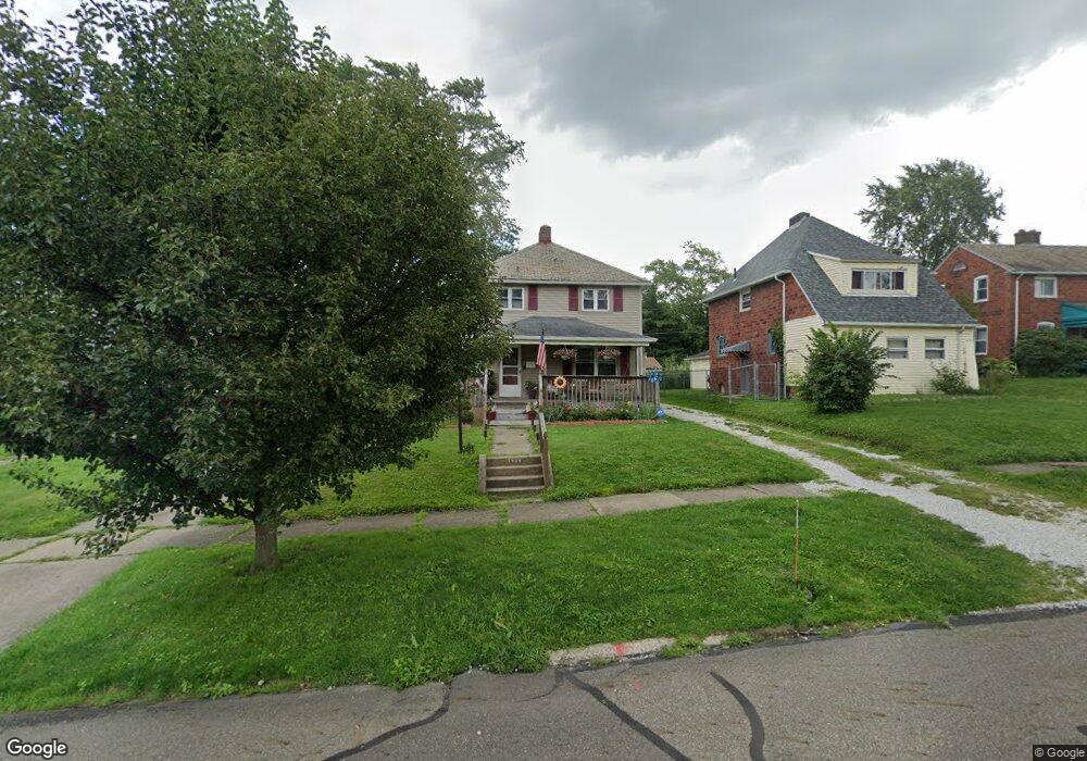
1434 S Morgan Ave Alliance, OH 44601
Estimated Value: $89,000 - $133,000
3
Beds
2
Baths
1,248
Sq Ft
$90/Sq Ft
Est. Value
About This Home
This home is located at 1434 S Morgan Ave, Alliance, OH 44601 and is currently estimated at $112,632, approximately $90 per square foot. 1434 S Morgan Ave is a home located in Stark County with nearby schools including Alliance Elementary School at Rockhill, Alliance Intermediate School at Northside, and Alliance Middle School.
Ownership History
Date
Name
Owned For
Owner Type
Purchase Details
Closed on
Dec 23, 2003
Sold by
Davis Aaron and Davis Nicole
Bought by
Davis Aaron and Davis Nicole
Current Estimated Value
Purchase Details
Closed on
Mar 13, 2002
Sold by
Price Kevin and Price Cathryn R
Bought by
Price Kevin D and Price Cathryn R
Purchase Details
Closed on
Jan 11, 2002
Sold by
Charter One Bank Fsb
Bought by
Price Kevin
Purchase Details
Closed on
Nov 13, 2001
Sold by
Schmied Anthony J
Bought by
Charter One Bank Fsb
Purchase Details
Closed on
Jul 11, 1996
Sold by
Schafer Michael S
Bought by
Schmied Anthony J and Smith Angela
Home Financials for this Owner
Home Financials are based on the most recent Mortgage that was taken out on this home.
Original Mortgage
$22,000
Interest Rate
8.09%
Mortgage Type
New Conventional
Create a Home Valuation Report for This Property
The Home Valuation Report is an in-depth analysis detailing your home's value as well as a comparison with similar homes in the area
Home Values in the Area
Average Home Value in this Area
Purchase History
| Date | Buyer | Sale Price | Title Company |
|---|---|---|---|
| Davis Aaron | -- | -- | |
| Price Kevin D | -- | -- | |
| Price Kevin | $19,000 | Chicago Title Insurance Comp | |
| Charter One Bank Fsb | $27,000 | -- | |
| Schmied Anthony J | $25,000 | -- |
Source: Public Records
Mortgage History
| Date | Status | Borrower | Loan Amount |
|---|---|---|---|
| Previous Owner | Schmied Anthony J | $22,000 |
Source: Public Records
Tax History Compared to Growth
Tax History
| Year | Tax Paid | Tax Assessment Tax Assessment Total Assessment is a certain percentage of the fair market value that is determined by local assessors to be the total taxable value of land and additions on the property. | Land | Improvement |
|---|---|---|---|---|
| 2025 | -- | $34,550 | $4,970 | $29,580 |
| 2024 | -- | $34,550 | $4,970 | $29,580 |
| 2023 | $935 | $23,280 | $4,800 | $18,480 |
| 2022 | $942 | $23,280 | $4,800 | $18,480 |
| 2021 | $943 | $23,280 | $4,800 | $18,480 |
| 2020 | $835 | $19,260 | $4,170 | $15,090 |
| 2019 | $823 | $19,260 | $4,170 | $15,090 |
| 2018 | $827 | $19,260 | $4,170 | $15,090 |
| 2017 | $741 | $16,990 | $3,470 | $13,520 |
| 2016 | $748 | $16,990 | $3,470 | $13,520 |
| 2015 | $754 | $16,990 | $3,470 | $13,520 |
| 2014 | $728 | $15,620 | $3,190 | $12,430 |
| 2013 | $363 | $15,620 | $3,190 | $12,430 |
Source: Public Records
Map
Nearby Homes
- 815 Grace St
- 1395 S Webb Ave
- 729 Waugh St
- 1233 Woodland Ave
- 551 South St
- 1044 S Liberty Ave
- 814 Milner St
- 1175 S Freedom Ave
- 1437 S Linden Ave
- 831 Wade Ave
- 390 E College St
- 1005 S Freedom Ave
- 1846 S Freedom Ave
- 1475 Chatauqua Ct
- 317 E State St
- 112 E College St
- 452 E Summit St
- 442 S Liberty Ave
- 432 S Linden Ave
- 853 Fairway Dr
- 1442 S Morgan Ave
- 1416 S Morgan Ave
- 1452 S Morgan Ave
- 1421 Wade Ave
- 1460 S Morgan Ave
- 1406 S Morgan Ave
- 1411 Wade Ave
- 1504 S Morgan Ave
- 1435 Wade Ave
- 1433 S Morgan Ave
- 1441 S Morgan Ave
- 1423 S Morgan Ave
- 1415 S Morgan Ave
- 1451 S Morgan Ave
- 1512 S Morgan Ave
- 1405 S Morgan Ave
- 1428 Wade Ave
- 1392 S Morgan Ave
- 1422 Wade Ave
- 1438 Wade Ave