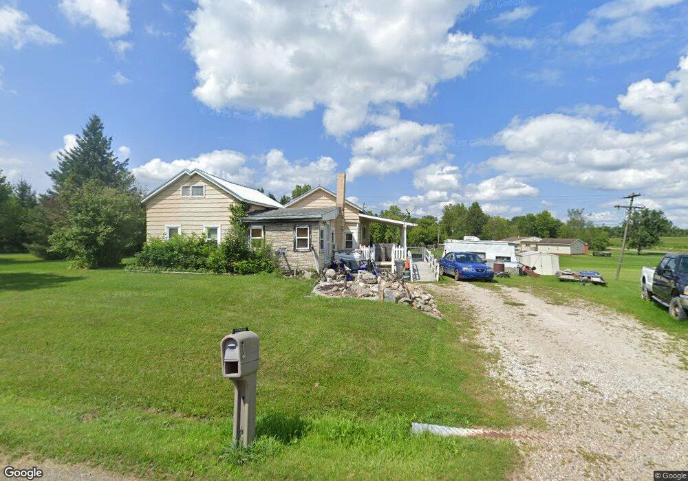
14340 Addison Rd Addison, MI 49220
Estimated Value: $145,000 - $272,000
Studio
1
Bath
650
Sq Ft
$296/Sq Ft
Est. Value
About This Home
This home is located at 14340 Addison Rd, Addison, MI 49220 and is currently estimated at $192,272, approximately $295 per square foot. 14340 Addison Rd is a home located in Hillsdale County with nearby schools including Addison Elementary School, Addison Middle School, and Addison High School.
Ownership History
Date
Name
Owned For
Owner Type
Purchase Details
Closed on
Dec 30, 2009
Sold by
Nieswender Betty J
Bought by
Holbrook Robert Bruce
Current Estimated Value
Home Financials for this Owner
Home Financials are based on the most recent Mortgage that was taken out on this home.
Original Mortgage
$134,000
Outstanding Balance
$41,010
Interest Rate
4.9%
Mortgage Type
Future Advance Clause Open End Mortgage
Estimated Equity
$151,262
Purchase Details
Closed on
Sep 9, 1998
Sold by
Truman Francis H
Bought by
Holbrook Robert Bruce
Create a Home Valuation Report for This Property
The Home Valuation Report is an in-depth analysis detailing your home's value as well as a comparison with similar homes in the area
Purchase History
| Date | Buyer | Sale Price | Title Company |
|---|---|---|---|
| Holbrook Robert Bruce | $160,000 | Public Title Agency | |
| Holbrook Robert Bruce | -- | -- |
Source: Public Records
Mortgage History
| Date | Status | Borrower | Loan Amount |
|---|---|---|---|
| Open | Holbrook Robert Bruce | $134,000 |
Source: Public Records
Tax History
| Year | Tax Paid | Tax Assessment Tax Assessment Total Assessment is a certain percentage of the fair market value that is determined by local assessors to be the total taxable value of land and additions on the property. | Land | Improvement |
|---|---|---|---|---|
| 2025 | $337 | $61,780 | $0 | $0 |
| 2024 | $3 | $39,900 | $0 | $0 |
| 2023 | $313 | $35,430 | $0 | $0 |
| 2022 | $1,225 | $32,090 | $0 | $0 |
| 2021 | $1,186 | $30,000 | $0 | $0 |
| 2020 | $1,176 | $31,190 | $0 | $0 |
| 2019 | $1,165 | $25,930 | $0 | $0 |
| 2018 | $1,123 | $27,170 | $0 | $0 |
| 2017 | $1,092 | $25,820 | $0 | $0 |
| 2016 | $1,085 | $25,550 | $0 | $0 |
| 2015 | $263 | $25,550 | $0 | $0 |
| 2013 | -- | $23,380 | $0 | $0 |
| 2012 | $249 | $24,630 | $0 | $0 |
Source: Public Records
Map
Nearby Homes
- 13840 N Adams Rd
- 4955 N Somerset Rd
- 13820 N Adams Rd
- 16001 Addison Rd
- 6482 Sorby Hwy
- 11480 N Adams Rd
- 2951 N Meridian Rd
- 9571 Waldron Rd
- 0
- VL Manitou Beach Road Proposed
- 0 Manitou Beach Rd Lot B
- 10421 E Greenlawn Dr
- 17475 U S 223
- 360 Park St
- 348 Lenawee St
- 9265 Devils Lake Hwy
- 8676 Cherry Point Dr
- 8164 Clarks Cove
- 12677 U S 223
- 2251 N Waldron Rd
- 14480 Addison Rd
- 6100 Somerset Rd
- 14260 Addison Rd
- 14160 Addison Rd
- 6160 Somerset Rd
- 14400 Addison Rd
- 14071 Addison Rd
- 14900 Addison Rd
- 6300 Somerset Rd
- 14660 Addison Rd
- 14002 Addison Rd
- 10501 N Somerset Rd
- 6100 N Somerset Rd
- 8031 N Somerset Rd
- 13891 Addison Rd
- 13891 Addison Rd Unit ADDISON RD
- 5749 N Somerset Rd
- 5749 N Somerset Rd Unit SOMERSET
- 5749 Somerset Rd
- 5749 Somerset Rd Unit SOMERSET
Your Personal Tour Guide
Ask me questions while you tour the home.