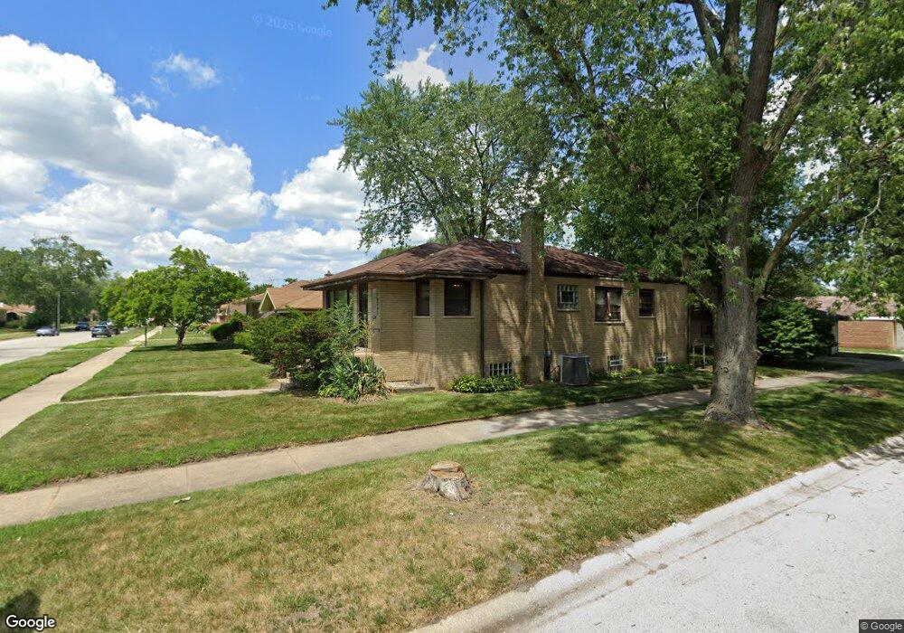
14347 Ellis Ave Dolton, IL 60419
Estimated Value: $156,000 - $194,000
3
Beds
1
Bath
1,106
Sq Ft
$158/Sq Ft
Est. Value
About This Home
This home is located at 14347 Ellis Ave, Dolton, IL 60419 and is currently estimated at $175,166, approximately $158 per square foot. 14347 Ellis Ave is a home located in Cook County with nearby schools including Lincoln Elementary School, Lincoln Junior High School, and Thornridge High School.
Ownership History
Date
Name
Owned For
Owner Type
Purchase Details
Closed on
May 14, 2015
Sold by
Tunstall Dionne and Tunstall Mark
Bought by
Tunstall Mark
Current Estimated Value
Purchase Details
Closed on
Sep 2, 2005
Sold by
Calloway Lisa R
Bought by
Tunstall Mark and Tunstall Dionne
Home Financials for this Owner
Home Financials are based on the most recent Mortgage that was taken out on this home.
Original Mortgage
$113,600
Outstanding Balance
$63,774
Interest Rate
6.95%
Mortgage Type
Balloon
Estimated Equity
$111,392
Purchase Details
Closed on
Aug 25, 1995
Sold by
Hurysz Edward J and Hurysz Eugenia C
Bought by
Calloway Lisa R
Home Financials for this Owner
Home Financials are based on the most recent Mortgage that was taken out on this home.
Original Mortgage
$81,350
Interest Rate
7.43%
Create a Home Valuation Report for This Property
The Home Valuation Report is an in-depth analysis detailing your home's value as well as a comparison with similar homes in the area
Home Values in the Area
Average Home Value in this Area
Purchase History
| Date | Buyer | Sale Price | Title Company |
|---|---|---|---|
| Tunstall Mark | -- | None Available | |
| Tunstall Mark | $142,000 | Stewart Title Of Illinois | |
| Calloway Lisa R | $84,000 | -- |
Source: Public Records
Mortgage History
| Date | Status | Borrower | Loan Amount |
|---|---|---|---|
| Open | Tunstall Mark | $113,600 | |
| Previous Owner | Calloway Lisa R | $81,350 |
Source: Public Records
Tax History
| Year | Tax Paid | Tax Assessment Tax Assessment Total Assessment is a certain percentage of the fair market value that is determined by local assessors to be the total taxable value of land and additions on the property. | Land | Improvement |
|---|---|---|---|---|
| 2025 | $7,685 | $15,000 | $1,964 | $13,036 |
| 2024 | $7,685 | $15,000 | $1,964 | $13,036 |
| 2023 | $4,857 | $15,000 | $1,964 | $13,036 |
| 2022 | $4,857 | $9,148 | $1,733 | $7,415 |
| 2021 | $4,876 | $9,147 | $1,733 | $7,414 |
| 2020 | $4,788 | $9,147 | $1,733 | $7,414 |
| 2019 | $4,187 | $8,206 | $1,617 | $6,589 |
| 2018 | $4,056 | $8,206 | $1,617 | $6,589 |
| 2017 | $3,866 | $8,206 | $1,617 | $6,589 |
| 2016 | $4,236 | $8,274 | $1,502 | $6,772 |
| 2015 | $4,016 | $8,274 | $1,502 | $6,772 |
| 2014 | $4,024 | $8,274 | $1,502 | $6,772 |
| 2013 | $3,867 | $8,593 | $1,502 | $7,091 |
Source: Public Records
Map
Nearby Homes
- 14325 Ingleside Ave
- 14341 Drexel Ave
- 14315 Dobson Ave
- 14314 Minerva Ave
- 14234 Ingleside Ave
- 14418 Drexel Ave
- 14234 Minerva Ave
- 14208 Ingleside Ave
- 14214 Minerva Ave
- 14341 University Ave
- 1107 E 145th St
- 14200 Drexel Ave
- 14525 Dobson Ave
- 14201 Maryland Ave
- 14223 University Ave
- 14405 Woodlawn Ave
- 14408 Lincoln Ave
- 14227 Woodlawn Ave
- 14631 Lincoln Ave
- 14526 Cottage Grove Ave
- 14345 Ellis Ave
- 14341 Ellis Ave
- 14401 Ellis Ave
- 14337 Ellis Ave
- 14346 Dobson Ave
- 14342 Dobson Ave
- 14405 Ellis Ave
- 14335 Ellis Ave
- 14340 Dobson Ave
- 14400 Dobson Ave
- 14336 Dobson Ave
- 14409 Ellis Ave
- 14346 Ellis Ave
- 14344 Ellis Ave
- 14331 Ellis Ave
- 14404 Dobson Ave
- 14340 Ellis Ave
- 14334 Dobson Ave
- 14400 Ellis Ave
- 14336 Ellis Ave
Your Personal Tour Guide
Ask me questions while you tour the home.