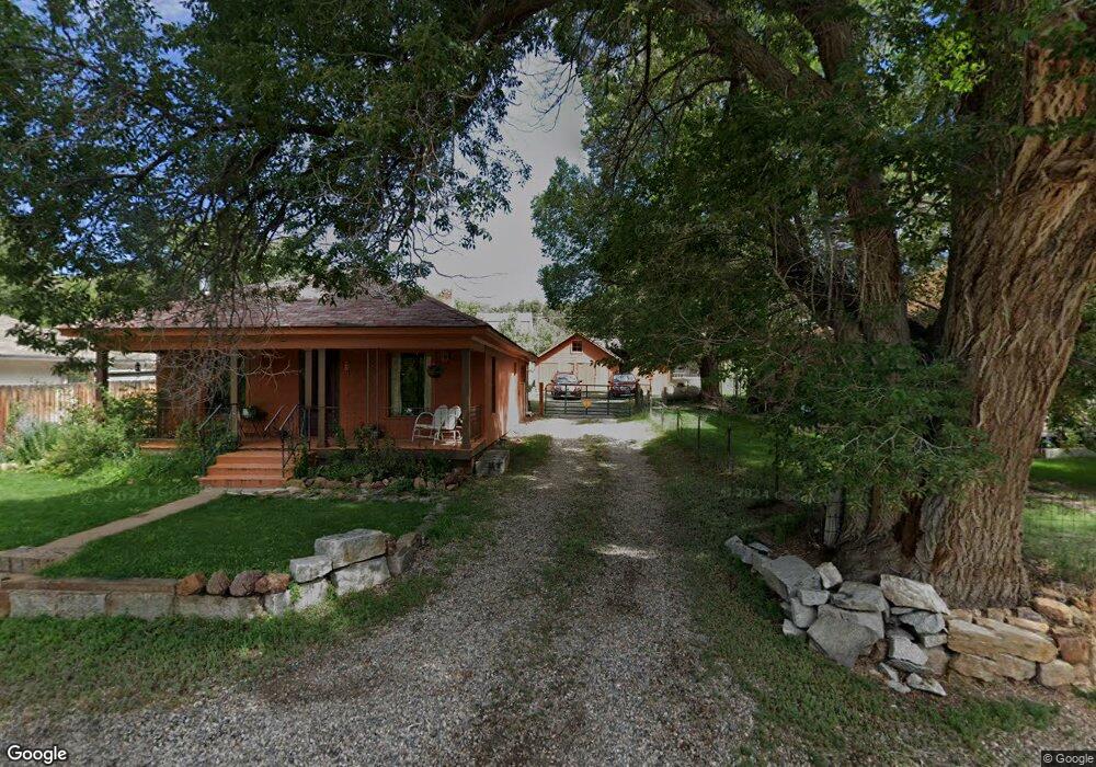
1435 Bella Vista Ln Cotopaxi, CO 81223
Estimated Value: $390,000 - $503,000
2
Beds
2
Baths
1,440
Sq Ft
$307/Sq Ft
Est. Value
About This Home
This home is located at 1435 Bella Vista Ln, Cotopaxi, CO 81223 and is currently estimated at $441,623, approximately $306 per square foot. 1435 Bella Vista Ln is a home located in Fremont County with nearby schools including Cotopaxi Elementary School and Cotopaxi Junior/Senior High School.
Ownership History
Date
Name
Owned For
Owner Type
Purchase Details
Closed on
Jan 13, 2021
Sold by
Ellis Steven E
Bought by
Walls Cheryl A
Current Estimated Value
Home Financials for this Owner
Home Financials are based on the most recent Mortgage that was taken out on this home.
Original Mortgage
$269,250
Outstanding Balance
$240,307
Interest Rate
2.71%
Mortgage Type
Commercial
Estimated Equity
$201,316
Purchase Details
Closed on
Aug 7, 2017
Sold by
Keller Bobby Charles and Keller Jimmie Sue
Bought by
Ellis Steven E
Create a Home Valuation Report for This Property
The Home Valuation Report is an in-depth analysis detailing your home's value as well as a comparison with similar homes in the area
Home Values in the Area
Average Home Value in this Area
Purchase History
| Date | Buyer | Sale Price | Title Company |
|---|---|---|---|
| Walls Cheryl A | $359,000 | None Available | |
| Ellis Steven E | $282,000 | Unified Title Company |
Source: Public Records
Mortgage History
| Date | Status | Borrower | Loan Amount |
|---|---|---|---|
| Open | Walls Cheryl A | $269,250 |
Source: Public Records
Tax History Compared to Growth
Tax History
| Year | Tax Paid | Tax Assessment Tax Assessment Total Assessment is a certain percentage of the fair market value that is determined by local assessors to be the total taxable value of land and additions on the property. | Land | Improvement |
|---|---|---|---|---|
| 2024 | $933 | $22,745 | $0 | $0 |
| 2023 | $933 | $19,060 | $0 | $0 |
| 2022 | $907 | $19,328 | $0 | $0 |
| 2021 | $913 | $19,885 | $0 | $0 |
| 2020 | $834 | $18,506 | $0 | $0 |
| 2019 | $833 | $18,506 | $0 | $0 |
| 2018 | $763 | $16,940 | $0 | $0 |
| 2017 | $764 | $16,940 | $0 | $0 |
| 2016 | $778 | $17,260 | $0 | $0 |
| 2015 | $777 | $17,260 | $0 | $0 |
| 2012 | $767 | $18,437 | $8,827 | $9,610 |
Source: Public Records
Map
Nearby Homes
- 2900 County Road 1
- Lot 9 Sundance Rd
- Lot 9 Sundance Rd
- 675 Black Gulch Rd
- TBD L 43rd Trail
- TBD- MB 43rd Trail
- TBD L 42nd Trail
- 987 38th Trail
- TR-16 White Wing Way
- TR-17 White Wing Way
- TBD Mcdonnell Dr
- 0 Mcdonnell Dr
- TR-56 Mcdonnell Dr
- 0 F Path and 37th Trail
- 37th Trail F Path
- 788 36th Trail
- 38 Mac Donnell Dr
- 38 Mcdonnell Dr
- TBD MB L 35th Trail