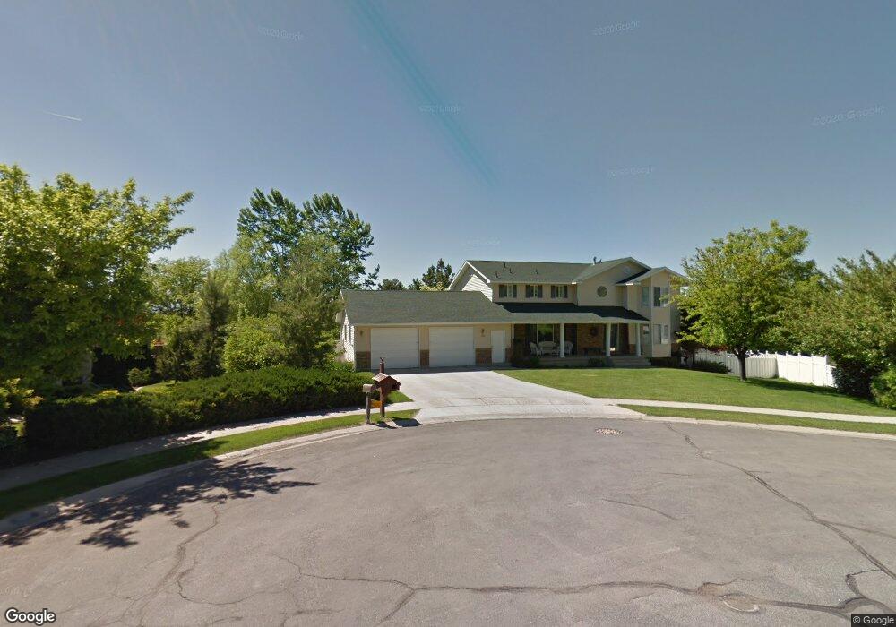
1435 E 2060 N North Logan, UT 84341
Estimated Value: $618,000 - $684,310
6
Beds
4
Baths
4,219
Sq Ft
$156/Sq Ft
Est. Value
About This Home
This home is located at 1435 E 2060 N, North Logan, UT 84341 and is currently estimated at $659,078, approximately $156 per square foot. 1435 E 2060 N is a home located in Cache County with nearby schools including Greenville School, Cedar Ridge School, and North Cache Middle School.
Ownership History
Date
Name
Owned For
Owner Type
Purchase Details
Closed on
Apr 16, 2019
Sold by
Burtenshaw Mark and Burtenshaw Kathryn W
Bought by
Griffiths Beau and Griffiths Emily
Current Estimated Value
Home Financials for this Owner
Home Financials are based on the most recent Mortgage that was taken out on this home.
Original Mortgage
$236,578
Outstanding Balance
$152,341
Interest Rate
4.3%
Mortgage Type
New Conventional
Estimated Equity
$506,737
Create a Home Valuation Report for This Property
The Home Valuation Report is an in-depth analysis detailing your home's value as well as a comparison with similar homes in the area
Home Values in the Area
Average Home Value in this Area
Purchase History
| Date | Buyer | Sale Price | Title Company |
|---|---|---|---|
| Griffiths Beau | -- | Pinnacle Title |
Source: Public Records
Mortgage History
| Date | Status | Borrower | Loan Amount |
|---|---|---|---|
| Open | Griffiths Beau | $236,578 |
Source: Public Records
Tax History
| Year | Tax Paid | Tax Assessment Tax Assessment Total Assessment is a certain percentage of the fair market value that is determined by local assessors to be the total taxable value of land and additions on the property. | Land | Improvement |
|---|---|---|---|---|
| 2025 | $2,570 | $359,710 | $0 | $0 |
| 2024 | $2,862 | $372,825 | $0 | $0 |
| 2023 | $2,939 | $358,220 | $0 | $0 |
| 2022 | $2,819 | $328,280 | $0 | $0 |
| 2021 | $2,722 | $491,600 | $70,550 | $421,050 |
| 2020 | $2,215 | $375,000 | $70,550 | $304,450 |
| 2019 | $2,469 | $375,000 | $70,550 | $304,450 |
| 2018 | $2,273 | $356,330 | $70,550 | $285,780 |
| 2017 | $2,100 | $173,310 | $0 | $0 |
| 2016 | $2,133 | $173,310 | $0 | $0 |
| 2015 | $1,888 | $152,895 | $0 | $0 |
| 2014 | $1,844 | $152,895 | $0 | $0 |
| 2013 | -- | $152,895 | $0 | $0 |
Source: Public Records
Map
Nearby Homes
- 2025 N 1550 E
- 1495 E 2300 N
- 1593 N 110 W Unit 201
- 611 E 2450 N Unit 1
- 1593 N 110 W Unit 202
- 1593 N 110 W Unit 204
- 1593 N 110 W Unit 203
- 1200 W 1400 N
- 2950 N Mahogony Valley Rd E Unit 7
- 1598 N Sharptail Cir
- 1000 W 2500 N
- 2143 N 950 E
- 1336 E Talmage Ln Unit 38
- 1454 N 1400 E
- 1901 Southpointe Ct
- Sydney Plan at Mountainside Estates
- Providence Plan at Mountainside Estates
- Maryland Plan at Mountainside Estates
- Rochester Plan at Mountainside Estates
- Oakley Plan at Mountainside Estates