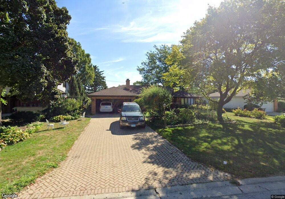
1435 Parkside Dr Unit 2 Park Ridge, IL 60068
Estimated Value: $601,000 - $709,000
3
Beds
2
Baths
2,281
Sq Ft
$281/Sq Ft
Est. Value
About This Home
This home is located at 1435 Parkside Dr Unit 2, Park Ridge, IL 60068 and is currently estimated at $641,220, approximately $281 per square foot. 1435 Parkside Dr Unit 2 is a home located in Cook County with nearby schools including Franklin Elementary School, Emerson Middle School, and Maine East High School.
Ownership History
Date
Name
Owned For
Owner Type
Purchase Details
Closed on
Oct 15, 2018
Sold by
Bergstrom Niels U and Bergstrom Debra A
Bought by
Bergstrom Niels U and Bergstrom Debra A
Current Estimated Value
Purchase Details
Closed on
Apr 25, 2011
Sold by
Lundberg Marvin A
Bought by
Bergstrom Niels U and Bergstrom Debra A
Home Financials for this Owner
Home Financials are based on the most recent Mortgage that was taken out on this home.
Original Mortgage
$264,000
Interest Rate
4.63%
Mortgage Type
New Conventional
Create a Home Valuation Report for This Property
The Home Valuation Report is an in-depth analysis detailing your home's value as well as a comparison with similar homes in the area
Home Values in the Area
Average Home Value in this Area
Purchase History
| Date | Buyer | Sale Price | Title Company |
|---|---|---|---|
| Bergstrom Niels U | -- | None Available | |
| Bergstrom Niels U | $330,000 | Cti |
Source: Public Records
Mortgage History
| Date | Status | Borrower | Loan Amount |
|---|---|---|---|
| Previous Owner | Bergstrom Niels U | $264,000 |
Source: Public Records
Tax History Compared to Growth
Tax History
| Year | Tax Paid | Tax Assessment Tax Assessment Total Assessment is a certain percentage of the fair market value that is determined by local assessors to be the total taxable value of land and additions on the property. | Land | Improvement |
|---|---|---|---|---|
| 2024 | $11,955 | $44,011 | $9,315 | $34,696 |
| 2023 | $12,374 | $51,000 | $9,315 | $41,685 |
| 2022 | $12,374 | $51,000 | $9,315 | $41,685 |
| 2021 | $10,417 | $37,580 | $7,452 | $30,128 |
| 2020 | $12,174 | $37,580 | $7,452 | $30,128 |
| 2019 | $10,111 | $42,225 | $7,452 | $34,773 |
| 2018 | $12,174 | $45,975 | $6,520 | $39,455 |
| 2017 | $12,139 | $45,975 | $6,520 | $39,455 |
| 2016 | $11,929 | $45,975 | $6,520 | $39,455 |
| 2015 | $9,369 | $33,001 | $5,356 | $27,645 |
| 2014 | $9,978 | $33,001 | $5,356 | $27,645 |
| 2013 | $9,451 | $33,001 | $5,356 | $27,645 |
Source: Public Records
Map
Nearby Homes
- 1580 Habberton Ave
- 8619 W Park Ln
- 8253 N Western Ave
- 8554 W Bruce Dr
- 1712 Woodland Ave
- 1819 Glenview Ave
- 1144 N Greenwood Ave
- 1710 Dempster St Unit C
- 1720 Greendale Ave
- 1044 N Knight Ave
- 8517 W Madison Dr
- 8426 W Betty Terrace
- 1025 N Knight Ave
- 1041 Vernon Ave
- 1420 Oakton St
- 1039 N Northwest Hwy Unit A5
- 1717 Oakton St
- 8974 N Western Ave Unit D409
- 1815 Oakton St Unit 2A
- 8808 Briar Ct Unit 88082A
- 1445 Parkside Dr
- 1425 Parkside Dr
- 1455 Parkside Dr
- 1415 Parkside Dr
- 1468 Parkside Dr
- 1488 Parkside Dr
- 1405 Parkside Dr
- 1465 Parkside Dr
- 1833 Burton Ln
- 1842 De Cook Ave
- 1448 Parkside Dr
- 1395 Parkside Dr
- 1852 De Cook Ave
- 8421 N Western Ave
- 8429 N Western Ave
- 8754 W Sunset Rd
- 1475 Parkside Dr
- 8743 W Park Ln
- 1843 Burton Ln
- 1841 De Cook Ave