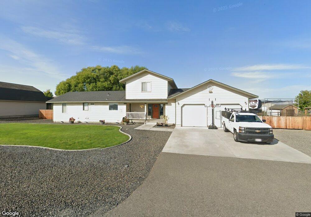
1435 S 58th Ave Unit UPDATED! West Richland, WA 99353
Estimated Value: $410,000 - $464,000
3
Beds
2
Baths
1,272
Sq Ft
$348/Sq Ft
Est. Value
About This Home
This home is located at 1435 S 58th Ave Unit UPDATED!, West Richland, WA 99353 and is currently estimated at $443,041, approximately $348 per square foot. 1435 S 58th Ave Unit UPDATED! is a home located in Benton County with nearby schools including Tapteal Elementary School, Hanford High School, and Liberty Christian School of the Tri-Cities.
Ownership History
Date
Name
Owned For
Owner Type
Purchase Details
Closed on
Feb 16, 2016
Sold by
Seabaugh Brad W and Seabaugh Tera L
Bought by
Galloway Sean and Galloway Jessica
Current Estimated Value
Home Financials for this Owner
Home Financials are based on the most recent Mortgage that was taken out on this home.
Original Mortgage
$208,666
Outstanding Balance
$166,453
Interest Rate
3.97%
Mortgage Type
VA
Estimated Equity
$276,588
Create a Home Valuation Report for This Property
The Home Valuation Report is an in-depth analysis detailing your home's value as well as a comparison with similar homes in the area
Home Values in the Area
Average Home Value in this Area
Purchase History
| Date | Buyer | Sale Price | Title Company |
|---|---|---|---|
| Galloway Sean | $202,000 | Stewart Title Company |
Source: Public Records
Mortgage History
| Date | Status | Borrower | Loan Amount |
|---|---|---|---|
| Open | Galloway Sean | $208,666 |
Source: Public Records
Tax History Compared to Growth
Tax History
| Year | Tax Paid | Tax Assessment Tax Assessment Total Assessment is a certain percentage of the fair market value that is determined by local assessors to be the total taxable value of land and additions on the property. | Land | Improvement |
|---|---|---|---|---|
| 2024 | $4,226 | $396,810 | $50,000 | $346,810 |
| 2023 | $4,226 | $396,810 | $50,000 | $346,810 |
| 2022 | $3,589 | $316,780 | $50,000 | $266,780 |
| 2021 | $3,405 | $290,100 | $50,000 | $240,100 |
| 2020 | $3,426 | $263,420 | $50,000 | $213,420 |
| 2019 | $2,689 | $254,530 | $50,000 | $204,530 |
| 2018 | $2,729 | $213,950 | $58,000 | $155,950 |
| 2017 | $2,419 | $187,960 | $58,000 | $129,960 |
| 2016 | $2,298 | $187,960 | $58,000 | $129,960 |
| 2015 | $2,178 | $187,960 | $58,000 | $129,960 |
| 2014 | -- | $174,950 | $40,600 | $134,350 |
| 2013 | -- | $174,950 | $40,600 | $134,350 |
Source: Public Records
Map
Nearby Homes
- 5700 Norma St
- 5600 Oasis St
- 5600 Aloha Dr
- 996 Miraflores Ave
- TBD S 58th Ave
- 5322 Seahawk Dr
- 5323 Chukar Ct
- 6575 Agate Ct
- 8195 Lennox St
- 8410 Lennox St
- 8184 Lennox St
- 5043 Swallow Ct
- 6370 Cobalt Dr
- 1393 Kalani Ct
- 1325 Kalani Ct
- 1313 Kalani Ct
- 1356 Kalani Ct
- 1334 Kalani Ct
- 1322 Kalani Ct
- 882 Pikes Peak Dr
- 1435 S 58th Ave
- 1475 S 58th Ave
- 5810 Oasis St
- 5870 Oasis St
- 5803 Norma St
- 1301 S 58th Ave
- 1511 S 58th Ave
- 1510 S 58th Ave
- 5901 Norma St
- 1510 Aria Ct
- 1521 S 58th Ave
- 5608 Oasis St
- 5606 Oasis St
- 1520 S 58th Ave
- 1250 S 58th Ave
- 5903 Norma St
- 5604 Oasis St
- 1550 Aria Ct
- 1550 Aria Ct Unit Includes Full landsc
- 1501 57th Ct