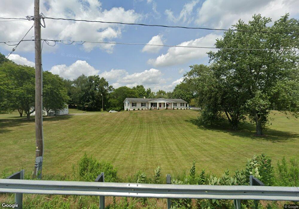
1435 State St NE Canton, OH 44721
Estimated Value: $319,000 - $427,000
2
Beds
3
Baths
1,522
Sq Ft
$245/Sq Ft
Est. Value
About This Home
This home is located at 1435 State St NE, Canton, OH 44721 and is currently estimated at $372,895, approximately $245 per square foot. 1435 State St NE is a home located in Stark County with nearby schools including Lake Middle/High School.
Ownership History
Date
Name
Owned For
Owner Type
Purchase Details
Closed on
Jul 29, 2010
Sold by
Weyrick Shirley A and Estate Of Ralph M Motz
Bought by
Caudill Brian D and Caudill Lisa J
Current Estimated Value
Home Financials for this Owner
Home Financials are based on the most recent Mortgage that was taken out on this home.
Original Mortgage
$187,475
Outstanding Balance
$125,248
Interest Rate
4.75%
Mortgage Type
FHA
Estimated Equity
$247,647
Create a Home Valuation Report for This Property
The Home Valuation Report is an in-depth analysis detailing your home's value as well as a comparison with similar homes in the area
Home Values in the Area
Average Home Value in this Area
Purchase History
| Date | Buyer | Sale Price | Title Company |
|---|---|---|---|
| Caudill Brian D | $190,000 | Village Title Agency |
Source: Public Records
Mortgage History
| Date | Status | Borrower | Loan Amount |
|---|---|---|---|
| Open | Caudill Brian D | $187,475 |
Source: Public Records
Tax History Compared to Growth
Tax History
| Year | Tax Paid | Tax Assessment Tax Assessment Total Assessment is a certain percentage of the fair market value that is determined by local assessors to be the total taxable value of land and additions on the property. | Land | Improvement |
|---|---|---|---|---|
| 2025 | -- | $110,960 | $55,130 | $55,830 |
| 2024 | -- | $110,960 | $55,130 | $55,830 |
| 2023 | $4,183 | $89,190 | $32,100 | $57,090 |
| 2022 | $2,099 | $89,190 | $32,100 | $57,090 |
| 2021 | $4,245 | $89,190 | $32,100 | $57,090 |
| 2020 | $4,009 | $75,500 | $27,650 | $47,850 |
| 2019 | $3,973 | $75,510 | $27,660 | $47,850 |
| 2018 | $3,898 | $75,510 | $27,660 | $47,850 |
| 2017 | $3,814 | $67,240 | $28,070 | $39,170 |
| 2016 | $3,821 | $67,240 | $28,070 | $39,170 |
| 2015 | $3,818 | $67,240 | $28,070 | $39,170 |
| 2014 | $1,521 | $64,450 | $26,920 | $37,530 |
| 2013 | $1,761 | $64,450 | $26,920 | $37,530 |
Source: Public Records
Map
Nearby Homes
- 8994 Kent Ave NE
- 9393 Kent Ave NE
- 9766 Smithdale Ave NE
- 2231 Lovers Ln NE
- 9790 Smithdale Ave NE
- 2315 Old Elm St NE
- 8275 Rolling Hill Ave NW
- 10277 Market Ave N
- 8314 Sapphire Ave NE
- 8271 Pheasant Ave NW
- Tupelo Plan at Sparwood Farms
- Cedar Plan at Sparwood Farms
- Elder Plan at Sparwood Farms
- Aspen Plan at Sparwood Farms
- 10387 Middlebranch Ave NE
- 2793 Rita St NE
- 1975 Eloise Cir NE
- 7272 Ashburton Cir NW
- 10277 Carlswood Ave NE
- 2623 Notre Dame St NE
- 1435 State St NE
- 1451 State St NE
- 1460 State St NE
- 9153 Grubb Ct NE
- 1319 State St NE
- 1508 State St NE
- 1330 State St NE
- 1551 State St NE
- 9189 Grubb Ct NE
- 1300 State St NE
- 1274 State St NE
- 1313 State St NE
- 1246 State St NE
- 1224 State St NE
- 1654 State St NE
- 1195 State St NE
- 1169 State St NE
- 1196 State St NE
- 9069 Kent Ave NE
- 1164 State St NE