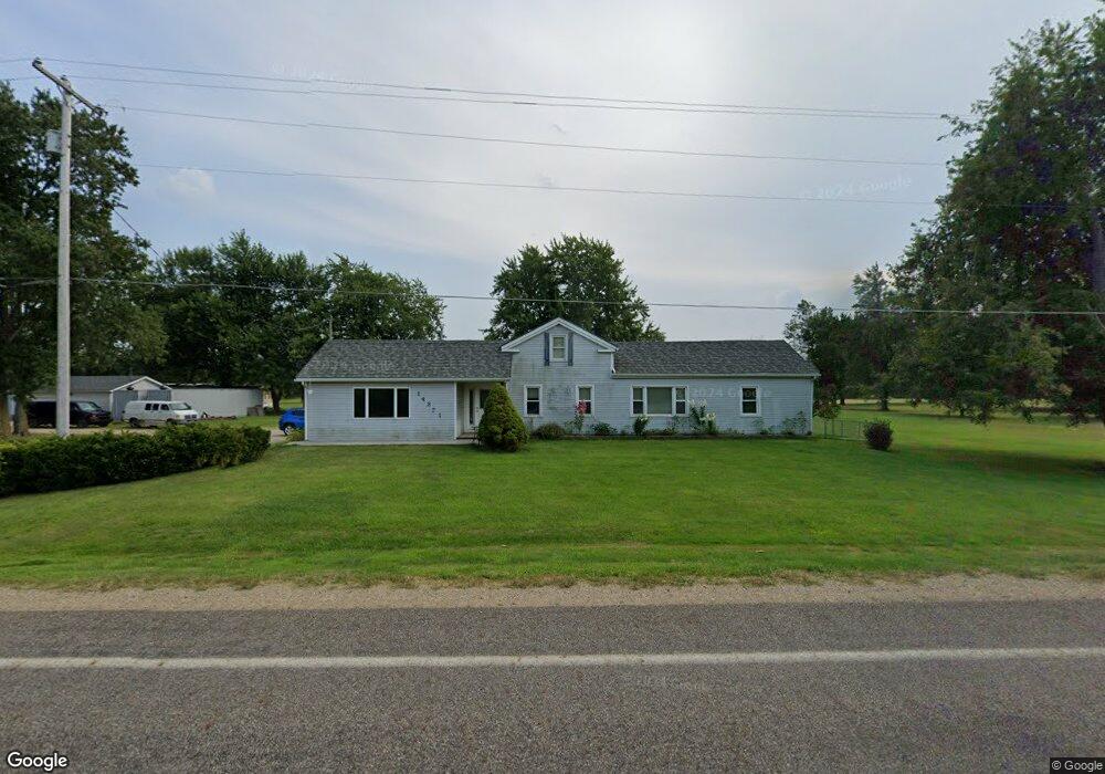
14351 Hudson Rd Hudson, MI 49247
Estimated Value: $206,000 - $292,000
Studio
2
Baths
1,690
Sq Ft
$157/Sq Ft
Est. Value
About This Home
This home is located at 14351 Hudson Rd, Hudson, MI 49247 and is currently estimated at $265,511, approximately $157 per square foot. 14351 Hudson Rd is a home located in Hillsdale County with nearby schools including Lincoln Elementary School, Southern Michigan Center For Science & Industry (SMCSI), and Hudson Middle School.
Ownership History
Date
Name
Owned For
Owner Type
Purchase Details
Closed on
Oct 18, 2004
Sold by
Mccabe Sheryl L and Mccabe Patrick J
Bought by
Citifinancial Mortgage Co
Current Estimated Value
Purchase Details
Closed on
Mar 26, 2004
Sold by
Mccabe Sheryl L and Mccabe Patrick J
Bought by
Citifinancial Mortgage Co
Purchase Details
Closed on
May 18, 1998
Sold by
Mcnett Robert W
Bought by
Mccabe Patrick J and Mccabe Sheryl L
Purchase Details
Closed on
Sep 15, 1987
Bought by
Mcnett Robert W
Purchase Details
Closed on
Aug 28, 1964
Bought by
Smith
Create a Home Valuation Report for This Property
The Home Valuation Report is an in-depth analysis detailing your home's value as well as a comparison with similar homes in the area
Purchase History
| Date | Buyer | Sale Price | Title Company |
|---|---|---|---|
| Citifinancial Mortgage Co | -- | E Title Agency | |
| Citifinancial Mortgage Co | $173,526 | -- | |
| Mccabe Patrick J | $87,500 | -- | |
| Mcnett Robert W | $40,800 | -- | |
| Smith | -- | -- |
Source: Public Records
Tax History
| Year | Tax Paid | Tax Assessment Tax Assessment Total Assessment is a certain percentage of the fair market value that is determined by local assessors to be the total taxable value of land and additions on the property. | Land | Improvement |
|---|---|---|---|---|
| 2025 | $679 | $124,400 | $0 | $0 |
| 2024 | $7 | $116,800 | $0 | $0 |
| 2023 | $630 | $95,400 | $0 | $0 |
| 2022 | $1,669 | $77,400 | $0 | $0 |
| 2021 | $1,638 | $67,500 | $0 | $0 |
| 2020 | $1,619 | $62,400 | $0 | $0 |
| 2019 | $1,594 | $59,400 | $0 | $0 |
| 2018 | $1,547 | $59,400 | $0 | $0 |
| 2017 | $1,552 | $58,200 | $0 | $0 |
| 2016 | $1,329 | $62,800 | $0 | $0 |
| 2015 | $531 | $62,800 | $0 | $0 |
| 2013 | -- | $53,400 | $0 | $0 |
| 2012 | -- | $45,840 | $0 | $0 |
Source: Public Records
Map
Nearby Homes
- 14700 Hudson Rd
- 200 Grove St
- 143 Lafayette St
- 324 Railroad St
- 14300 Union Rd
- 207 N Church St
- 110 Hill St
- 321 S Wood St
- 310 School St
- 645 S Meridian Rd
- 437 Mckenzie St
- 560 State St
- 792 Meadowbrook Dr
- 7100 S Waldron Rd
- 2507 S Waldron Rd
- 3120 N Posey Lake Hwy
- 18000 blk #2 Forrister Rd
- 18000 blk #1 Forrister Rd
- 18430 Forrister Rd
- 18000 blk #3 Forrister Rd
- 14311 Hudson Rd
- 14411 Hudson Rd
- 14271 Hudson Rd
- 14231 Hudson Rd
- 14479 Hudson Rd
- 14479 Hudson Rd Unit HUDSON
- 14211 Hudson Rd
- 14520 Hudson Rd
- 14191 Hudson Rd
- 14560 Hudson Rd
- 14591 Hudson Rd
- 14140 Hudson Rd
- 14580 Hudson Rd
- 14133 Hudson Rd
- 14133 Hudson Rd Unit HUDSON
- 14611 Hudson Rd
- 14600 Hudson Rd
- 14691 Hudson Rd
- 14660 Hudson Rd
- 14680 Hudson Rd
Your Personal Tour Guide
Ask me questions while you tour the home.