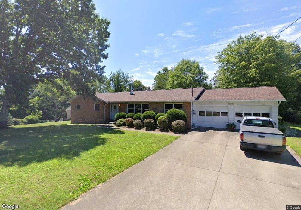
1436 Roosevelt St Morgantown, WV 26505
Woodburn NeighborhoodEstimated Value: $276,000 - $333,000
3
Beds
2
Baths
1,807
Sq Ft
$167/Sq Ft
Est. Value
About This Home
This home is located at 1436 Roosevelt St, Morgantown, WV 26505 and is currently estimated at $302,435, approximately $167 per square foot. 1436 Roosevelt St is a home located in Monongalia County with nearby schools including Eastwood Elementary School, Suncrest Middle School, and Morgantown High School.
Ownership History
Date
Name
Owned For
Owner Type
Purchase Details
Closed on
Sep 14, 2018
Sold by
Berry Stacy J and Crozier Frederick P
Bought by
Berry Stacy J and Crozier Frederick P
Current Estimated Value
Purchase Details
Closed on
Dec 23, 2010
Sold by
Mcafee Sandra and Nedrow Randall Ralph
Bought by
Berry Stacy J and Crozier Frederick P
Home Financials for this Owner
Home Financials are based on the most recent Mortgage that was taken out on this home.
Original Mortgage
$160,000
Outstanding Balance
$106,993
Interest Rate
4.46%
Mortgage Type
New Conventional
Estimated Equity
$195,442
Create a Home Valuation Report for This Property
The Home Valuation Report is an in-depth analysis detailing your home's value as well as a comparison with similar homes in the area
Home Values in the Area
Average Home Value in this Area
Purchase History
| Date | Buyer | Sale Price | Title Company |
|---|---|---|---|
| Berry Stacy J | -- | None Available | |
| Berry Stacy J | $200,000 | None Available |
Source: Public Records
Mortgage History
| Date | Status | Borrower | Loan Amount |
|---|---|---|---|
| Open | Berry Stacy J | $160,000 |
Source: Public Records
Tax History Compared to Growth
Tax History
| Year | Tax Paid | Tax Assessment Tax Assessment Total Assessment is a certain percentage of the fair market value that is determined by local assessors to be the total taxable value of land and additions on the property. | Land | Improvement |
|---|---|---|---|---|
| 2024 | $1,524 | $116,760 | $27,180 | $89,580 |
| 2023 | $1,541 | $116,760 | $27,180 | $89,580 |
| 2022 | $1,492 | $117,060 | $27,180 | $89,880 |
| 2021 | $1,385 | $108,240 | $27,180 | $81,060 |
| 2020 | $1,404 | $109,320 | $27,180 | $82,140 |
| 2019 | $1,412 | $109,320 | $27,180 | $82,140 |
| 2018 | $1,405 | $108,480 | $27,180 | $81,300 |
| 2017 | $1,391 | $106,980 | $25,680 | $81,300 |
| 2016 | $1,394 | $106,620 | $24,300 | $82,320 |
| 2015 | $1,329 | $105,360 | $23,040 | $82,320 |
| 2014 | $1,260 | $103,740 | $21,480 | $82,260 |
Source: Public Records
Map
Nearby Homes
- 1036 N Willey St
- TBD Hodges St
- tbd Winter Alley
- 1000 Willey St
- 0 Bartlow St
- 1041 Montrose Ave
- tbd Wright St
- 813 Ridgeway Ave
- 809 Monongalia Ave
- 774 Garrison Ave
- 621 Louise Ave
- 613 Louise Ave
- 229 Cornell Ave
- 608 Clinton Ave
- TBD Keyser Ave
- TBD Glenn St
- 21 Marion St
- 524 Pearl Ave
- #2 Westminster Dr
- 1 Westminster Dr
- 1426 Roosevelt St
- 1448 Roosevelt St
- 1435 Roosevelt St
- 781 Des Moines Ave
- 1445 Roosevelt St
- 1454 Roosevelt St
- 805 Des Moines Ave
- 1417 Roosevelt St
- 1414 Roosevelt St
- 0 Des Moines Ave
- 782 Des Moines Ave
- 813 Des Moines Ave
- 1153 Louise Ave
- 1443 - 1449 Willey St
- 1145 Louise Ave
- 1411 Willey St
- 1411 Willey St A
- 1411 Willey St B
- 800 Des Moines Ave
- 1459 Roosevelt St