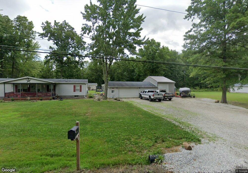
14363 Ardmore Dr NE Alliance, OH 44601
Estimated Value: $116,000 - $168,000
3
Beds
2
Baths
1,560
Sq Ft
$94/Sq Ft
Est. Value
About This Home
This home is located at 14363 Ardmore Dr NE, Alliance, OH 44601 and is currently estimated at $147,000, approximately $94 per square foot. 14363 Ardmore Dr NE is a home located in Stark County with nearby schools including Marlington High School and Regina Coeli/St Joseph School.
Ownership History
Date
Name
Owned For
Owner Type
Purchase Details
Closed on
Aug 30, 2018
Sold by
Zickefoose Robert L
Bought by
Vance Jimmy A and Vance Paula D
Current Estimated Value
Home Financials for this Owner
Home Financials are based on the most recent Mortgage that was taken out on this home.
Original Mortgage
$59,830
Interest Rate
4.5%
Mortgage Type
Future Advance Clause Open End Mortgage
Create a Home Valuation Report for This Property
The Home Valuation Report is an in-depth analysis detailing your home's value as well as a comparison with similar homes in the area
Home Values in the Area
Average Home Value in this Area
Purchase History
| Date | Buyer | Sale Price | Title Company |
|---|---|---|---|
| Vance Jimmy A | $62,070 | First American Title Insuran |
Source: Public Records
Mortgage History
| Date | Status | Borrower | Loan Amount |
|---|---|---|---|
| Closed | Vance Jimmy A | $59,830 |
Source: Public Records
Tax History Compared to Growth
Tax History
| Year | Tax Paid | Tax Assessment Tax Assessment Total Assessment is a certain percentage of the fair market value that is determined by local assessors to be the total taxable value of land and additions on the property. | Land | Improvement |
|---|---|---|---|---|
| 2025 | -- | $45,010 | $14,350 | $30,660 |
| 2024 | -- | $45,010 | $14,350 | $30,660 |
| 2023 | $963 | $27,340 | $5,360 | $21,980 |
| 2022 | $987 | $27,940 | $5,360 | $22,580 |
| 2021 | $991 | $27,940 | $5,360 | $22,580 |
| 2020 | $949 | $23,840 | $4,590 | $19,250 |
| 2019 | $942 | $23,840 | $4,590 | $19,250 |
| 2018 | $943 | $23,840 | $4,590 | $19,250 |
| 2017 | $1,000 | $23,660 | $2,450 | $21,210 |
| 2016 | $1,000 | $23,660 | $2,450 | $21,210 |
| 2015 | $977 | $24,260 | $2,450 | $21,810 |
| 2014 | $921 | $20,900 | $2,100 | $18,800 |
| 2013 | $458 | $20,900 | $2,100 | $18,800 |
Source: Public Records
Map
Nearby Homes
- 14422 Sturbridge Rd NE
- 14723 Bolton St NE
- 0 Johnson Ave NE Unit 5142926
- 0 Klinger Ave NE
- 0 Homestead Ave NE
- 0 Meadowbrook Ave
- 11480 Aebi Ave NE
- 000 Klinger Ave
- 13109 Edison St NE
- 15520 Coalbank St NE
- 13975 Greenbower St NE
- 432 Johnson Ave
- 0 Knoll St NE
- 11344 Walnut Ave NE
- 11940 Freshley Ave NE
- 15789 Coalbank St NE
- 511 W Ely St
- 0 Meadow St NE
- 505 N Union Ave
- 124 E Wayne St
- 14363 Ardmore Dr NE
- 14363 Ardmore Dr NE
- 14351 Ardmore Dr NE
- 14402 Madison Dr NE
- 12106 Bon Air Ave NE
- 14394 Ardmore Dr NE
- 14411 Ardmore Dr NE
- 12090 Bon Air Ave NE
- 12133 Bon Air Ave NE
- 12117 Bon Air Ave NE
- 12117 Bon Air Ave NE
- 12078 Bon Air Ave NE
- 14416 Ardmore Dr NE
- 14393 Spruce Dr NE
- 14443 Ardmore Dr NE
- 12081 Bon Air Ave NE
- 12081 Bon Air Ave NE
- 12081 Bon Air Ave NE
- 12081 Bon Air Ave NE
- 12055 Wisconsin Rd NE