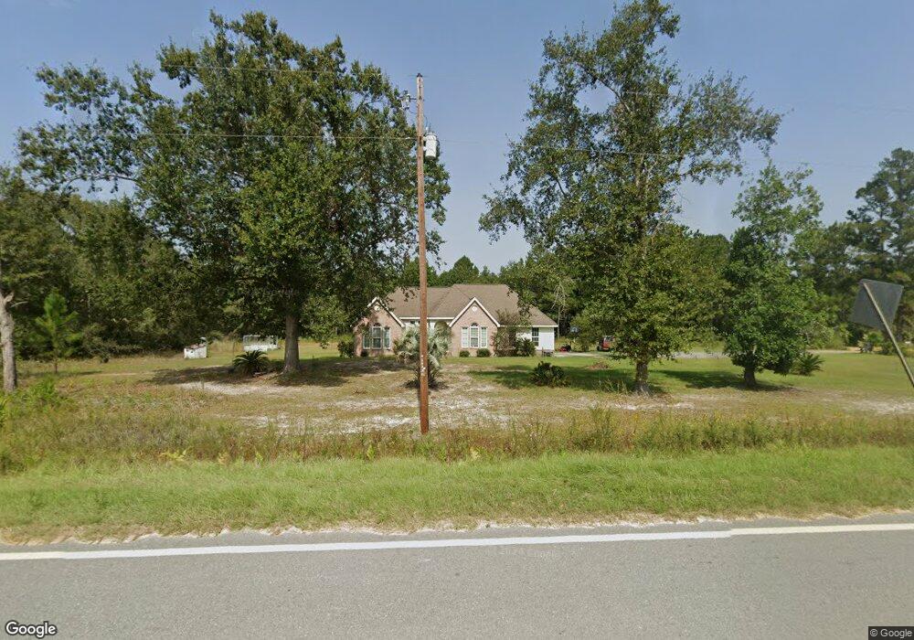
1437 Broadhurst Rd Screven, GA 31560
Estimated Value: $247,000 - $354,000
--
Bed
2
Baths
1,944
Sq Ft
$152/Sq Ft
Est. Value
About This Home
This home is located at 1437 Broadhurst Rd, Screven, GA 31560 and is currently estimated at $295,765, approximately $152 per square foot. 1437 Broadhurst Rd is a home located in Wayne County with nearby schools including Screven Elementary School, Arthur Williams Middle School, and Wayne County High School.
Ownership History
Date
Name
Owned For
Owner Type
Purchase Details
Closed on
Mar 8, 2005
Sold by
Horne Darren S
Bought by
Horne Iris Sabrina
Current Estimated Value
Purchase Details
Closed on
Jul 1, 2004
Bought by
Horne Iris Sabrina
Purchase Details
Closed on
May 1, 2002
Purchase Details
Closed on
Aug 1, 2001
Purchase Details
Closed on
May 1, 2001
Purchase Details
Closed on
Oct 1, 1998
Purchase Details
Closed on
Aug 1, 1995
Purchase Details
Closed on
Jan 1, 1991
Create a Home Valuation Report for This Property
The Home Valuation Report is an in-depth analysis detailing your home's value as well as a comparison with similar homes in the area
Home Values in the Area
Average Home Value in this Area
Purchase History
| Date | Buyer | Sale Price | Title Company |
|---|---|---|---|
| Horne Iris Sabrina | -- | -- | |
| Horne Iris Sabrina | $15,000 | -- | |
| -- | $12,600 | -- | |
| -- | $15,000 | -- | |
| -- | $18,400 | -- | |
| -- | $10,000 | -- | |
| -- | $5,000 | -- | |
| -- | -- | -- |
Source: Public Records
Tax History Compared to Growth
Tax History
| Year | Tax Paid | Tax Assessment Tax Assessment Total Assessment is a certain percentage of the fair market value that is determined by local assessors to be the total taxable value of land and additions on the property. | Land | Improvement |
|---|---|---|---|---|
| 2024 | $2,423 | $96,480 | $5,772 | $90,708 |
| 2023 | $2,555 | $85,168 | $5,772 | $79,396 |
| 2022 | $2,025 | $69,331 | $5,772 | $63,559 |
| 2021 | $1,926 | $62,113 | $5,772 | $56,341 |
| 2020 | $1,992 | $62,113 | $5,772 | $56,341 |
| 2019 | $2,052 | $62,113 | $5,772 | $56,341 |
| 2018 | $2,052 | $62,113 | $5,772 | $56,341 |
| 2017 | $1,766 | $62,113 | $5,772 | $56,341 |
| 2016 | $1,709 | $62,113 | $5,772 | $56,341 |
| 2014 | $1,714 | $62,113 | $5,772 | $56,341 |
| 2013 | -- | $62,113 | $5,772 | $56,341 |
Source: Public Records
Map
Nearby Homes
- 868 Broadhurst Rd W
- 107 Gaffney St
- 0 Dale Mill Rd
- 102 Highsmith Ave
- 109 Joyner St
- 406 Cw Collins St
- 301 Whitaker Dr
- 391 S Forks Rd
- 0 S Forks Rd
- 9009 Waycross Hwy
- 7132 Waycross Hwy
- 301 Broadhurst Rd
- 7114 Waycross Hwy
- 59 Enoch Moody Rd
- 7014 Waycross Hwy
- 88 Minnesota Rd
- 0 Rogers Break Unit 1656131
- 0 Us Highway 301
- 675 Foxwood Cir
- 176 Covey Way Rd
- 765 Wilson Rd
- 967 Broadhurst Rd
- 5125 Bennett Rd
- 1765 Broadhurst Rd
- 411 Wilson Rd
- 2218 Wilson Rd
- 1100 Broadhurst Rd
- 1100 Broadhurst Rd Unit waynecounty
- 218 Wilson Rd
- 5189 Bennett Rd
- 5185 Bennett Rd
- 0 W Broadhurst Rd
- 343 Camden Rd
- 5127 Bennett Rd
- 5148 Bennett Rd
- 426 White Star Rd
- 0 Bennett Rd Unit 254408
- 0 Bennett Rd Unit 114168
- 0 Bennett Rd Unit 116496
- 0 Bennett Rd Unit 116728