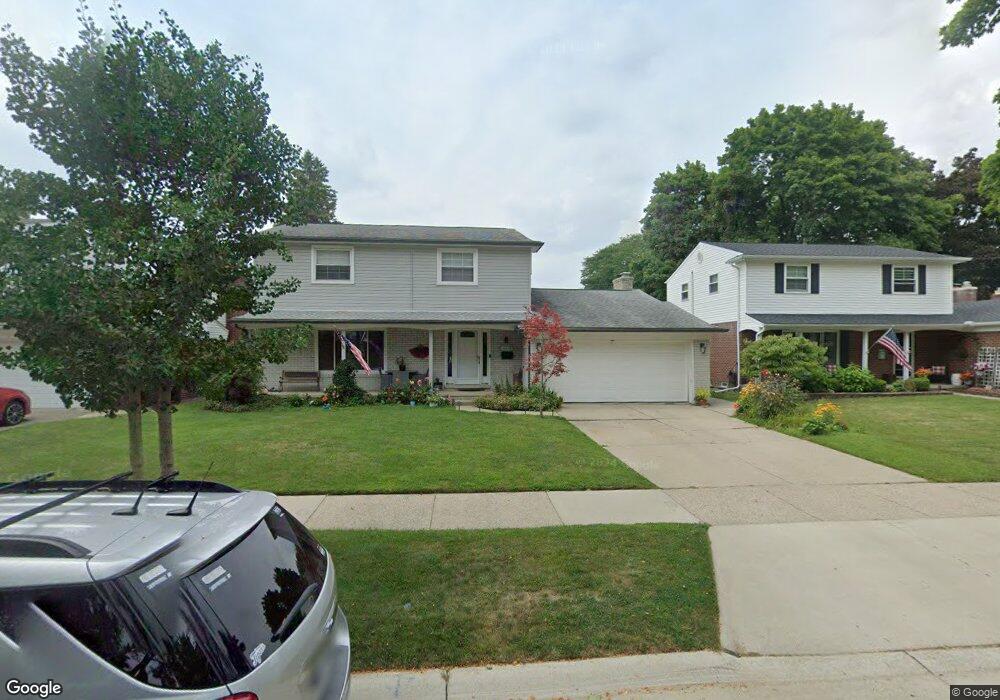
14375 Hubbard St Livonia, MI 48154
Estimated Value: $335,000 - $396,000
4
Beds
3
Baths
1,918
Sq Ft
$196/Sq Ft
Est. Value
About This Home
This home is located at 14375 Hubbard St, Livonia, MI 48154 and is currently estimated at $376,837, approximately $196 per square foot. 14375 Hubbard St is a home located in Wayne County with nearby schools including Kennedy Elementary School, Johnson Upper Elementary School, and Frost Middle School.
Ownership History
Date
Name
Owned For
Owner Type
Purchase Details
Closed on
Nov 9, 2007
Sold by
Gmac Mortgage Llc
Bought by
Perez Jesse
Current Estimated Value
Purchase Details
Closed on
Dec 1, 2006
Sold by
Mortgage Electronic Registration Systems
Bought by
Gmac Mortgage Llc and Gmac Mortgage Corp
Purchase Details
Closed on
Oct 19, 2006
Sold by
Yunck William W and Yunck Theresa
Bought by
Mortgage Electronic Registration Systems
Purchase Details
Closed on
Jan 12, 2004
Sold by
Longnecker John E and Longnecker Maria M
Bought by
Yunck William W
Create a Home Valuation Report for This Property
The Home Valuation Report is an in-depth analysis detailing your home's value as well as a comparison with similar homes in the area
Home Values in the Area
Average Home Value in this Area
Purchase History
| Date | Buyer | Sale Price | Title Company |
|---|---|---|---|
| Perez Jesse | $165,000 | Attorneys Title Agency Llc | |
| Gmac Mortgage Llc | -- | Enterprise Title | |
| Mortgage Electronic Registration Systems | $217,857 | None Available | |
| Yunck William W | $250,400 | Multiple |
Source: Public Records
Tax History Compared to Growth
Tax History
| Year | Tax Paid | Tax Assessment Tax Assessment Total Assessment is a certain percentage of the fair market value that is determined by local assessors to be the total taxable value of land and additions on the property. | Land | Improvement |
|---|---|---|---|---|
| 2025 | $2,212 | $169,500 | $0 | $0 |
| 2024 | $2,212 | $162,100 | $0 | $0 |
| 2023 | $2,111 | $149,000 | $0 | $0 |
| 2022 | $3,706 | $136,100 | $0 | $0 |
| 2021 | $3,617 | $128,000 | $0 | $0 |
| 2019 | $3,470 | $118,600 | $0 | $0 |
| 2018 | $1,793 | $111,900 | $0 | $0 |
| 2017 | $3,173 | $107,600 | $0 | $0 |
| 2016 | $3,336 | $107,600 | $0 | $0 |
| 2015 | $7,596 | $94,210 | $0 | $0 |
| 2012 | -- | $71,880 | $15,300 | $56,580 |
Source: Public Records
Map
Nearby Homes
- 14214 Cranston St
- 32950 Perth St
- 32136 Lyndon St
- 33025 Martin St
- 33040 Allen St
- 14879 Fairfield St
- 14677 Auburndale St
- 14563 Melrose St
- 14327 Arden St
- 15075 Hubbard St Unit 5
- 15040 Berwick St
- 31126 Grennada St
- 31221 Lyndon St
- 32651 5 Mile Rd Unit 15
- 14164 Bainbridge St
- 14292 Hubbell St
- 14154 Hubbell St
- 30831 Lyndon St
- 14127 Hillcrest St
- 15600 Auburndale St
- 14393 Hubbard St
- 14357 Hubbard St
- 14339 Hubbard St
- 14411 Hubbard St
- 32421 Allen Ct
- 14321 Hubbard St
- 14374 Hubbard St
- 14356 Hubbard St
- 14392 Hubbard St
- 32443 Allen Ct
- 14338 Hubbard St
- 14303 Hubbard St
- 14320 Hubbard St
- 32400 Allen Ct
- 32390 Allen Ct
- 14285 Hubbard St
- 32463 Allen Ct
- 14302 Hubbard St
- 14400 Hubbard St
- 14377 Cranston St