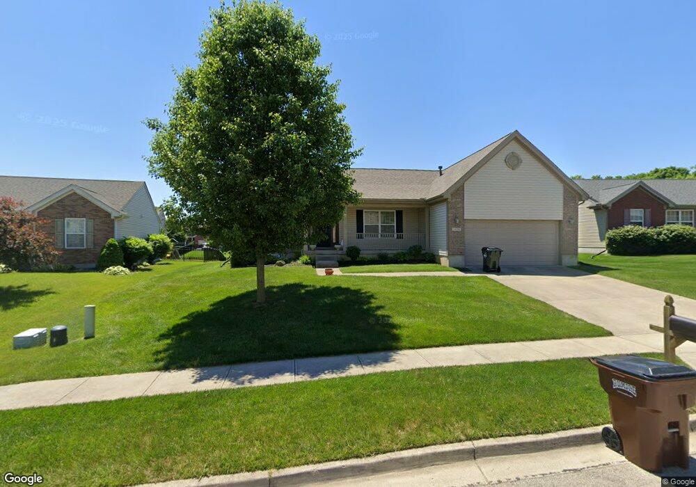
1438 Observatory Dr Fairborn, OH 45324
Estimated Value: $332,676 - $363,000
3
Beds
2
Baths
1,728
Sq Ft
$204/Sq Ft
Est. Value
About This Home
This home is located at 1438 Observatory Dr, Fairborn, OH 45324 and is currently estimated at $353,169, approximately $204 per square foot. 1438 Observatory Dr is a home located in Greene County with nearby schools including Fairborn Primary School, Fairborn Intermediate School, and Fairborn Middle School.
Ownership History
Date
Name
Owned For
Owner Type
Purchase Details
Closed on
Sep 22, 2009
Sold by
Inverness Group Incorporated
Bought by
Stringfield Man Li
Current Estimated Value
Purchase Details
Closed on
Jun 30, 2009
Sold by
Hills Land & Development Company
Bought by
Inverness Group Incorporated
Home Financials for this Owner
Home Financials are based on the most recent Mortgage that was taken out on this home.
Original Mortgage
$20,000,000
Interest Rate
5.43%
Mortgage Type
Purchase Money Mortgage
Create a Home Valuation Report for This Property
The Home Valuation Report is an in-depth analysis detailing your home's value as well as a comparison with similar homes in the area
Home Values in the Area
Average Home Value in this Area
Purchase History
| Date | Buyer | Sale Price | Title Company |
|---|---|---|---|
| Stringfield Man Li | $198,700 | None Available | |
| Inverness Group Incorporated | $34,300 | Attorney |
Source: Public Records
Mortgage History
| Date | Status | Borrower | Loan Amount |
|---|---|---|---|
| Previous Owner | Inverness Group Incorporated | $20,000,000 |
Source: Public Records
Tax History
| Year | Tax Paid | Tax Assessment Tax Assessment Total Assessment is a certain percentage of the fair market value that is determined by local assessors to be the total taxable value of land and additions on the property. | Land | Improvement |
|---|---|---|---|---|
| 2025 | $4,299 | $101,390 | $16,190 | $85,200 |
| 2024 | $4,299 | $101,390 | $16,190 | $85,200 |
| 2023 | $4,282 | $101,390 | $16,190 | $85,200 |
| 2022 | $3,762 | $75,350 | $13,500 | $61,850 |
| 2021 | $3,820 | $75,350 | $13,500 | $61,850 |
| 2020 | $3,842 | $75,350 | $13,500 | $61,850 |
| 2019 | $3,171 | $63,660 | $11,660 | $52,000 |
| 2018 | $3,206 | $63,660 | $11,660 | $52,000 |
| 2017 | $3,266 | $63,660 | $11,660 | $52,000 |
| 2016 | $3,266 | $64,620 | $11,660 | $52,960 |
| 2015 | $3,116 | $64,620 | $11,660 | $52,960 |
| 2014 | $3,017 | $64,620 | $11,660 | $52,960 |
Source: Public Records
Map
Nearby Homes
- 1200 Whitetail Dr
- 1121 Whitetail Dr
- 1105 Windsong Trail
- 1840 Spring Ridge Ct
- 2549 Fawn Dr
- 1788 Fawnwood Ct
- 00 Trebein Rd
- 1010 Brehm Blvd
- Lot 1 Trebein Rd
- 1494 Indigo Dr
- 1183 Brehm Blvd
- 630 Hidden Valley Ct
- 1155 Elloway Place
- 1634 Arden Bend
- 1622 Arden Bend
- 479 Park Hills Crossing
- 482 Kalynn Cir Unit 18
- 474 Kalynn Cir
- 474 Kalynn Cir Unit 19
- 444 Park Hills Crossing Unit 54
- 1442 Observatory Dr
- 1434 Observatory Dr
- 1430 Observatory Dr
- 1446 Observatory Dr
- 2333 Weston Dr
- 2363 Gardner Dr
- 2359 Gardner Dr
- 2371 Gardner Dr
- 2355 Gardner Dr
- 1426 Observatory Dr
- 1431 Observatory Dr
- 1450 Observatory Dr
- 1449 Observatory Dr
- 2325 Weston Dr
- 2375 Gardner Dr
- 2351 Gardner Dr
- 1429 Observatory Dr
- 1425 Gatehouse Ct
- 1454 Observatory Dr
- 1420 Observatory Dr
Your Personal Tour Guide
Ask me questions while you tour the home.