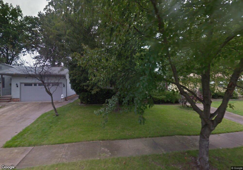
14389 Janice Dr Maple Heights, OH 44137
Estimated Value: $161,000 - $180,000
3
Beds
2
Baths
1,036
Sq Ft
$166/Sq Ft
Est. Value
About This Home
This home is located at 14389 Janice Dr, Maple Heights, OH 44137 and is currently estimated at $172,460, approximately $166 per square foot. 14389 Janice Dr is a home located in Cuyahoga County with nearby schools including Abraham Lincoln Elementary School, Rockside/ J.F. Kennedy School, and Barack Obama School.
Ownership History
Date
Name
Owned For
Owner Type
Purchase Details
Closed on
May 14, 2025
Sold by
Ulmer Gary
Bought by
Breezie Re Llc
Current Estimated Value
Home Financials for this Owner
Home Financials are based on the most recent Mortgage that was taken out on this home.
Original Mortgage
$23,000
Interest Rate
8.2%
Purchase Details
Closed on
Feb 5, 1999
Sold by
Kolopajlo Joyce
Bought by
Ulmer Caroline
Purchase Details
Closed on
Dec 4, 1998
Sold by
Estate Of Nellie Sherba
Bought by
Kolopajlo Joyce and Ulmer Carolyn
Purchase Details
Closed on
Sep 2, 1975
Sold by
Sindelar Kenneth R and R M
Bought by
Sherba Nellie M
Purchase Details
Closed on
Jan 1, 1975
Bought by
Sindelar Kenneth R and R M
Create a Home Valuation Report for This Property
The Home Valuation Report is an in-depth analysis detailing your home's value as well as a comparison with similar homes in the area
Home Values in the Area
Average Home Value in this Area
Purchase History
| Date | Buyer | Sale Price | Title Company |
|---|---|---|---|
| Breezie Re Llc | $68,000 | City Title | |
| Ulmer Caroline | -- | -- | |
| Kolopajlo Joyce | -- | -- | |
| Sherba Nellie M | $42,200 | -- | |
| Sindelar Kenneth R | -- | -- |
Source: Public Records
Mortgage History
| Date | Status | Borrower | Loan Amount |
|---|---|---|---|
| Closed | Breezie Re Llc | $23,000 | |
| Open | Breezie Re Llc | $77,000 |
Source: Public Records
Tax History
| Year | Tax Paid | Tax Assessment Tax Assessment Total Assessment is a certain percentage of the fair market value that is determined by local assessors to be the total taxable value of land and additions on the property. | Land | Improvement |
|---|---|---|---|---|
| 2024 | $3,988 | $56,070 | $8,820 | $47,250 |
| 2023 | $2,578 | $34,480 | $7,530 | $26,950 |
| 2022 | $2,606 | $34,480 | $7,530 | $26,950 |
| 2021 | $2,786 | $34,480 | $7,530 | $26,950 |
| 2020 | $2,362 | $28,250 | $6,160 | $22,090 |
| 2019 | $2,347 | $80,700 | $17,600 | $63,100 |
| 2018 | $2,180 | $28,250 | $6,160 | $22,090 |
| 2017 | $2,170 | $26,290 | $4,380 | $21,910 |
| 2016 | $2,093 | $26,290 | $4,380 | $21,910 |
| 2015 | $3,195 | $26,290 | $4,380 | $21,910 |
| 2014 | $3,195 | $28,250 | $4,690 | $23,560 |
Source: Public Records
Map
Nearby Homes
- 14320 Janice Dr
- 14808 James Ave
- 14012 Wheeler Rd
- 13810 Martin Dr
- 13741 Grove Dr
- 13804 Rockside Rd
- 14357 Turney Rd
- 14956 Carol Dr
- SL15 Rocky Top Ct
- 15 Rockytop Ct
- 14214 Tabor Ave
- 15305 Steinway Blvd
- 13410 Hathaway Rd
- 6089 Dunham Rd
- 14203 Tabor Ave
- 14404 Tokay Ave
- 6039 E 135th St
- 6425 Farmington Dr
- 12955 Milo Rd
- 14619 Tokay Ave
- 14363 Janice Dr
- 14415 Janice Dr
- 14337 Janice Dr
- 14437 Janice Dr
- 14325 Janice Dr
- 14465 Janice Dr
- 14388 Janice Dr
- 14360 Janice Dr
- 14412 Janice Dr
- 14334 Janice Dr
- 14436 Janice Dr
- 14289 Janice Dr
- 14489 Janice Dr
- 14462 Janice Dr
- 14511 Janice Dr
- 14280 Janice Dr
- 14486 Janice Dr
- 14415 Lisa Dr
- 14340 James Ave
- 14391 Lisa Dr
Your Personal Tour Guide
Ask me questions while you tour the home.