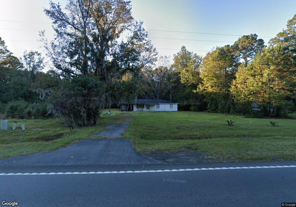
14389 Us Highway 17 Townsend, GA 31331
Estimated Value: $236,355 - $354,000
3
Beds
2
Baths
1,710
Sq Ft
$173/Sq Ft
Est. Value
About This Home
This home is located at 14389 Us Highway 17, Townsend, GA 31331 and is currently estimated at $295,178, approximately $172 per square foot. 14389 Us Highway 17 is a home located in McIntosh County with nearby schools including Todd Grant Elementary School, McIntosh County Middle School, and McIntosh County Academy.
Ownership History
Date
Name
Owned For
Owner Type
Purchase Details
Closed on
Jun 27, 2014
Sold by
King Shawanda
Bought by
Sharpe Bonnie Leonard
Current Estimated Value
Home Financials for this Owner
Home Financials are based on the most recent Mortgage that was taken out on this home.
Original Mortgage
$15,000
Interest Rate
4.17%
Mortgage Type
New Conventional
Purchase Details
Closed on
Feb 1, 2011
Sold by
King Shawanda
Bought by
King Shawanda
Create a Home Valuation Report for This Property
The Home Valuation Report is an in-depth analysis detailing your home's value as well as a comparison with similar homes in the area
Home Values in the Area
Average Home Value in this Area
Purchase History
| Date | Buyer | Sale Price | Title Company |
|---|---|---|---|
| Sharpe Bonnie Leonard | $15,000 | -- | |
| King Shawanda | -- | -- |
Source: Public Records
Mortgage History
| Date | Status | Borrower | Loan Amount |
|---|---|---|---|
| Closed | Sharpe Bonnie Leonard | $15,000 |
Source: Public Records
Tax History Compared to Growth
Tax History
| Year | Tax Paid | Tax Assessment Tax Assessment Total Assessment is a certain percentage of the fair market value that is determined by local assessors to be the total taxable value of land and additions on the property. | Land | Improvement |
|---|---|---|---|---|
| 2024 | $1,496 | $48,440 | $2,440 | $46,000 |
| 2023 | $1,463 | $47,080 | $2,200 | $44,880 |
| 2022 | $1,255 | $39,600 | $2,080 | $37,520 |
| 2021 | $775 | $29,160 | $2,080 | $27,080 |
| 2020 | $352 | $7,080 | $2,080 | $5,000 |
| 2019 | $343 | $7,160 | $2,080 | $5,080 |
| 2018 | $190 | $7,160 | $2,080 | $5,080 |
| 2017 | $215 | $7,200 | $2,080 | $5,120 |
| 2016 | $344 | $7,200 | $2,080 | $5,120 |
| 2015 | $288 | $14,972 | $1,880 | $13,093 |
| 2014 | -- | $16,393 | $3,300 | $13,093 |
Source: Public Records
Map
Nearby Homes
- 14261 US Highway 17
- 3 ACRES Lewis Ln SW
- 1366 Lewis Ln SW
- Lot 35 Lewis Ln
- Lot 27B Eulonia Lake Estates Rd SW
- Lot 30 Freedom Trail SW
- Lot 43 Freedom Trail SW
- 0 Briar Patch Lot#27 Place
- 0 Briar Patch Lot 15 Place
- 0 Briar Patch Lot 16 Place
- 1138 Hanover Ln
- 1119 Hanover Ln
- 1340 Pelican Ln SE
- 1181 Charlton Chase NE
- Lot 21 Sutherland Bluff Dr NE
- 0 Briar Patch Rd SE Unit 1658040
- 0 Briar Patch Rd SE Unit 1658033
- 0 Briar Patch Rd SE Unit 1658042
- 0 Briar Patch Rd SE Unit 1658032
- 0 Briar Patch Rd SE Unit 1658039
- 1514 Lewis Ln SW
- 4001 Highway 17
- 100 Acre Highway 17
- 0 Highway 17
- 14488 E Us Highway 17 N
- 1475 Lewis Ln SW
- 14408 Us Highway 17
- 1501 Lewis Ln SW
- 1081 Lewis Ln SW
- 14299 Us Highway 17
- 1436 Lewis Ln SW
- 1218 Lewis Ln SW
- 1082 Lewis Ln SW
- 14546 Us Highway 17
- 1275 Lewis Ln SW
- 4.4 ACRES E S Highway 17
- 1215 Lewis Ln SW
- 1122 Lewis Ln SW
- 1160 Lewis Ln SW
- 14656 E Us Highway 17 N