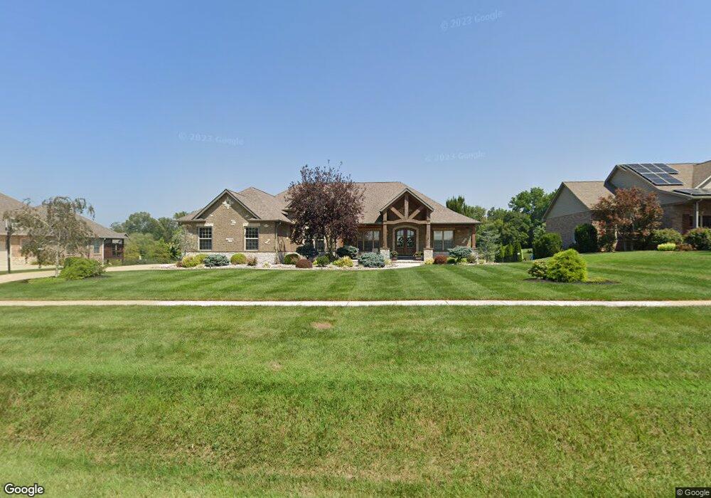
1439 S Clinton Rd Caseyville, IL 62232
Estimated Value: $712,000 - $898,515
--
Bed
--
Bath
2,801
Sq Ft
$285/Sq Ft
Est. Value
About This Home
This home is located at 1439 S Clinton Rd, Caseyville, IL 62232 and is currently estimated at $798,629, approximately $285 per square foot. 1439 S Clinton Rd is a home located in St. Clair County with nearby schools including Moye Elementary School, Fulton Junior High School, and O'Fallon Township High School.
Ownership History
Date
Name
Owned For
Owner Type
Purchase Details
Closed on
Jan 28, 2011
Sold by
Turner Enterprises Inc
Bought by
Daniel Patrick and Daniel Carol
Current Estimated Value
Home Financials for this Owner
Home Financials are based on the most recent Mortgage that was taken out on this home.
Original Mortgage
$474,761
Outstanding Balance
$326,559
Interest Rate
4.89%
Mortgage Type
VA
Estimated Equity
$472,070
Purchase Details
Closed on
Jan 21, 2011
Sold by
Turner Sean R and Turner Heidi M
Bought by
Turner Enterprises Inc
Home Financials for this Owner
Home Financials are based on the most recent Mortgage that was taken out on this home.
Original Mortgage
$474,761
Outstanding Balance
$326,559
Interest Rate
4.89%
Mortgage Type
VA
Estimated Equity
$472,070
Create a Home Valuation Report for This Property
The Home Valuation Report is an in-depth analysis detailing your home's value as well as a comparison with similar homes in the area
Home Values in the Area
Average Home Value in this Area
Purchase History
| Date | Buyer | Sale Price | Title Company |
|---|---|---|---|
| Daniel Patrick | $521,000 | Abstracts & Titles Inc | |
| Turner Enterprises Inc | -- | Abstract Titles Inc |
Source: Public Records
Mortgage History
| Date | Status | Borrower | Loan Amount |
|---|---|---|---|
| Open | Daniel Patrick | $474,761 |
Source: Public Records
Tax History Compared to Growth
Tax History
| Year | Tax Paid | Tax Assessment Tax Assessment Total Assessment is a certain percentage of the fair market value that is determined by local assessors to be the total taxable value of land and additions on the property. | Land | Improvement |
|---|---|---|---|---|
| 2024 | $17,287 | $258,566 | $43,722 | $214,844 |
| 2023 | $16,058 | $228,779 | $38,685 | $190,094 |
| 2022 | $14,307 | $201,977 | $32,132 | $169,845 |
| 2021 | $13,849 | $191,701 | $30,497 | $161,204 |
| 2020 | $14,179 | $181,589 | $28,888 | $152,701 |
| 2019 | $13,849 | $181,589 | $28,888 | $152,701 |
| 2018 | $12,892 | $168,425 | $29,485 | $138,940 |
| 2017 | $12,648 | $161,591 | $28,288 | $133,303 |
| 2016 | $12,537 | $157,942 | $27,649 | $130,293 |
| 2014 | $11,146 | $149,653 | $14,764 | $134,889 |
| 2013 | $24 | $152,412 | $15,036 | $137,376 |
Source: Public Records
Map
Nearby Homes
- 124 Long Branch Ln
- 678 Prato Ct
- 690 Vinci Dr
- 1128 Pisa Dr
- 1303 S Clinton Rd
- 104 Forest Oaks Dr
- 28 Geneva Dr
- 1012 Crooked Stick Dr
- 9 Ambrosius Place
- 1909 Windcrest Dr
- 1821 Orr Ln
- 100 Antler Creek Ct
- 6506 Timber Lake Dr
- 305 Forest Oaks Dr
- 1240 Pausch Rd
- 1240 Pausch Rd Unit 6.65 ac
- 1240 Pausch Rd Unit 39.72 ac
- 0 Walker Meadows Subdivision
- 0 Boreal Ridge Subdivision
- 363 Old Collinsville Rd
- 1441 S Clinton Rd
- 1437 S Clinton Rd
- 63 Long Branch Ln
- 104 Hunters Landing Dr
- 101 Bethel Meadows Rd
- 108 Hunters Landing Dr
- 59 Long Branch Ln
- 0 Long Branch Unit 22047932
- 0 Long Branch Unit 22047929
- 58 Long Branch Ln
- 0 S Clinton Unit 17032656
- 0 S Clinton Unit 10871476
- 0 S Clinton Unit 10870299
- 105 Hunters Landing Dr
- 109 Hunters Landing Dr
- 0 Long Branch Ln
- 68 Long Branch Ln
- 1431 S Clinton Rd
- 55 Long Branch Ln
- 116 Long Branch Ln