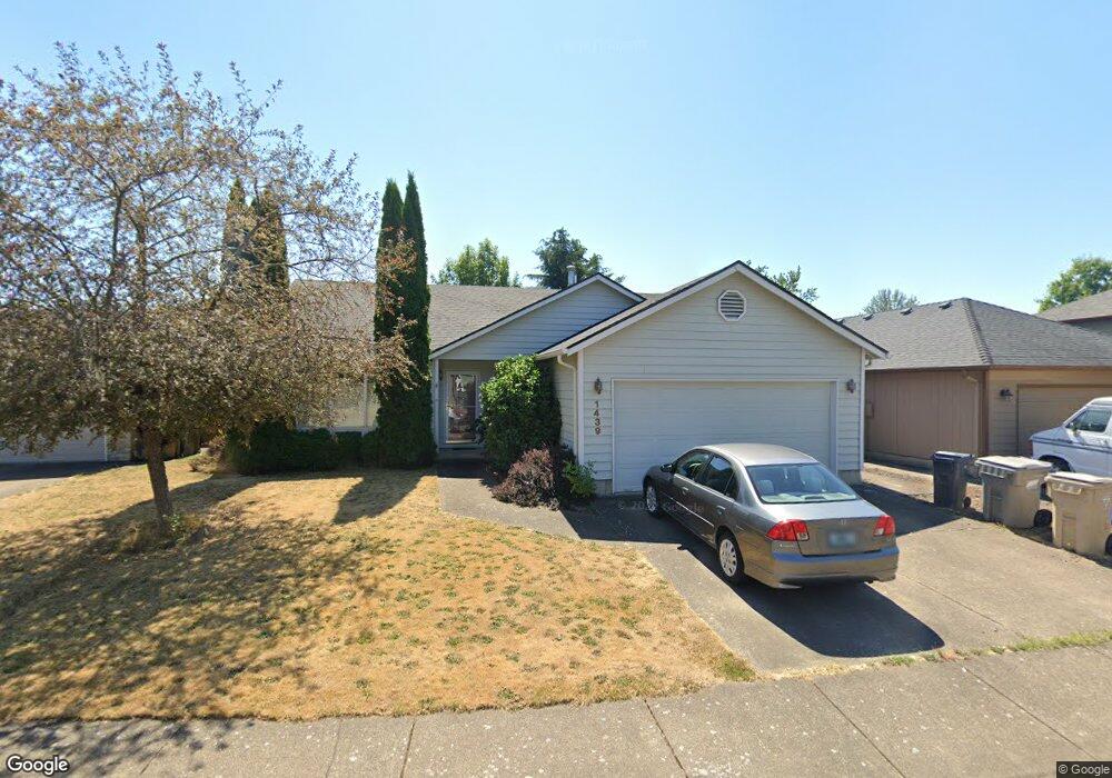
1439 SW Birdie Dr Corvallis, OR 97333
Southwest Corvallis NeighborhoodEstimated Value: $532,538 - $585,000
3
Beds
2
Baths
1,444
Sq Ft
$381/Sq Ft
Est. Value
About This Home
This home is located at 1439 SW Birdie Dr, Corvallis, OR 97333 and is currently estimated at $550,385, approximately $381 per square foot. 1439 SW Birdie Dr is a home located in Benton County with nearby schools including Adams Elementary School, Linus Pauling Middle School, and Corvallis High School.
Ownership History
Date
Name
Owned For
Owner Type
Purchase Details
Closed on
Aug 12, 2008
Sold by
Schnebly Larry E
Bought by
Trueblood Julianne F
Current Estimated Value
Home Financials for this Owner
Home Financials are based on the most recent Mortgage that was taken out on this home.
Original Mortgage
$189,900
Outstanding Balance
$124,575
Interest Rate
6.32%
Mortgage Type
Purchase Money Mortgage
Estimated Equity
$425,810
Purchase Details
Closed on
Dec 26, 2007
Sold by
Cox Geneva M
Bought by
Cox Geneva M and Schnebly Larry E
Create a Home Valuation Report for This Property
The Home Valuation Report is an in-depth analysis detailing your home's value as well as a comparison with similar homes in the area
Home Values in the Area
Average Home Value in this Area
Purchase History
| Date | Buyer | Sale Price | Title Company |
|---|---|---|---|
| Trueblood Julianne F | $269,900 | Amerititle | |
| Cox Geneva M | -- | None Available | |
| Cox Geneva M | -- | None Available |
Source: Public Records
Mortgage History
| Date | Status | Borrower | Loan Amount |
|---|---|---|---|
| Open | Trueblood Julianne F | $189,900 |
Source: Public Records
Tax History Compared to Growth
Tax History
| Year | Tax Paid | Tax Assessment Tax Assessment Total Assessment is a certain percentage of the fair market value that is determined by local assessors to be the total taxable value of land and additions on the property. | Land | Improvement |
|---|---|---|---|---|
| 2024 | $5,612 | $292,157 | -- | -- |
| 2023 | $5,285 | $283,648 | $0 | $0 |
| 2022 | $5,130 | $275,386 | $0 | $0 |
| 2021 | $4,960 | $267,365 | $0 | $0 |
| 2020 | $4,933 | $259,578 | $0 | $0 |
| 2019 | $4,431 | $252,017 | $0 | $0 |
| 2018 | $4,467 | $244,677 | $0 | $0 |
| 2017 | $3,992 | $237,550 | $0 | $0 |
| 2016 | $3,931 | $230,631 | $0 | $0 |
| 2015 | $3,819 | $223,914 | $0 | $0 |
| 2014 | $3,712 | $217,392 | $0 | $0 |
| 2012 | -- | $204,913 | $0 | $0 |
Source: Public Records
Map
Nearby Homes
- 3559 SW Par Place
- 1080 SW 35th St
- 1125 SW Cole Place
- 4149 SW Research Way
- 3871 SW Neer Ave
- 1935 SW Whiteside Dr
- 2520 SW Whiteside Dr
- 865 SW Grove St
- 1907 SW Brooklane Dr
- 1140 SW Sylvia St
- 3211 SW Hawkeye Ave
- 4624 SW 47th Place
- 1050 SW Timian St
- 4651 SW 47th Place
- 2604 SW Wolverine Dr
- 3475 SW Buckeye Place
- 0 SW Gerold St
- Parcel #142681 SW Gerold St
- 2829 SW Wolverine Dr
- 2632 SW Brooklane Dr
- 1443 SW Birdie Dr
- 1435 SW Birdie Dr
- 3565 SW Par Place
- 1447 SW Birdie Dr
- 1431 SW Birdie Dr
- 3573 SW Par Place
- 1438 SW Birdie Dr
- 1440 SW Birdie Dr
- 3581 SW Par Place
- 1451 SW Birdie Dr
- 1444 SW Birdie Dr
- 3553 SW Par Place
- 1457 SW Birdie Dr
- 1446 SW Birdie Dr
- 3589 SW Par Place
- 1430 SW 35th St
- 3550 SW Par Place
- 1448 SW Birdie Dr
- 3566 SW Par Place
- 1452 SW Birdie Dr