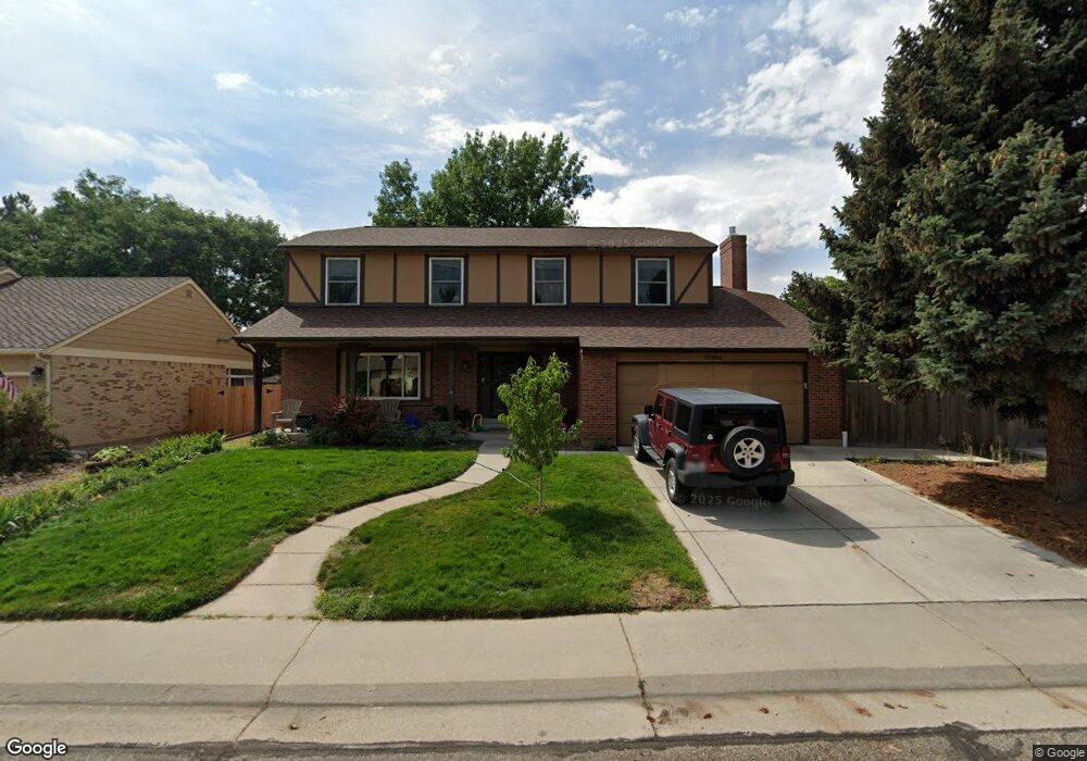
14396 W 71st Dr Arvada, CO 80004
Ralston Valley NeighborhoodEstimated Value: $715,971 - $799,000
4
Beds
3
Baths
3,075
Sq Ft
$245/Sq Ft
Est. Value
About This Home
This home is located at 14396 W 71st Dr, Arvada, CO 80004 and is currently estimated at $753,993, approximately $245 per square foot. 14396 W 71st Dr is a home located in Jefferson County with nearby schools including Van Arsdale Elementary School, Oberon Middle School, and Ralston Valley Senior High School.
Ownership History
Date
Name
Owned For
Owner Type
Purchase Details
Closed on
May 10, 2019
Sold by
Roberts John M and Roberts Judith P
Bought by
Law John O and Law Melinda L
Current Estimated Value
Home Financials for this Owner
Home Financials are based on the most recent Mortgage that was taken out on this home.
Original Mortgage
$476,910
Outstanding Balance
$417,588
Interest Rate
4%
Mortgage Type
New Conventional
Estimated Equity
$336,405
Create a Home Valuation Report for This Property
The Home Valuation Report is an in-depth analysis detailing your home's value as well as a comparison with similar homes in the area
Home Values in the Area
Average Home Value in this Area
Purchase History
| Date | Buyer | Sale Price | Title Company |
|---|---|---|---|
| Law John O | $529,900 | Empire Title Co Springs Llc |
Source: Public Records
Mortgage History
| Date | Status | Borrower | Loan Amount |
|---|---|---|---|
| Open | Law John O | $476,910 |
Source: Public Records
Tax History
| Year | Tax Paid | Tax Assessment Tax Assessment Total Assessment is a certain percentage of the fair market value that is determined by local assessors to be the total taxable value of land and additions on the property. | Land | Improvement |
|---|---|---|---|---|
| 2024 | $4,229 | $43,599 | $15,537 | $28,062 |
| 2023 | $4,229 | $43,599 | $15,537 | $28,062 |
| 2022 | $3,416 | $34,886 | $11,922 | $22,964 |
| 2021 | $3,473 | $35,890 | $12,265 | $23,625 |
| 2020 | $3,102 | $32,144 | $12,553 | $19,591 |
| 2019 | $2,379 | $32,144 | $12,553 | $19,591 |
| 2018 | $2,214 | $29,810 | $7,496 | $22,314 |
| 2017 | $2,027 | $29,810 | $7,496 | $22,314 |
| 2016 | $2,487 | $26,133 | $5,803 | $20,330 |
| 2015 | $2,354 | $26,133 | $5,803 | $20,330 |
| 2014 | $2,354 | $23,252 | $4,872 | $18,380 |
Source: Public Records
Map
Nearby Homes
- 7250 Devinney Ct Unit E
- 6888 Howell St
- 13844 W 68th Dr
- 14050 W 68th Ave
- 6970 Isabell Ct
- 13920 W 74th Place
- 7391 Coors Dr
- 15172 W 69th Place
- 15325 W 69th Dr
- Sonnenvilla Plan at Geos - Single Family Homes
- 15232 W 69th Place
- 7539 Isabell Cir
- 13946 W 76th Place
- 15280 W 69th Cir Unit A
- 15280 W 69th Cir Unit B
- 15290 W 68th Place
- 15344 W 69th Ave
- 15294 W 68th Place
- 6762 Beech Dr
- 15266 W 68th Loop
- 14366 W 71st Dr
- 14426 W 71st Dr
- 7138 Gardenia St
- 7128 Gardenia St
- 14466 W 71st Dr
- 14336 W 71st Dr
- 14397 W 71st Dr
- 14377 W 71st Dr
- 7131 Flora St
- 7129 Gardenia St
- 14437 W 71st Dr
- 14357 W 71st Dr
- 7138 N Gardenia St
- 7127 Flora St
- 7140 Gladiola St
- 7118 Gardenia St
- 14477 W 71st Dr
- 7136 Gladiola St
- 7119 Gardenia St
- 14327 W 71st Dr
Your Personal Tour Guide
Ask me questions while you tour the home.