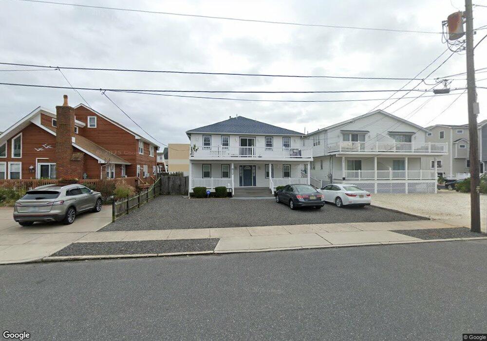
144 61st St Unit 2ND Sea Isle City, NJ 08243
Estimated Value: $901,609 - $1,158,000
--
Bed
--
Bath
1,350
Sq Ft
$788/Sq Ft
Est. Value
About This Home
This home is located at 144 61st St Unit 2ND, Sea Isle City, NJ 08243 and is currently estimated at $1,063,652, approximately $787 per square foot. 144 61st St Unit 2ND is a home located in Cape May County with nearby schools including Ocean City Primary School, Ocean City Intermediate School, and Ocean City High School.
Ownership History
Date
Name
Owned For
Owner Type
Purchase Details
Closed on
Oct 30, 2002
Sold by
Griffith Jeff A
Bought by
Cook Odus L and Cook Martha J
Current Estimated Value
Home Financials for this Owner
Home Financials are based on the most recent Mortgage that was taken out on this home.
Original Mortgage
$278,800
Outstanding Balance
$117,378
Interest Rate
6.09%
Estimated Equity
$946,274
Purchase Details
Closed on
Apr 12, 1989
Sold by
Rump Robert
Bought by
Rump Doris
Create a Home Valuation Report for This Property
The Home Valuation Report is an in-depth analysis detailing your home's value as well as a comparison with similar homes in the area
Home Values in the Area
Average Home Value in this Area
Purchase History
| Date | Buyer | Sale Price | Title Company |
|---|---|---|---|
| Cook Odus L | $348,500 | -- | |
| Rump Doris | -- | -- |
Source: Public Records
Mortgage History
| Date | Status | Borrower | Loan Amount |
|---|---|---|---|
| Open | Cook Odus L | $278,800 |
Source: Public Records
Tax History Compared to Growth
Tax History
| Year | Tax Paid | Tax Assessment Tax Assessment Total Assessment is a certain percentage of the fair market value that is determined by local assessors to be the total taxable value of land and additions on the property. | Land | Improvement |
|---|---|---|---|---|
| 2025 | $3,825 | $427,900 | $339,700 | $88,200 |
| 2024 | $3,825 | $427,900 | $339,700 | $88,200 |
| 2023 | $3,646 | $427,900 | $339,700 | $88,200 |
| 2022 | $3,427 | $427,900 | $339,700 | $88,200 |
| 2021 | $3,072 | $427,900 | $339,700 | $88,200 |
| 2020 | $3,141 | $427,900 | $339,700 | $88,200 |
| 2019 | $3,072 | $427,900 | $339,700 | $88,200 |
| 2018 | $3,038 | $427,900 | $339,700 | $88,200 |
| 2017 | $2,974 | $427,900 | $339,700 | $88,200 |
| 2016 | $2,875 | $427,900 | $339,700 | $88,200 |
| 2015 | $2,686 | $456,100 | $365,100 | $91,000 |
| 2014 | $2,664 | $456,100 | $365,100 | $91,000 |
Source: Public Records
Map
Nearby Homes
- 126 61st St Unit West
- 126 61st St Unit East
- 134 59th St Unit East
- 6009 Landis Ave Unit North
- 6009 Pleasure Ave Unit NORTH
- 135 65th St Unit 12
- 6500 Central Ave Unit SOUTH
- 6500 Central Ave Unit SOUTH UNIT
- 6500 Central Ave Unit South/A
- 34 55th St
- 139 55th St Unit A
- 309 56th St Unit B5
- 329 56th St Unit East Unit
- 233 54th St Unit East
- 210 52nd St Unit SOUTH
- 34 73rd St Unit West Unit
- 34 73rd St Unit East
- 7305 Pleasure Ave Unit North
- 7304 Pleasure Ave Unit SOUTH
- 7509 Central Ave Unit 1
- 144 61st St Unit 1ST
- 138 61st St
- 148 61st St
- 148 61st St
- 148 61st St Unit East
- 132 61st St
- 132 61st St Unit w
- 130 61st St
- 130 61st St Unit East Unit
- 128 61st St
- 126 61st St
- 137 61st St
- 137 61st St
- 137 61st St Unit A
- 143 61st St
- 131 61st St
- 6101 Central Ave
- 6101 Central Ave
- 6103 Central Ave Unit North
- 125 61st St